Marilyn · Borders
Larriston Fells
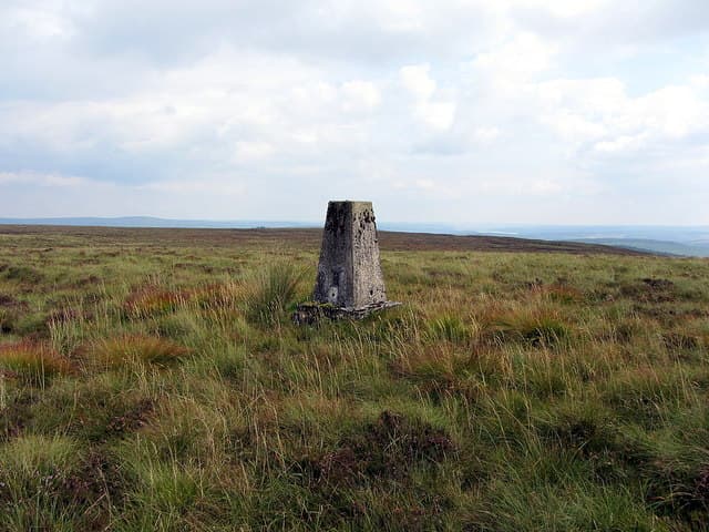
A 512m moorland top above Newcastleton on the Anglo-Scottish border, looking south into Kielder Forest and the Cheviots. The summit sits on the historic divide of the Debatable Lands. 512 m — a Borders hill.
Quick facts
- Height
- 512m/ 1680ft
- Prominence
- 159 m
- Grid ref
- NY 56903 92094
- Parking
- NY 52000 94000
- Nearest city
- Carlisle· 40km
- Dogs
- Dogs on lead required near livestockDog-friendly guide ↗
Height and prominence cross-checked against the Database of British and Irish Hills (CC BY).
No GPX track yet
Walked this route? Share your track to help other walkers.
Standard route
grass moorland 60% · heather 30% · boggy ground 10%
A 4-5 hour round from Newcastleton or the forest roads above Hermitage takes in heathery moorland and forest edge. Some walkers continue to Tudhope Hill on the same outing.
Terrain
Heather moor, forest rides and tussocky grass on the ridge. Wet underfoot near the boundary fence.
In winter
Sheltered by Kielder plantation to the south but exposed to easterly fronts. Forest tracks help winter approach when the hill itself is snowy.
Best time of year
Getting there
- Glasgow4h 23m
- Edinburgh2h 18m
OS maps: OS Landranger 80, OS Explorer 042W, OS Explorer 324
Mobile signal: Good. Borders near England; EE reliable.
Current conditions
Daylight Today
- Sunrise
- 06:40
- Sunset
- 19:32
- Civil dawn
- 06:04
- Civil dusk
- 20:09
NOAA Solar Calculator · 14 September 2026
Around Larriston Fells on the SCOT network
Getting there, basing yourself, and what to do off the hill.
Larriston Fells — common questions
- How hard is Larriston Fells?
- We grade Larriston Fells at 2/5, which puts it in moderate territory. Ground conditions: Heather moor, forest rides and tussocky grass on the ridge.
- How much drop does Larriston Fells have?
- The drop is 159m: measured from the summit of Larriston Fells down to the saddle joining it to higher terrain. Passing the 150m-drop threshold on all sides is exactly what makes it a Marilyn.
- Where's the parking for Larriston Fells?
- Park at NY 52000 94000. Double-check the grid reference on an OS map first; informal laybys here fill early in high season.
- What's the best month to climb Larriston Fells?
- Aim for March, April, May, June, July, August, September, October, November on Larriston Fells. In the remaining months treat it as a winter hill — full kit, solid navigation, and a look at the relevant SAIS avalanche forecast before you go.
- Can dogs go up Larriston Fells?
- Dogs are fine on a lead. The route passes livestock or ground-nesting bird habitat, so keep them close throughout.
- Will I get phone signal on Larriston Fells?
- Good. Borders near England; EE reliable.
- Is Larriston Fells safe in winter?
- Sheltered by Kielder plantation to the south but exposed to easterly fronts. Forest tracks help winter approach when the hill itself is snowy.
Get the OutdoorSCOT weekly
One email a week — new route, hill and bothy guides, seasonal conditions and the odd hard-won lesson. No spam, unsubscribe in one click.