Marilyn · Borders
Belling Hill
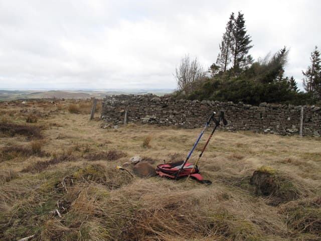
Belling Hill rises to 354m in the Cheviot foothills of Roxburghshire, above the Bowmont Water near Hownam (NT 64203 11835). A quiet grass and heather hill close to the English border with views toward the main Cheviot ridge and the Schil.
Quick facts
- Height
- 354.4m/ 1163ft
- Prominence
- 152 m
- Grid ref
- NT 64203 11835
- Nearest city
- Carlisle· 61km
- Dogs
- Dogs on lead required near livestockDog-friendly guide ↗
Height and prominence cross-checked against the Database of British and Irish Hills (CC BY).
No GPX track yet
Walked this route? Share your track to help other walkers.
Standard route
heather moorland 55% · grass slopes 35% · rocky summit 10%
Approach from the minor road near Hownam Mains or Cocklawfoot, following sheep tracks and shepherds' paths up the south-west flank to the 354m summit. About 5km return — allow 2-3 hours.
Terrain
Roxburghshire grass and heather slopes typical of the inner Cheviot foothills. Sheep tracks help; the upper slopes are pathless but easy underfoot.
In winter
A gentle winter target. The southern Borders rarely hold deep snow, though the upper slopes can be windswept and exposed in storms.
Best time of year
Getting there
- Glasgow5h 31m
- Edinburgh2h 9m
OS maps: OS Landranger 80, OS Explorer 016W
Mobile signal: Good. Roxburghshire; EE reasonable.
Current conditions
Daylight Today
- Sunrise
- 06:40
- Sunset
- 19:32
- Civil dawn
- 06:03
- Civil dusk
- 20:09
NOAA Solar Calculator · 14 September 2026
Around Belling Hill on the SCOT network
Getting there, basing yourself, and what to do off the hill.
Belling Hill — common questions
- How hard is Belling Hill?
- We grade Belling Hill at 1/5, which puts it in easy territory. Ground conditions: Roxburghshire grass and heather slopes typical of the inner Cheviot foothills.
- How much drop does Belling Hill have?
- The drop is 152m: measured from the summit of Belling Hill down to the saddle joining it to higher terrain. Passing the 150m-drop threshold on all sides is exactly what makes it a Marilyn.
- What's the best month to climb Belling Hill?
- Aim for March, April, May, June, July, August, September, October on Belling Hill. In the remaining months treat it as a winter hill — full kit, solid navigation, and a look at the relevant SAIS avalanche forecast before you go.
- Can dogs go up Belling Hill?
- Dogs are fine on a lead. The route passes livestock or ground-nesting bird habitat, so keep them close throughout.
- Will I get phone signal on Belling Hill?
- Good. Roxburghshire; EE reasonable.
- Is Belling Hill safe in winter?
- A gentle winter target. The southern Borders rarely hold deep snow, though the upper slopes can be windswept and exposed in storms.
Get the OutdoorSCOT weekly
One email a week — new route, hill and bothy guides, seasonal conditions and the odd hard-won lesson. No spam, unsubscribe in one click.