Marilyn · Argyll & Bute
Cruachan Min
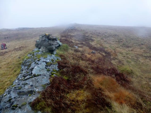
Cruachan Min — the Smooth Stack — is a 376m hill on the southern fringe of Mull's Ardmeanach peninsula, set above the Burg cliffs. The summit, true to its name, is a rounded grassy crown, sharply different from the basalt steps that drop into Loch Scridain.
Quick facts
- Height
- 376m/ 1234ft
- Prominence
- 261 m
- Grid ref
- NM 44579 21713
- Nearest city
- Oban· 42km
- Dogs
- Dogs on lead required near livestockDog-friendly guide ↗
Height and prominence cross-checked against the Database of British and Irish Hills (CC BY).
No GPX track yet
Walked this route? Share your track to help other walkers.
Standard route
heather and bog 65% · grass slopes 25% · rocky summit 10%
Approach from the Tiroran end of the Burg track and ascend west onto the open hillside before turning south-west to the summit. The gradient is gentle once on the ridge. Plan on around 4 hours for the round including the long access path.
Terrain
A pleasant mix of short heather, grass and occasional rock. The smooth upper hill is exceptionally easy walking by Mull standards once the bracken belt is cleared.
In winter
Generally a benign winter walk with snow rarely lying. Take care on the long access track in low winter sun — surface ice forms in shaded corners.
Best time of year
Getting there
- Glasgow5h 1m
- Edinburgh8h 40m
Ferry access
Oban → Craignure
- Crossing time45 min
- Summer sailingsUp to 8 sailings daily (Apr–Oct)
- Winter sailings4–5 sailings daily (Nov–Mar)
- Book ahead7 days
- Last ferry backCheck CalMac timetable — sailings run until ~21:00 in peak summer
Foot passengers can usually turn up without booking. Book vehicle spaces in advance. The Lochaline → Fishnish crossing (15 min) is shorter but serves east Mull only.
Book on CalMac ↗OS maps: OS Landranger 48, OS Explorer 373
Mobile signal: Poor. No coverage start to finish; remote Mull glen has no infrastructure.
Current conditions
Daylight Today
- Sunrise
- 05:23
- Sunset
- 21:39
- Civil dawn
- 04:33
- Civil dusk
- 22:30
NOAA Solar Calculator · 30 July 2026
Around Cruachan Min on the SCOT network
Getting there, basing yourself, and what to do off the hill.
Cruachan Min — common questions
- What difficulty is Cruachan Min?
- On the OutdoorSCOT scale, Cruachan Min comes in at 1/5 — easy. Terrain: A pleasant mix of short heather, grass and occasional rock.
- How prominent is Cruachan Min?
- Cruachan Min has 261m of topographic prominence — the height of its summit above the highest col connecting it to higher ground. Marilyns are defined by that measure: at least 150m of drop on all sides.
- When should I climb Cruachan Min?
- The standard good-weather months for Cruachan Min are March, April, May, June, July, August, September, October. Outside those months, expect winter conditions on the high ground — full mountain kit, navigation skills, and a check of the SAIS avalanche forecast for the relevant region.
- Can I bring my dog up Cruachan Min?
- On a lead only — the route crosses ground with livestock or nesting-bird interest.
- What's mobile reception like on Cruachan Min?
- Poor. No coverage start to finish; remote Mull glen has no infrastructure.
- How do I get the ferry to Cruachan Min?
- Oban → Craignure. Up to 8 sailings daily (Apr–Oct) in summer; 4–5 sailings daily (Nov–Mar) in winter. Book at least 7 days ahead. Foot passengers can usually turn up without booking. Book vehicle spaces in advance. The Lochaline → Fishnish crossing (15 min) is shorter but serves east Mull only.
- Is Cruachan Min safe in winter?
- Generally a benign winter walk with snow rarely lying. Take care on the long access track in low winter sun — surface ice forms in shaded corners.
Get the OutdoorSCOT weekly
One email a week — new route, hill and bothy guides, seasonal conditions and the odd hard-won lesson. No spam, unsubscribe in one click.