Sub-Marilyn · Argyll & Bute
Creach Bheinn
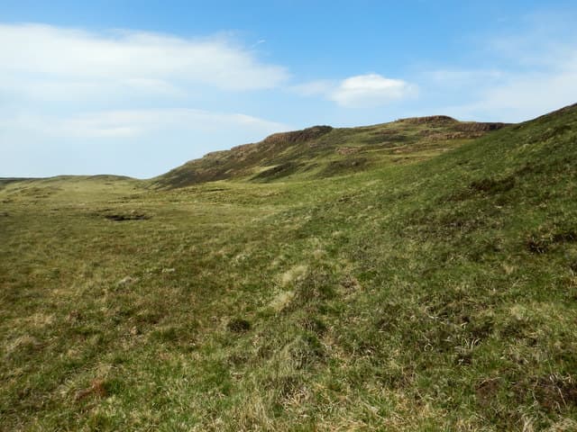
Creach Bheinn — the Hill of Spoil — is the high point of Mull's Ardmeanach peninsula at 491m, presiding over the Burg cliffs and MacCulloch's Fossil Tree. The summit looks straight out at the Treshnish Isles and across the Sound to Coll and Tiree.
Quick facts
- Height
- 491.6m/ 1613ft
- Prominence
- 146 m
- Grid ref
- NM 41954 29111
- Nearest city
- Oban· 44km
- Dogs
- Dogs on lead required near livestockDog-friendly guide ↗
Sub-Marilyn: 146m of drop — misses the 150m Marilyn cut by 4m. We keep it on the list as a near-miss.
Height and prominence cross-checked against the Database of British and Irish Hills (CC BY).
No GPX track yet
Walked this route? Share your track to help other walkers.
Standard route
heather and bog 60% · grass slopes 25% · rocky summit 15%
From the parking area at Tiroran follow the National Trust path west toward Burg, then break off and climb north onto the ridge. The going eases on the broad summit plateau. Reckon on 5 hours for the round walk including the access track.
Terrain
Long approach on a stony NTS path followed by pathless ground over heather and basalt benches. Wild goats range across the western slopes and may be encountered on the upper hill.
In winter
Generally snow-free at this altitude but exposed to wind off the open Atlantic. The long walk-in shortens significantly with the reduced daylight of midwinter.
Best time of year
Getting there
- Glasgow5h 11m
- Edinburgh8h 49m
Ferry access
Oban → Craignure
- Crossing time45 min
- Summer sailingsUp to 8 sailings daily (Apr–Oct)
- Winter sailings4–5 sailings daily (Nov–Mar)
- Book ahead7 days
- Last ferry backCheck CalMac timetable — sailings run until ~21:00 in peak summer
Foot passengers can usually turn up without booking. Book vehicle spaces in advance. The Lochaline → Fishnish crossing (15 min) is shorter but serves east Mull only.
Book on CalMac ↗OS maps: OS Landranger 48, OS Explorer 373, OS Explorer 375W
Mobile signal: Poor. Remote Lismore or Morvern; limited coverage.
Current conditions
Daylight Today
- Sunrise
- 05:23
- Sunset
- 21:40
- Civil dawn
- 04:32
- Civil dusk
- 22:30
NOAA Solar Calculator · 30 July 2026
Around Creach Bheinn on the SCOT network
Getting there, basing yourself, and what to do off the hill.
Getting there: Oban station
Argyll ferry hub; Mull, Lismore, Coll, Tiree, Barra connections
44km from the hill
tripscot.co.uk
On TripSCOTBase yourself in Tobermory
Mull base — Ben More, Treshnish, ferry to Iona
28km from the hill
tripscot.co.uk
On TasteSCOTAfter the hill: Tobermory
Mull — colourful harbour-front distillery making both unpeated and peated (Ledaig) whisky
28km from the hill
tastescot.co.uk
Creach Bheinn — common questions
- How hard is Creach Bheinn?
- We grade Creach Bheinn at 1/5, which puts it in easy territory. Ground conditions: Long approach on a stony NTS path followed by pathless ground over heather and basalt benches.
- How much drop does Creach Bheinn have?
- The drop is 146m: measured from the summit of Creach Bheinn down to the saddle joining it to higher terrain. That leaves it 4m short of the 150m drop a Marilyn needs — DoBIH classes it a sub-Marilyn, a near-miss rather than a full Marilyn.
- What's the best month to climb Creach Bheinn?
- Aim for March, April, May, June, July, August, September, October on Creach Bheinn. In the remaining months treat it as a winter hill — full kit, solid navigation, and a look at the relevant SAIS avalanche forecast before you go.
- Can dogs go up Creach Bheinn?
- Dogs are fine on a lead. The route passes livestock or ground-nesting bird habitat, so keep them close throughout.
- Will I get phone signal on Creach Bheinn?
- Poor. Remote Lismore or Morvern; limited coverage.
- How do I get the ferry to Creach Bheinn?
- Oban → Craignure. Up to 8 sailings daily (Apr–Oct) in summer; 4–5 sailings daily (Nov–Mar) in winter. Book at least 7 days ahead. Foot passengers can usually turn up without booking. Book vehicle spaces in advance. The Lochaline → Fishnish crossing (15 min) is shorter but serves east Mull only.
- Is Creach Bheinn safe in winter?
- Generally snow-free at this altitude but exposed to wind off the open Atlantic. The long walk-in shortens significantly with the reduced daylight of midwinter.
Get the OutdoorSCOT weekly
One email a week — new route, hill and bothy guides, seasonal conditions and the odd hard-won lesson. No spam, unsubscribe in one click.