Marilyn · Argyll & Bute
Beinn Chreagach
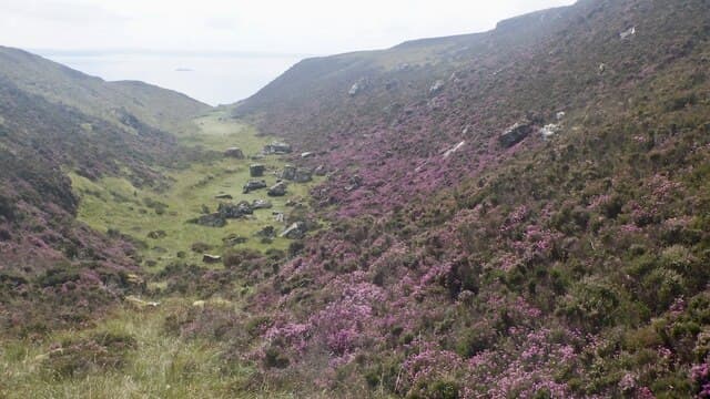
This Beinn Chreagach is the 313m basalt summit between Calgary Bay and Dervaig on the north arm of Mull, distinct from its higher namesake on the Ross. The hill is a low plateau with steep flanks dropping toward the Sound of Mull and gives a fine view across to the Treshnish Isles.
Quick facts
- Height
- 313m/ 1027ft
- Grid ref
- NM 40349 40197
- Nearest city
- Oban· 47km
- Dogs
- Dogs on lead required near livestockDog-friendly guide ↗
No GPX track yet
Walked this route? Share your track to help other walkers.
Standard route
basalt plateau 45% · rough grassland 35% · heather 20%
Park near the road end at Treshnish Farm and head south-east up the broad heather slope. The going is short and steady, with the plateau gained in about 45 minutes. Round trip is around 2.5 hours.
Terrain
Wide basalt plateau with shallow peat patches and short heather. Drier than the equivalent inland Mull tops thanks to free-draining slabs.
In winter
A reliable winter walk with very little snow accumulation. The exposed plateau funnels wind from the Atlantic so dress for the gust speeds rather than the lapse rate.
Best time of year
Getting there
- Glasgow5h 20m
- Edinburgh8h 57m
Ferry access
Oban → Craignure
- Crossing time45 min
- Summer sailingsUp to 8 sailings daily (Apr–Oct)
- Winter sailings4–5 sailings daily (Nov–Mar)
- Book ahead7 days
- Last ferry backCheck CalMac timetable — sailings run until ~21:00 in peak summer
Foot passengers can usually turn up without booking. Book vehicle spaces in advance. The Lochaline → Fishnish crossing (15 min) is shorter but serves east Mull only.
Book on CalMac ↗OS maps: OS Landranger 47, OS Landranger 48, OS Explorer 374E, OS Explorer 374W, OS Explorer 375W
Mobile signal: Poor. North Mull; intermittent EE near Tobermory.
Current conditions
Daylight Today
- Sunrise
- 04:37
- Sunset
- 22:19
- Civil dawn
- 03:32
- Civil dusk
- 23:24
NOAA Solar Calculator · 27 June 2026
Around Beinn Chreagach on the SCOT network
Getting there, basing yourself, and what to do off the hill.
Getting there: Oban station
Argyll ferry hub; Mull, Lismore, Coll, Tiree, Barra connections
46km from the hill
tripscot.co.uk
On TripSCOTBase yourself in Tobermory
Mull base — Ben More, Treshnish, ferry to Iona
18km from the hill
tripscot.co.uk
On TasteSCOTAfter the hill: Tobermory
Mull — colourful harbour-front distillery making both unpeated and peated (Ledaig) whisky
18km from the hill
tastescot.co.uk
Beinn Chreagach — common questions
- How hard is Beinn Chreagach?
- Beinn Chreagach is rated 1/5 (easy) on the OutdoorSCOT scale. Terrain: Wide basalt plateau with shallow peat patches and short heather.
- When is the best time to climb Beinn Chreagach?
- The standard good-weather months for Beinn Chreagach are March, April, May, June, July, August, September, October. Outside those months, expect winter conditions on the high ground — full mountain kit, navigation skills, and a check of the SAIS avalanche forecast for the relevant region.
- Can I bring my dog up Beinn Chreagach?
- Yes, but dogs must be kept on a lead — there is livestock or ground-nesting bird interest on the route.
- Is there mobile signal on Beinn Chreagach?
- Poor. North Mull; intermittent EE near Tobermory.
- How do I get the ferry to Beinn Chreagach?
- Oban → Craignure. Up to 8 sailings daily (Apr–Oct) in summer; 4–5 sailings daily (Nov–Mar) in winter. Book at least 7 days ahead. Foot passengers can usually turn up without booking. Book vehicle spaces in advance. The Lochaline → Fishnish crossing (15 min) is shorter but serves east Mull only.
- Is Beinn Chreagach safe in winter?
- A reliable winter walk with very little snow accumulation. The exposed plateau funnels wind from the Atlantic so dress for the gust speeds rather than the lapse rate.
Get the OutdoorSCOT weekly
One email a week — new route, hill and bothy guides, seasonal conditions and the odd hard-won lesson. No spam, unsubscribe in one click.