Marilyn · Argyll & Bute
Coirc Bheinn
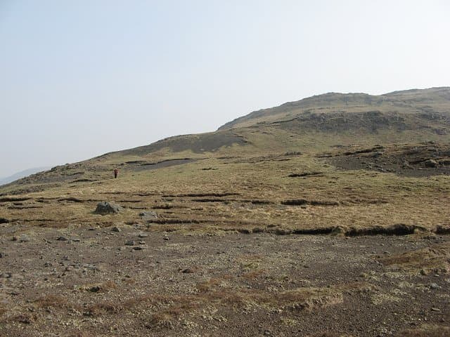
Coirc Bheinn — the Cauldron Hill — rises 561m south of Loch na Keal on the southern edge of Mull's Ben More massif. Its slopes drop into a fine corrie on the north side and give one of the best low-angle views straight up at Ben More's east ridge.
Quick facts
- Height
- 561m/ 1841ft
- Prominence
- 188 m
- Grid ref
- NM 48754 32668
- Nearest city
- Oban· 37km
- Dogs
- Dogs on lead required near livestockDog-friendly guide ↗
Height and prominence cross-checked against the Database of British and Irish Hills (CC BY).
No GPX track yet
Walked this route? Share your track to help other walkers.
Standard route
heather and bog 60% · grass slopes 25% · rocky summit 15%
Park at the road end at the head of Loch Ba and follow the rough stalkers' track south into Glen Cannel before climbing west onto the north-east shoulder. The corrie rim makes a natural handrail to the summit. Return time is around 4 hours.
Terrain
Damp deer-cropped grass and heather on the lower slopes, with occasional bog crossings. The upper hill is firmer, with short rocky steps on the corrie rim and a stony summit dome.
In winter
Snow can settle on the upper hill from December onwards but rarely persists long. The bigger winter hazard is rapid weather change rolling in from the Atlantic — visibility can drop in minutes.
Best time of year
Getting there
- Glasgow5h 56m
- Edinburgh8h 34m
Ferry access
Oban → Craignure
- Crossing time45 min
- Summer sailingsUp to 8 sailings daily (Apr–Oct)
- Winter sailings4–5 sailings daily (Nov–Mar)
- Book ahead7 days
- Last ferry backCheck CalMac timetable — sailings run until ~21:00 in peak summer
Foot passengers can usually turn up without booking. Book vehicle spaces in advance. The Lochaline → Fishnish crossing (15 min) is shorter but serves east Mull only.
Book on CalMac ↗OS maps: OS Landranger 48, OS Explorer 373, OS Explorer 375W
Mobile signal: Poor. Signal absent; inform a contact before heading into the remote Mull interior.
Current conditions
Daylight Today
- Sunrise
- 05:22
- Sunset
- 21:40
- Civil dawn
- 04:32
- Civil dusk
- 22:30
NOAA Solar Calculator · 30 July 2026
Around Coirc Bheinn on the SCOT network
Getting there, basing yourself, and what to do off the hill.
Getting there: Oban station
Argyll ferry hub; Mull, Lismore, Coll, Tiree, Barra connections
37km from the hill
tripscot.co.uk
On TripSCOTBase yourself in Tobermory
Mull base — Ben More, Treshnish, ferry to Iona
23km from the hill
tripscot.co.uk
On TasteSCOTAfter the hill: Tobermory
Mull — colourful harbour-front distillery making both unpeated and peated (Ledaig) whisky
23km from the hill
tastescot.co.uk
Coirc Bheinn — common questions
- How hard is Coirc Bheinn?
- We grade Coirc Bheinn at 2/5, which puts it in moderate territory. Terrain: Damp deer-cropped grass and heather on the lower slopes, with occasional bog crossings.
- How prominent is Coirc Bheinn?
- Coirc Bheinn has 188m of topographic prominence — the height of its summit above the highest col connecting it to higher ground. Marilyns are defined by that measure: at least 150m of drop on all sides.
- When should I climb Coirc Bheinn?
- The standard good-weather months for Coirc Bheinn are March, April, May, June, July, August, September, October. Outside those months, expect winter conditions on the high ground — full mountain kit, navigation skills, and a check of the SAIS avalanche forecast for the relevant region.
- Can I bring my dog up Coirc Bheinn?
- On a lead only — the route crosses ground with livestock or nesting-bird interest.
- What's mobile reception like on Coirc Bheinn?
- Poor. Signal absent; inform a contact before heading into the remote Mull interior.
- How do I get the ferry to Coirc Bheinn?
- Oban → Craignure. Up to 8 sailings daily (Apr–Oct) in summer; 4–5 sailings daily (Nov–Mar) in winter. Book at least 7 days ahead. Foot passengers can usually turn up without booking. Book vehicle spaces in advance. The Lochaline → Fishnish crossing (15 min) is shorter but serves east Mull only.
- Is Coirc Bheinn safe in winter?
- Snow can settle on the upper hill from December onwards but rarely persists long. The bigger winter hazard is rapid weather change rolling in from the Atlantic — visibility can drop in minutes.
Get the OutdoorSCOT weekly
One email a week — new route, hill and bothy guides, seasonal conditions and the odd hard-won lesson. No spam, unsubscribe in one click.