Marilyn · Argyll & Bute
Beinn Chreagach
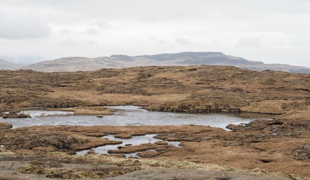
Beinn Chreagach — the Craggy Hill — is the highest point on the southern side of Loch Scridain, rising 378m above the road to Bunessan. The west view from the cairn takes in the white sands of the Ross of Mull, Iona, and the Treshnish basalt stacks on a clear day.
Quick facts
- Height
- 378.5m/ 1242ft
- Grid ref
- NM 51991 21689
- Nearest city
- Oban· 35km
- Dogs
- Dogs on lead required near livestockDog-friendly guide ↗
No GPX track yet
Walked this route? Share your track to help other walkers.
Standard route
basalt grassland 50% · rocky ridge 30% · heather 20%
Park on the wide verge near Pennyghael at the foot of the hill and ascend directly north up the open hillside, weaving through the rocky bands. The climb is short but unrelenting. Allow 2.5 hours for the round trip.
Terrain
A mosaic of short cropped turf and bare basalt outcrops, with very little bog. Quite a contrast to most Mull hills, the slabby rock provides easy walking lines once you read the terrain.
In winter
The basalt slabs become treacherously slick under rain or thin ice and the climb is steeper than it looks. Best left for a settled cold day or a dry spring.
Best time of year
Getting there
- Glasgow5h 43m
- Edinburgh7h 22m
Ferry access
Oban → Craignure
- Crossing time45 min
- Summer sailingsUp to 8 sailings daily (Apr–Oct)
- Winter sailings4–5 sailings daily (Nov–Mar)
- Book ahead7 days
- Last ferry backCheck CalMac timetable — sailings run until ~21:00 in peak summer
Foot passengers can usually turn up without booking. Book vehicle spaces in advance. The Lochaline → Fishnish crossing (15 min) is shorter but serves east Mull only.
Book on CalMac ↗OS maps: OS Landranger 48, OS Explorer 373, OS Explorer 375W
Mobile signal: Poor. South Mull/Ross of Mull; intermittent coverage.
Current conditions
Daylight Today
- Sunrise
- 04:37
- Sunset
- 22:17
- Civil dawn
- 03:33
- Civil dusk
- 23:21
NOAA Solar Calculator · 27 June 2026
Around Beinn Chreagach on the SCOT network
Getting there, basing yourself, and what to do off the hill.
Beinn Chreagach — common questions
- How hard is Beinn Chreagach?
- Beinn Chreagach is rated 1/5 (easy) on the OutdoorSCOT scale. Terrain: A mosaic of short cropped turf and bare basalt outcrops, with very little bog.
- When is the best time to climb Beinn Chreagach?
- The standard good-weather months for Beinn Chreagach are March, April, May, June, July, August, September, October. Outside those months, expect winter conditions on the high ground — full mountain kit, navigation skills, and a check of the SAIS avalanche forecast for the relevant region.
- Can I bring my dog up Beinn Chreagach?
- Yes, but dogs must be kept on a lead — there is livestock or ground-nesting bird interest on the route.
- Is there mobile signal on Beinn Chreagach?
- Poor. South Mull/Ross of Mull; intermittent coverage.
- How do I get the ferry to Beinn Chreagach?
- Oban → Craignure. Up to 8 sailings daily (Apr–Oct) in summer; 4–5 sailings daily (Nov–Mar) in winter. Book at least 7 days ahead. Foot passengers can usually turn up without booking. Book vehicle spaces in advance. The Lochaline → Fishnish crossing (15 min) is shorter but serves east Mull only.
- Is Beinn Chreagach safe in winter?
- The basalt slabs become treacherously slick under rain or thin ice and the climb is steeper than it looks. Best left for a settled cold day or a dry spring.
Get the OutdoorSCOT weekly
One email a week — new route, hill and bothy guides, seasonal conditions and the odd hard-won lesson. No spam, unsubscribe in one click.