Marilyn · Argyll & Bute
Beinn na Croise
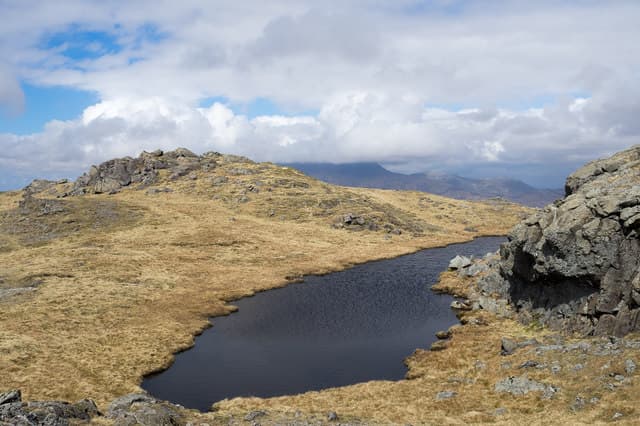
Beinn na Croise — the Hill of the Cross — is a 503m basalt top on the south shore of Loch Scridain, looking across the loch to the cliffs of Ardmeanach. Its prominence and isolated stance give surprisingly extensive views over the Ross of Mull toward Iona.
Quick facts
- Height
- 503m/ 1650ft
- Prominence
- 250 m
- Grid ref
- NM 55979 25099
- Nearest city
- Oban· 30km
- Dogs
- Dogs on lead required near livestockDog-friendly guide ↗
Height and prominence cross-checked against the Database of British and Irish Hills (CC BY).
No GPX track yet
Walked this route? Share your track to help other walkers.
Standard route
heather and bog 60% · grass slopes 25% · rocky summit 15%
Park carefully on the verge near Pennyghael and head south up the open hillside, contouring around the lower crags before tackling the broad north ridge. The summit is a stone-strewn dome. Plan on 3 to 4 hours return.
Terrain
Wet heather and bog on the lower flanks gives way to firmer grass and rock on the ridge. Several small burns cross the line of ascent and can run high after rain.
In winter
A useful winter hill when conditions on the mainland are severe — snow rarely persists below 400m here. Frequent rain can leave the lower bog all but impassable, so check forecasts.
Best time of year
Getting there
- Glasgow5h 35m
- Edinburgh7h 13m
Ferry access
Oban → Craignure
- Crossing time45 min
- Summer sailingsUp to 8 sailings daily (Apr–Oct)
- Winter sailings4–5 sailings daily (Nov–Mar)
- Book ahead7 days
- Last ferry backCheck CalMac timetable — sailings run until ~21:00 in peak summer
Foot passengers can usually turn up without booking. Book vehicle spaces in advance. The Lochaline → Fishnish crossing (15 min) is shorter but serves east Mull only.
Book on CalMac ↗OS maps: OS Landranger 48, OS Explorer 375W
Mobile signal: Poor. Neither EE nor Vodafone works on this remote Mull hill.
Current conditions
Daylight Today
- Sunrise
- 05:22
- Sunset
- 21:39
- Civil dawn
- 04:32
- Civil dusk
- 22:29
NOAA Solar Calculator · 30 July 2026
Around Beinn na Croise on the SCOT network
Getting there, basing yourself, and what to do off the hill.
Beinn na Croise — common questions
- What difficulty is Beinn na Croise?
- On the OutdoorSCOT scale, Beinn na Croise comes in at 2/5 — moderate. Underfoot: Wet heather and bog on the lower flanks gives way to firmer grass and rock on the ridge.
- What is Beinn na Croise's prominence?
- 250m of prominence. That's the vertical drop from the summit to the col that links Beinn na Croise to the next higher ground. That drop is what qualifies it as a Marilyn — a hill with at least 150m of descent on every side.
- When is the best time to climb Beinn na Croise?
- March, April, May, June, July, August, September, October give the most reliable conditions on Beinn na Croise. Beyond that window the high ground turns wintry: carry full mountain kit, be confident navigating, and check the SAIS avalanche forecast for the area.
- Is Beinn na Croise dog-friendly?
- Yes, but dogs must be kept on a lead — there is livestock or ground-nesting bird interest on the route.
- Is there mobile signal on Beinn na Croise?
- Poor. Neither EE nor Vodafone works on this remote Mull hill.
- How do I get the ferry to Beinn na Croise?
- Oban → Craignure. Up to 8 sailings daily (Apr–Oct) in summer; 4–5 sailings daily (Nov–Mar) in winter. Book at least 7 days ahead. Foot passengers can usually turn up without booking. Book vehicle spaces in advance. The Lochaline → Fishnish crossing (15 min) is shorter but serves east Mull only.
- Is Beinn na Croise safe in winter?
- A useful winter hill when conditions on the mainland are severe — snow rarely persists below 400m here. Frequent rain can leave the lower bog all but impassable, so check forecasts.
Get the OutdoorSCOT weekly
One email a week — new route, hill and bothy guides, seasonal conditions and the odd hard-won lesson. No spam, unsubscribe in one click.