Marilyn · Perthshire
Cruach Tairbeirt
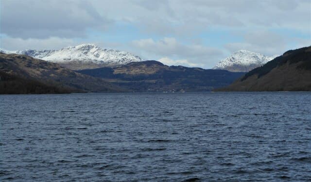
Cruach Tairbeirt — the isthmus stack — rises to 415m above Arrochar at NN 312 058, between Loch Long and Loch Lomond on the narrow neck of land that gives Tarbet its name. Vikings reputedly dragged longships across this isthmus in 1263. The summit looks straight across to the Cobbler and along Loch Long towards the Clyde.
Quick facts
- Height
- 415m/ 1362ft
- Prominence
- 280 m
- Grid ref
- NN 31266 05864
- Nearest city
- Glasgow· 49km
- Dogs
- Dogs on lead required near livestockDog-friendly guide ↗
Height and prominence cross-checked against the Database of British and Irish Hills (CC BY).
No GPX track yet
Walked this route? Share your track to help other walkers.
Standard route
heather moorland 60% · grass slopes 30% · rocky summit 10%
Begin at the small car park beside Arrochar & Tarbet railway station. A waymarked forest path climbs north-west on a zig-zag through Sitka spruce to a clearing on the south ridge, then follows a clear path north along the open crest to the summit cairn.
Terrain
Stone-cobbled forest path through the lower spruce, then a peaty open ridge with occasional duckboards laid by the National Park rangers. The summit is short turf and bare schist with a small cairn.
In winter
Damp west-coast hill where ice forms on the wooden boardwalks under the forest canopy. Snow on the open ridge is wet and patchy. Microspikes useful on the path; the open ridge is rarely an issue.
Best time of year
Getting there
- Glasgow2h 31m
- Edinburgh4h 1m
OS maps: OS Landranger 56, OS Explorer 0039S, OS Explorer 364S
Mobile signal: Poor. Remote Cowal/Trossachs edge; limited coverage.
Current conditions
Daylight Today
- Sunrise
- 05:18
- Sunset
- 21:33
- Civil dawn
- 04:28
- Civil dusk
- 22:23
NOAA Solar Calculator · 30 July 2026
Around Cruach Tairbeirt on the SCOT network
Getting there, basing yourself, and what to do off the hill.
Cruach Tairbeirt — common questions
- Is Cruach Tairbeirt a hard climb?
- Cruach Tairbeirt is rated 1/5 (easy) on the OutdoorSCOT scale. Underfoot: Stone-cobbled forest path through the lower spruce, then a peaty open ridge with occasional duckboards laid by the National Park rangers.
- What is Cruach Tairbeirt's prominence?
- 280m of prominence. That's the vertical drop from the summit to the col that links Cruach Tairbeirt to the next higher ground. That drop is what qualifies it as a Marilyn — a hill with at least 150m of descent on every side.
- When is the best time to climb Cruach Tairbeirt?
- March, April, May, June, July, August, September, October give the most reliable conditions on Cruach Tairbeirt. Beyond that window the high ground turns wintry: carry full mountain kit, be confident navigating, and check the SAIS avalanche forecast for the area.
- Is Cruach Tairbeirt dog-friendly?
- Yes, but dogs must be kept on a lead — there is livestock or ground-nesting bird interest on the route.
- Is there mobile signal on Cruach Tairbeirt?
- Poor. Remote Cowal/Trossachs edge; limited coverage.
- Is Cruach Tairbeirt safe in winter?
- Damp west-coast hill where ice forms on the wooden boardwalks under the forest canopy. Snow on the open ridge is wet and patchy. Microspikes useful on the path; the open ridge is rarely an issue.
Get the OutdoorSCOT weekly
One email a week — new route, hill and bothy guides, seasonal conditions and the odd hard-won lesson. No spam, unsubscribe in one click.