Marilyn · Perthshire
Beinn Uird
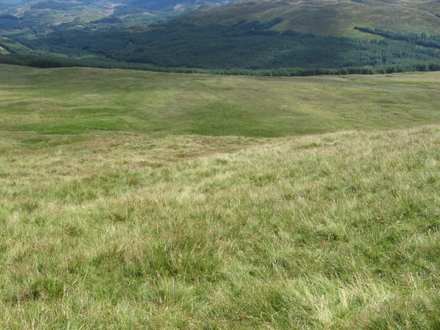
Beinn Uird — the anvil hill — reaches 596m on the wedge of high ground between Loch Long and Loch Lomond at NS 399 985. It is one of the lonely Luss/Argyll Forest tops where steep birch flanks rise from the Glen Douglas military railway towards a rocky little crown. The summit overlooks the head of Glen Mallan and the upper Loch Long.
Quick facts
- Height
- 596.6m/ 1957ft
- Prominence
- 212 m
- Grid ref
- NS 39949 98517
- Nearest city
- Glasgow· 38km
- Dogs
- Dogs on lead required near livestockDog-friendly guide ↗
Height and prominence cross-checked against the Database of British and Irish Hills (CC BY).
No GPX track yet
Walked this route? Share your track to help other walkers.
Standard route
heather moorland 65% · bog and wet grass 25% · rocky summit 10%
A typical line begins on the B832 from the head of Glen Luss at Glenmallochan, gaining height on the south-east shoulder through felled forestry and onto the heather ridge. The summit cairn sits among schist outcrops at the head of the Allt Uird.
Terrain
Felled forestry on the lower south-east shoulder — slash and stumps make for awkward going. Above the felling line the heather is short and the rocky top dries quickly, but boggy seeps appear on every saddle.
In winter
Atlantic, west-facing hill where wet snow turns rapidly to slush at this elevation. The principal risk is hidden ice between the forestry stumps on the descent. Snow on the summit blocks rarely lies more than a week at a time.
Best time of year
Getting there
- Glasgow1h 8m
- Edinburgh4h 38m
OS maps: OS Landranger 56, OS Explorer 0039S, OS Explorer 364S
Mobile signal: Poor. Remote Argyll/Trossachs edge; limited coverage.
Current conditions
Daylight Today
- Sunrise
- 05:17
- Sunset
- 21:32
- Civil dawn
- 04:28
- Civil dusk
- 22:22
NOAA Solar Calculator · 30 July 2026
Around Beinn Uird on the SCOT network
Getting there, basing yourself, and what to do off the hill.
Getting there: Arrochar & Tarbet station
Arrochar Alps — The Cobbler, Beinn Ime, Beinn Narnain, Ben Vane, Ben Vorlich
11km from the hill
tripscot.co.uk
On TripSCOTBase yourself in Luss
West Loch Lomond village — Highland Boundary, Loch Lomond Way
7km from the hill
tripscot.co.uk
On TasteSCOTAfter the hill: Loch Lomond
Alexandria — sprawling distillery on the south end of the loch
18km from the hill
tastescot.co.uk
Beinn Uird — common questions
- Is Beinn Uird a hard climb?
- Beinn Uird is rated 2/5 (moderate) on the OutdoorSCOT scale. Ground conditions: Felled forestry on the lower south-east shoulder — slash and stumps make for awkward going.
- How much drop does Beinn Uird have?
- The drop is 212m: measured from the summit of Beinn Uird down to the saddle joining it to higher terrain. Passing the 150m-drop threshold on all sides is exactly what makes it a Marilyn.
- What's the best month to climb Beinn Uird?
- Aim for March, April, May, June, July, August, September, October on Beinn Uird. In the remaining months treat it as a winter hill — full kit, solid navigation, and a look at the relevant SAIS avalanche forecast before you go.
- Can dogs go up Beinn Uird?
- Dogs are fine on a lead. The route passes livestock or ground-nesting bird habitat, so keep them close throughout.
- Will I get phone signal on Beinn Uird?
- Poor. Remote Argyll/Trossachs edge; limited coverage.
- Is Beinn Uird safe in winter?
- Atlantic, west-facing hill where wet snow turns rapidly to slush at this elevation. The principal risk is hidden ice between the forestry stumps on the descent. Snow on the summit blocks rarely lies more than a week at a time.
Get the OutdoorSCOT weekly
One email a week — new route, hill and bothy guides, seasonal conditions and the odd hard-won lesson. No spam, unsubscribe in one click.