Marilyn · Perthshire
Binnean nan Gobhar
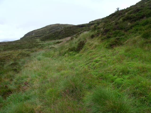
Binnean nan Gobhar — the little peak of the goats — is the rocky 584m top above Glen Douglas in the Luss Hills, at NS 419 967. It sits within sight of Beinn Bhreac and Cruach an t-Sidhein, on the spine that divides the headwaters of the Inveruglas Water from the Glen Mallan burns. Its steep northern face is the most striking aspect; the south side is gentler grass.
Quick facts
- Height
- 584.8m/ 1919ft
- Prominence
- 152 m
- Grid ref
- NS 41900 96756
- Nearest city
- Glasgow· 36km
- Dogs
- Dogs on lead required near livestockDog-friendly guide ↗
Height and prominence cross-checked against the Database of British and Irish Hills (CC BY).
No GPX track yet
Walked this route? Share your track to help other walkers.
Standard route
heather and bog 65% · grass slopes 25% · rocky summit 10%
The natural start is the Glen Douglas road south of the MoD installation; from there a faint quad track climbs north-east through bracken before fading on the heathery shoulder. The summit cairn sits on a small rocky scarp at the head of the corrie.
Terrain
Bracken, deep heather and patches of scree above the burn. The hill is steep-sided rather than long — a short, sharp climb on rough Luss ground with a couple of crag bands to thread on the upper slopes.
In winter
The north face holds wet snow for several days after a fall and the scree bands ice up unpredictably. A useful winter introduction to mixed ground if the snow is consolidated, but treat the crag bands with care in spindrift.
Best time of year
Getting there
- Glasgow1h 3m
- Edinburgh4h 32m
OS maps: OS Landranger 56, OS Explorer 046S, OS Explorer 365S
Mobile signal: Poor. No networks; download offline maps and inform a contact before departure.
Current conditions
Daylight Today
- Sunrise
- 05:17
- Sunset
- 21:32
- Civil dawn
- 04:28
- Civil dusk
- 22:22
NOAA Solar Calculator · 30 July 2026
Around Binnean nan Gobhar on the SCOT network
Getting there, basing yourself, and what to do off the hill.
Getting there: Arrochar & Tarbet station
Arrochar Alps — The Cobbler, Beinn Ime, Beinn Narnain, Ben Vane, Ben Vorlich
14km from the hill
tripscot.co.uk
On TripSCOTBase yourself in Luss
West Loch Lomond village — Highland Boundary, Loch Lomond Way
7km from the hill
tripscot.co.uk
On TasteSCOTAfter the hill: Loch Lomond
Alexandria — sprawling distillery on the south end of the loch
16km from the hill
tastescot.co.uk
Binnean nan Gobhar — common questions
- Is Binnean nan Gobhar a hard climb?
- Binnean nan Gobhar is rated 2/5 (moderate) on the OutdoorSCOT scale. Underfoot: Bracken, deep heather and patches of scree above the burn.
- What is Binnean nan Gobhar's prominence?
- 152m of prominence. That's the vertical drop from the summit to the col that links Binnean nan Gobhar to the next higher ground. That drop is what qualifies it as a Marilyn — a hill with at least 150m of descent on every side.
- When is the best time to climb Binnean nan Gobhar?
- March, April, May, June, July, August, September, October give the most reliable conditions on Binnean nan Gobhar. Beyond that window the high ground turns wintry: carry full mountain kit, be confident navigating, and check the SAIS avalanche forecast for the area.
- Is Binnean nan Gobhar dog-friendly?
- Yes, but dogs must be kept on a lead — there is livestock or ground-nesting bird interest on the route.
- Is there mobile signal on Binnean nan Gobhar?
- Poor. No networks; download offline maps and inform a contact before departure.
- Is Binnean nan Gobhar safe in winter?
- The north face holds wet snow for several days after a fall and the scree bands ice up unpredictably. A useful winter introduction to mixed ground if the snow is consolidated, but treat the crag bands with care in spindrift.
Get the OutdoorSCOT weekly
One email a week — new route, hill and bothy guides, seasonal conditions and the odd hard-won lesson. No spam, unsubscribe in one click.