Marilyn · Perthshire
Beinn Dubh
Beinn Dubh — the black hill — is the dark, peaty ridge that climbs from the village of Luss to 508m, at NS 404 045. Its silhouette dominates the view across Loch Lomond from Inveruglas. The Luss Heritage Path delivers walkers to its lower slopes; from the cairned top the view spans the loch islands of Inchlonaig and Inchconnachan.
Gaelic: “mountain, black” · Pronunciation: bine doo
Quick facts
- Height
- 508m/ 1667ft
- Prominence
- 193 m
- Grid ref
- NN 40445 04502
- Nearest city
- Stirling· 41km
- Dogs
- Dogs on lead required near livestockDog-friendly guide ↗
Height and prominence cross-checked against the Database of British and Irish Hills (CC BY).
No GPX track yet
Walked this route? Share your track to help other walkers.
Standard route
heather and bracken 60% · grass slopes 25% · rocky outcrops 15%
The classic horseshoe begins from the Luss village car park: follow Glen Luss road for a short distance, then take the signposted path west onto the south-east ridge of Beinn Dubh, climbing steadily over Mid Hill to the cairn. Return down the parallel Mid Hill ridge to Glen Striddle.
Terrain
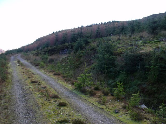
Eroded peat hags on the broad ridge — black, sticky going after rain, hence the name — with bracken on the lower flanks and grassy lawns near the summit cairn. A small path is intermittent.
In winter
Loch Lomond-side hill where the peat hags freeze hard and become easier to cross. Light snow cover is the norm and rarely lies long; the main hazard is glaze ice on the steep grass at the start of the ridge.
Best time of year
Getting there
- Glasgow1h 13m
- Edinburgh4h 38m
OS maps: OS Landranger 56, OS Explorer 0039S, OS Explorer 364S
Mobile signal: Poor. Remote Loch Lomond-side; limited coverage.
Current conditions
Daylight Today
- Sunrise
- 05:17
- Sunset
- 21:33
- Civil dawn
- 04:27
- Civil dusk
- 22:22
NOAA Solar Calculator · 30 July 2026
Around Beinn Dubh on the SCOT network
Getting there, basing yourself, and what to do off the hill.
Getting there: Arrochar & Tarbet station
Arrochar Alps — The Cobbler, Beinn Ime, Beinn Narnain, Ben Vane, Ben Vorlich
10km from the hill
tripscot.co.uk
On TripSCOTBase yourself in Luss
West Loch Lomond village — Highland Boundary, Loch Lomond Way
12km from the hill
tripscot.co.uk
On TasteSCOTAfter the hill: Loch Lomond
Alexandria — sprawling distillery on the south end of the loch
24km from the hill
tastescot.co.uk
Beinn Dubh — common questions
- What difficulty is Beinn Dubh?
- On the OutdoorSCOT scale, Beinn Dubh comes in at 2/5 — moderate. Terrain: Eroded peat hags on the broad ridge — black, sticky going after rain, hence the name — with bracken on the lower flanks and grassy lawns near the summit cairn.
- How prominent is Beinn Dubh?
- Beinn Dubh has 193m of topographic prominence — the height of its summit above the highest col connecting it to higher ground. Marilyns are defined by that measure: at least 150m of drop on all sides.
- When should I climb Beinn Dubh?
- The standard good-weather months for Beinn Dubh are March, April, May, June, July, August, September, October. Outside those months, expect winter conditions on the high ground — full mountain kit, navigation skills, and a check of the SAIS avalanche forecast for the relevant region.
- Can I bring my dog up Beinn Dubh?
- On a lead only — the route crosses ground with livestock or nesting-bird interest.
- What's mobile reception like on Beinn Dubh?
- Poor. Remote Loch Lomond-side; limited coverage.
- Is Beinn Dubh safe in winter?
- Loch Lomond-side hill where the peat hags freeze hard and become easier to cross. Light snow cover is the norm and rarely lies long; the main hazard is glaze ice on the steep grass at the start of the ridge.
Get the OutdoorSCOT weekly
One email a week — new route, hill and bothy guides, seasonal conditions and the odd hard-won lesson. No spam, unsubscribe in one click.