Marilyn · Perthshire
Creag nam Mial
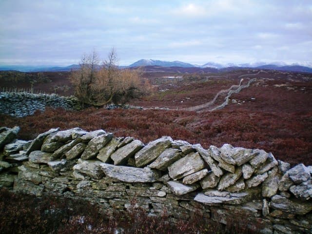
Creag nam Mial — crag of the wild animals — is a 561m hill on the southern fringe of the Tummel basin north of Dunkeld. Its slopes carry the remnants of native birch and rowan, with rocky bluffs giving the summit a more rugged character than its modest height suggests.
Quick facts
- Height
- 561.8m/ 1843ft
- Prominence
- 208 m
- Grid ref
- NO 05382 54109
- Nearest city
- Perth· 31km
- Dogs
- Dogs on lead required near livestockDog-friendly guide ↗
Height and prominence cross-checked against the Database of British and Irish Hills (CC BY).
No GPX track yet
Walked this route? Share your track to help other walkers.
Standard route
heather moorland 55% · rocky slopes 30% · grass slopes 15%
Start from the small parking area on the minor road through Glen Garr and follow a faint quad track through bracken and birch onto open heather. The final 80m or so involves picking a way between rocky outcrops to the cairn — roughly 6km return in 2 to 3 hours.
Terrain
Tussocky heather and bilberry over peat lower down, drying to firmer grass and exposed schist near the top. Burns crossing the lower slopes can run high after rain and add a wet-feet element.
In winter
Sheltered enough that early snow tends to melt quickly, though a hard frost can leave the upper outcrops glazed. A walking axe is rarely needed; spikes are useful if the cairn area ices over after a freeze-thaw cycle.
Best time of year
Getting there
- Glasgow3h 46m
- Edinburgh2h 4m
OS maps: OS Landranger 52, OS Landranger 53, OS Explorer 052S, OS Explorer 387S
Mobile signal: Expect little. zero EE on this remote Perthshire hill; nearest coverage near Pitlochry.
Current conditions
Daylight Today
- Sunrise
- 05:10
- Sunset
- 21:31
- Civil dawn
- 04:19
- Civil dusk
- 22:22
NOAA Solar Calculator · 30 July 2026
Around Creag nam Mial on the SCOT network
Getting there, basing yourself, and what to do off the hill.
Getting there: Dunkeld & Birnam station
Birnam Hill, Hermitage walks, southern Perthshire gateway
12km from the hill
tripscot.co.uk
On TripSCOTBase yourself in Dunkeld
Southern Cairngorms gateway — Hermitage, Loch of the Lowes
12km from the hill
tripscot.co.uk
On TasteSCOTAfter the hill: Edradour
Pitlochry — until recently Scotland's smallest distillery; charming Perthshire setting
10km from the hill
tastescot.co.uk
Creag nam Mial — common questions
- Is Creag nam Mial a hard climb?
- Creag nam Mial is rated 2/5 (moderate) on the OutdoorSCOT scale. Ground conditions: Tussocky heather and bilberry over peat lower down, drying to firmer grass and exposed schist near the top.
- How much drop does Creag nam Mial have?
- The drop is 208m: measured from the summit of Creag nam Mial down to the saddle joining it to higher terrain. Passing the 150m-drop threshold on all sides is exactly what makes it a Marilyn.
- What's the best month to climb Creag nam Mial?
- Aim for March, April, May, June, July, August, September, October on Creag nam Mial. In the remaining months treat it as a winter hill — full kit, solid navigation, and a look at the relevant SAIS avalanche forecast before you go.
- Can dogs go up Creag nam Mial?
- Dogs are fine on a lead. The route passes livestock or ground-nesting bird habitat, so keep them close throughout.
- Will I get phone signal on Creag nam Mial?
- Expect little. zero EE on this remote Perthshire hill; nearest coverage near Pitlochry.
- Is Creag nam Mial safe in winter?
- Sheltered enough that early snow tends to melt quickly, though a hard frost can leave the upper outcrops glazed. A walking axe is rarely needed; spikes are useful if the cairn area ices over after a freeze-thaw cycle.
Get the OutdoorSCOT weekly
One email a week — new route, hill and bothy guides, seasonal conditions and the odd hard-won lesson. No spam, unsubscribe in one click.