Marilyn · Perthshire
Newtyle Hill
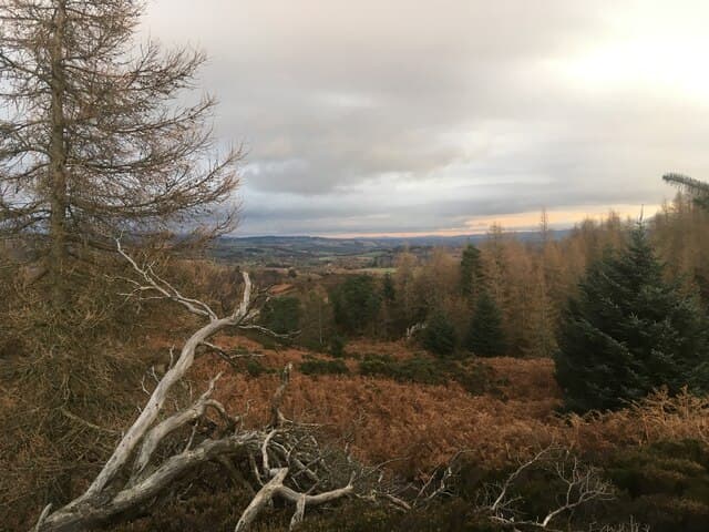
A 317m heather-and-pasture hill rising abruptly out of the fertile Strathmore plain on the south edge of the Sidlaws. Despite being almost a suburb of Coupar Angus, the top has the quality of a real summit, with a sudden view of the Tay estuary and the Lomond Hills of Fife to the south.
Quick facts
- Height
- 317m/ 1040ft
- Prominence
- 185 m
- Grid ref
- NO 05003 41881
- Nearest city
- Perth· 20km
- Dogs
- Dogs on lead required near livestockDog-friendly guide ↗
Height and prominence cross-checked against the Database of British and Irish Hills (CC BY).
No GPX track yet
Walked this route? Share your track to help other walkers.
Standard route
heather moorland 60% · grass and bracken 30% · rocky summit 10%
A right-of-way climbs from Newtyle village past Hatton Castle and onto the open hillside via field margins. The route follows a clear track to the trig pillar at the western end of the ridge — 4km return in roughly 1.5 hours.
Terrain
Lower slopes are mown estate paths through bracken; the upper section is short turf and exposed bedrock with a fence to follow if cloud comes in. Excellent footing throughout.
In winter
Sidlaw hills sit low enough that snow rarely settles for long. A bright winter afternoon often gives the clearest views of the year across Strathmore towards the Mounth. Wind exposure on the ridge is the only real consideration.
Best time of year
Getting there
- Glasgow3h 34m
- Edinburgh2h 49m
OS maps: OS Landranger 52, OS Landranger 53, OS Explorer 379E
Mobile signal: Reliable up top; EE seldom drops. Fine Angus and Strathmore views.
Current conditions
Daylight Today
- Sunrise
- 05:11
- Sunset
- 21:30
- Civil dawn
- 04:20
- Civil dusk
- 22:21
NOAA Solar Calculator · 30 July 2026
Around Newtyle Hill on the SCOT network
Getting there, basing yourself, and what to do off the hill.
Newtyle Hill — common questions
- How difficult is Newtyle Hill?
- Newtyle Hill carries a 1/5 (easy) grade on the OutdoorSCOT scale. Terrain: Lower slopes are mown estate paths through bracken; the upper section is short turf and exposed bedrock with a fence to follow if cloud comes in.
- How prominent is Newtyle Hill?
- Newtyle Hill has 185m of topographic prominence — the height of its summit above the highest col connecting it to higher ground. Marilyns are defined by that measure: at least 150m of drop on all sides.
- When should I climb Newtyle Hill?
- The standard good-weather months for Newtyle Hill are March, April, May, June, July, August, September, October. Outside those months, expect winter conditions on the high ground — full mountain kit, navigation skills, and a check of the SAIS avalanche forecast for the relevant region.
- Can I bring my dog up Newtyle Hill?
- On a lead only — the route crosses ground with livestock or nesting-bird interest.
- What's mobile reception like on Newtyle Hill?
- Reliable up top; EE seldom drops. Fine Angus and Strathmore views.
- Is Newtyle Hill safe in winter?
- Sidlaw hills sit low enough that snow rarely settles for long. A bright winter afternoon often gives the clearest views of the year across Strathmore towards the Mounth. Wind exposure on the ridge is the only real consideration.
Get the OutdoorSCOT weekly
One email a week — new route, hill and bothy guides, seasonal conditions and the odd hard-won lesson. No spam, unsubscribe in one click.