Marilyn · Perthshire
Creag na Criche
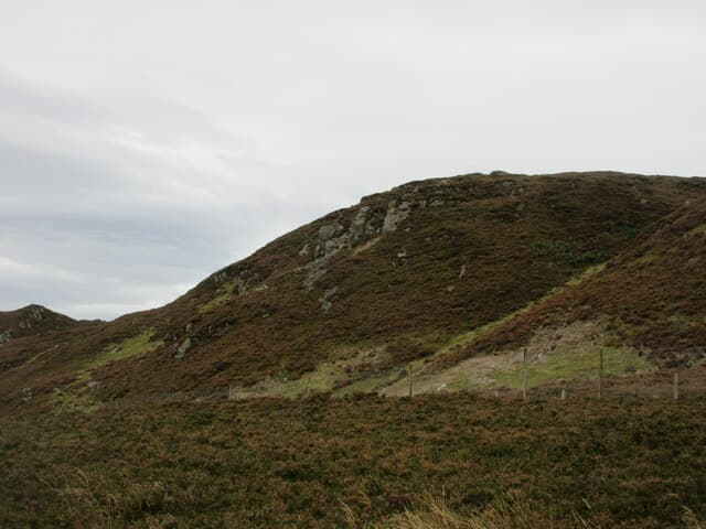
Creag na Criche — the crag of the boundary — rises to 456m on the watershed between Strath Braan and Glen Quaich in NN-square Perthshire. It sits north-east of Amulree above the upper River Braan, with the Sma' Glen falling away to the south. Despite the modest altitude, the summit cairn looks out across the Lawers range and over the rolling moors towards Schiehallion.
Quick facts
- Height
- 456.8m/ 1499ft
- Prominence
- 151 m
- Grid ref
- NN 98575 35079
- Nearest city
- Perth· 17km
- Dogs
- Dogs on lead required near livestockDog-friendly guide ↗
Height and prominence cross-checked against the Database of British and Irish Hills (CC BY).
No GPX track yet
Walked this route? Share your track to help other walkers.
Standard route
heather moorland 65% · grass slopes 25% · rocky summit 10%
Most parties start from the minor road past Loch Freuchie east of Amulree, climbing rough heather and tussock north-west onto the summit ridge. There is no constructed path; the going is pathless and route-finding relies on a steady contour onto the broad top crowned by a small cairn.
Terrain
Tussock grass, heather and patches of bog above the Loch Freuchie road. The lower slopes are grazed sheep ground; the top is open moor with a few peat hags either side of the summit dome. No marked path.
In winter
Below 500m, the main winter hazards are hard frozen tussocks, hidden bog pans and a very short daylight window. Snow accumulation is generally light and intermittent. A clear pair of poles and gaiters are more useful than crampons here.
Best time of year
Getting there
- Glasgow2h 16m
- Edinburgh2h 50m
OS maps: OS Landranger 52, OS Landranger 53, OS Explorer 379E
Mobile signal: Mixed. EE only occasional here; improves toward Loch Tay.
Current conditions
Daylight Today
- Sunrise
- 05:12
- Sunset
- 21:30
- Civil dawn
- 04:21
- Civil dusk
- 22:21
NOAA Solar Calculator · 30 July 2026
Around Creag na Criche on the SCOT network
Getting there, basing yourself, and what to do off the hill.
Creag na Criche — common questions
- How hard is Creag na Criche?
- We grade Creag na Criche at 1/5, which puts it in easy territory. Ground conditions: Tussock grass, heather and patches of bog above the Loch Freuchie road.
- How much drop does Creag na Criche have?
- The drop is 151m: measured from the summit of Creag na Criche down to the saddle joining it to higher terrain. Passing the 150m-drop threshold on all sides is exactly what makes it a Marilyn.
- What's the best month to climb Creag na Criche?
- Aim for March, April, May, June, July, August, September, October on Creag na Criche. In the remaining months treat it as a winter hill — full kit, solid navigation, and a look at the relevant SAIS avalanche forecast before you go.
- Can dogs go up Creag na Criche?
- Dogs are fine on a lead. The route passes livestock or ground-nesting bird habitat, so keep them close throughout.
- Will I get phone signal on Creag na Criche?
- Mixed. EE only occasional here; improves toward Loch Tay.
- Is Creag na Criche safe in winter?
- Below 500m, the main winter hazards are hard frozen tussocks, hidden bog pans and a very short daylight window. Snow accumulation is generally light and intermittent. A clear pair of poles and gaiters are more useful than crampons here.
Get the OutdoorSCOT weekly
One email a week — new route, hill and bothy guides, seasonal conditions and the odd hard-won lesson. No spam, unsubscribe in one click.