Marilyn · Perthshire
Deuchary Hill
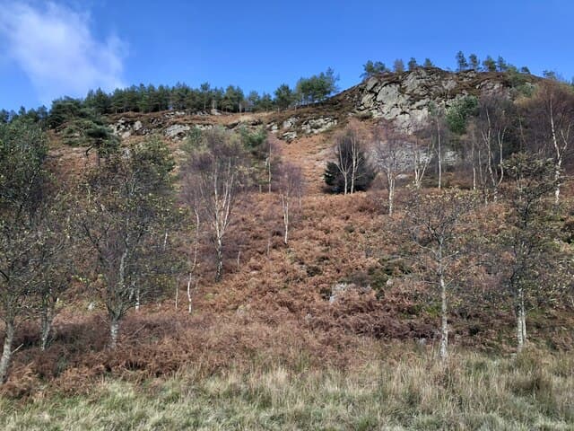
A pleasing 511m wooded summit rising directly behind Dunkeld, with the Tay valley spreading out below and Highland ridges crowding the northern horizon. Despite proximity to the A9, this is genuinely quiet country with deer, red squirrels and occasional capercaillie in the surrounding pinewoods.
Quick facts
- Height
- 511m/ 1677ft
- Prominence
- 220 m
- Grid ref
- NO 03734 48508
- Nearest city
- Perth· 26km
- Dogs
- Dogs on lead required near livestockDog-friendly guide ↗
Height and prominence cross-checked against the Database of British and Irish Hills (CC BY).
No GPX track yet
Walked this route? Share your track to help other walkers.
Standard route
forestry tracks 30% · heather moorland 50% · rocky summit 20%
A circular ascent from the Cally car park follows estate tracks up through Scots pine plantation before emerging onto open heather for the final pull to the trig. Around 8km return with steady but never strenuous gradients — typically 2.5 to 3 hours including stops.
Terrain
Forest track on the lower third, then a clear stalkers path zigzagging through bracken before opening onto firm heather and short turf. The summit area carries scattered granite slabs but no scrambling.
In winter
A reliable choice in winter when the bigger Perthshire hills are buried. Forest tracks stay walkable through snow and the modest elevation means temperatures rarely plunge dangerously low. Take a head torch in December as light fades by 4pm.
Best time of year
Getting there
- Glasgow3h 38m
- Edinburgh2h 59m
OS maps: OS Landranger 52, OS Landranger 53, OS Explorer 379E
Mobile signal: Patchy. EE hit and miss; stronger toward Dunkeld.
Current conditions
Daylight Today
- Sunrise
- 05:11
- Sunset
- 21:31
- Civil dawn
- 04:20
- Civil dusk
- 22:22
NOAA Solar Calculator · 30 July 2026
Around Deuchary Hill on the SCOT network
Getting there, basing yourself, and what to do off the hill.
Deuchary Hill — common questions
- Is Deuchary Hill a hard climb?
- Deuchary Hill is rated 2/5 (moderate) on the OutdoorSCOT scale. Underfoot: Forest track on the lower third, then a clear stalkers path zigzagging through bracken before opening onto firm heather and short turf.
- What is Deuchary Hill's prominence?
- 220m of prominence. That's the vertical drop from the summit to the col that links Deuchary Hill to the next higher ground. That drop is what qualifies it as a Marilyn — a hill with at least 150m of descent on every side.
- When is the best time to climb Deuchary Hill?
- March, April, May, June, July, August, September, October give the most reliable conditions on Deuchary Hill. Beyond that window the high ground turns wintry: carry full mountain kit, be confident navigating, and check the SAIS avalanche forecast for the area.
- Is Deuchary Hill dog-friendly?
- Yes, but dogs must be kept on a lead — there is livestock or ground-nesting bird interest on the route.
- Is there mobile signal on Deuchary Hill?
- Patchy. EE hit and miss; stronger toward Dunkeld.
- Is Deuchary Hill safe in winter?
- A reliable choice in winter when the bigger Perthshire hills are buried. Forest tracks stay walkable through snow and the modest elevation means temperatures rarely plunge dangerously low. Take a head torch in December as light fades by 4pm.
Get the OutdoorSCOT weekly
One email a week — new route, hill and bothy guides, seasonal conditions and the odd hard-won lesson. No spam, unsubscribe in one click.