Marilyn · Argyll
Cnoc Moy
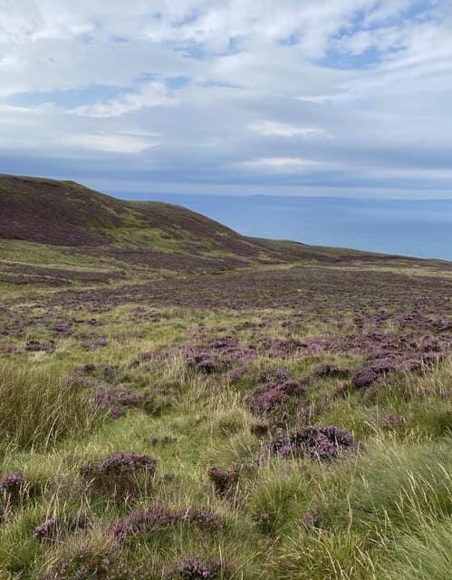
Cnoc Moy is the broad 446m moorland summit near the Mull of Kintyre, looking out toward Ireland and Rathlin Island. The ascent rewards the long drive south with a remarkable sense of edge-of-the-world isolation.
Quick facts
- Height
- 446m/ 1463ft
- Prominence
- 432 m
- Grid ref
- NR 61156 15224
- Dogs
- Dogs on lead required near livestockDog-friendly guide ↗
Height and prominence cross-checked against the Database of British and Irish Hills (CC BY).
No GPX track yet
Walked this route? Share your track to help other walkers.
Standard route
heather moorland 65% · grass slopes 25% · rocky summit 10%
From the road near Carskey Bay strike north up the long grassy ridge, with a stalkers' path easing the lower section. Allow around four hours for the return.
Terrain
Sheep-cropped grass and short heather over broad whaleback slopes. Peat hags appear on the plateau and require some weaving.
In winter
The peninsula's mild oceanic climate keeps snow brief, though Atlantic squalls can hit unannounced. Visibility matters more than ice axes here.
Best time of year
Getting there
- Glasgow4h 8m
- Edinburgh7h 51m
OS maps: OS Landranger 68, OS Explorer 356S
Mobile signal: Minimal. EE absent — nearest signal near Campbeltown or Tarbert.
Current conditions
Daylight Today
- Sunrise
- 05:26
- Sunset
- 21:33
- Civil dawn
- 04:38
- Civil dusk
- 22:21
NOAA Solar Calculator · 30 July 2026
Around Cnoc Moy on the SCOT network
Getting there, basing yourself, and what to do off the hill.
Cnoc Moy — common questions
- How hard is Cnoc Moy?
- We grade Cnoc Moy at 1/5, which puts it in easy territory. Ground conditions: Sheep-cropped grass and short heather over broad whaleback slopes.
- How much drop does Cnoc Moy have?
- The drop is 432m: measured from the summit of Cnoc Moy down to the saddle joining it to higher terrain. Passing the 150m-drop threshold on all sides is exactly what makes it a Marilyn.
- What's the best month to climb Cnoc Moy?
- Aim for March, April, May, June, July, August, September, October on Cnoc Moy. In the remaining months treat it as a winter hill — full kit, solid navigation, and a look at the relevant SAIS avalanche forecast before you go.
- Can dogs go up Cnoc Moy?
- Dogs are fine on a lead. The route passes livestock or ground-nesting bird habitat, so keep them close throughout.
- Will I get phone signal on Cnoc Moy?
- Minimal. EE absent — nearest signal near Campbeltown or Tarbert.
- Is Cnoc Moy safe in winter?
- The peninsula's mild oceanic climate keeps snow brief, though Atlantic squalls can hit unannounced. Visibility matters more than ice axes here.
Get the OutdoorSCOT weekly
One email a week — new route, hill and bothy guides, seasonal conditions and the odd hard-won lesson. No spam, unsubscribe in one click.