Marilyn · Argyll
Beinn na Lice
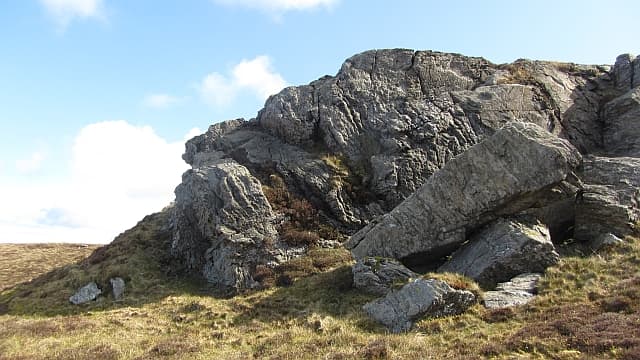
Beinn na Lice, the Hill of the Flagstone, rises to 428m close to the famous Mull of Kintyre lighthouse. Slate-grey outcrops on the summit gave it the name, and from the top the coast of Ireland feels almost within touching distance.
Quick facts
- Height
- 428m/ 1404ft
- Prominence
- 221 m
- Grid ref
- NR 60277 08539
- Dogs
- Dogs on lead required near livestockDog-friendly guide ↗
Height and prominence cross-checked against the Database of British and Irish Hills (CC BY).
No GPX track yet
Walked this route? Share your track to help other walkers.
Standard route
heather moorland 65% · grass slopes 25% · rocky summit 10%
A spur off the lighthouse road allows walkers to gain height quickly; from there a faint quad track leads onto the broad summit ridge. Around three hours return.
Terrain
Coarse grass, low heather and outcropping flagstone. Few obstacles but pathless throughout the upper section.
In winter
Snow rarely settles but storms blow straight off the Atlantic. Choose a calm window for the long single-track drive.
Best time of year
Getting there
- Glasgow4h 12m
- Edinburgh7h 54m
OS maps: OS Landranger 68, OS Explorer 356S
Mobile signal: Poor. No reliable coverage; EE fails in Kintyre's interior moors.
Current conditions
Daylight Today
- Sunrise
- 05:26
- Sunset
- 21:33
- Civil dawn
- 04:39
- Civil dusk
- 22:21
NOAA Solar Calculator · 30 July 2026
Around Beinn na Lice on the SCOT network
Getting there, basing yourself, and what to do off the hill.
Beinn na Lice — common questions
- What difficulty is Beinn na Lice?
- On the OutdoorSCOT scale, Beinn na Lice comes in at 1/5 — easy. Terrain: Coarse grass, low heather and outcropping flagstone.
- How prominent is Beinn na Lice?
- Beinn na Lice has 221m of topographic prominence — the height of its summit above the highest col connecting it to higher ground. Marilyns are defined by that measure: at least 150m of drop on all sides.
- When should I climb Beinn na Lice?
- The standard good-weather months for Beinn na Lice are March, April, May, June, July, August, September, October. Outside those months, expect winter conditions on the high ground — full mountain kit, navigation skills, and a check of the SAIS avalanche forecast for the relevant region.
- Can I bring my dog up Beinn na Lice?
- On a lead only — the route crosses ground with livestock or nesting-bird interest.
- What's mobile reception like on Beinn na Lice?
- Poor. No reliable coverage; EE fails in Kintyre's interior moors.
- Is Beinn na Lice safe in winter?
- Snow rarely settles but storms blow straight off the Atlantic. Choose a calm window for the long single-track drive.
Get the OutdoorSCOT weekly
One email a week — new route, hill and bothy guides, seasonal conditions and the odd hard-won lesson. No spam, unsubscribe in one click.