Marilyn · Argyll & Bute
Sgreadan Hill
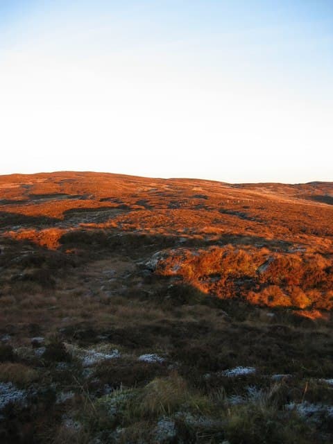
Sgreadan Hill sits at 397m in central Kintyre near the head of Loch Caolisport, possibly named for the scree-like outcrops on its sides. A wind farm now occupies parts of the slope, easing the approach considerably.
Quick facts
- Height
- 397m/ 1302ft
- Prominence
- 155 m
- Grid ref
- NR 74111 29556
- Nearest city
- Glasgow· 92km
- Dogs
- Dogs on lead required near livestockDog-friendly guide ↗
Height and prominence cross-checked against the Database of British and Irish Hills (CC BY).
No GPX track yet
Walked this route? Share your track to help other walkers.
Standard route
heather moorland 65% · grass slopes 25% · rocky summit 10%
Wind farm access tracks from Clachan provide a clean route close to the summit, with a short walk over open ground to the cairn. Two to three hours suffices.
Terrain
Hard gravel tracks for most of the ascent then mossy grass to the trig. The interior moor is wet away from turbines.
In winter
Service roads are kept passable in most winters. Watch for blade-shed ice exclusion zones in cold weather.
Best time of year
Getting there
- Glasgow4h 33m
- Edinburgh6h 17m
OS maps: OS Landranger 68, OS Explorer 356N
Mobile signal: Moderate. EE weak on top; improves toward Lochgilphead.
Current conditions
Daylight Today
- Sunrise
- 06:52
- Sunset
- 19:44
- Civil dawn
- 06:15
- Civil dusk
- 20:22
NOAA Solar Calculator · 14 September 2026
Around Sgreadan Hill on the SCOT network
Getting there, basing yourself, and what to do off the hill.
Getting there: Ardrossan Harbour station
Ferry to Brodick (Arran) — Goat Fell, Arran ridge
50km from the hill
tripscot.co.uk
On TripSCOTBase yourself in Campbeltown
Kintyre Way finish; Mull of Kintyre; whisky town
9km from the hill
tripscot.co.uk
On TasteSCOTAfter the hill: Glen Scotia
Campbeltown — coastal, salty Campbeltown survivor and one of the region's three
9km from the hill
tastescot.co.uk
Sgreadan Hill — common questions
- How hard is Sgreadan Hill?
- We grade Sgreadan Hill at 1/5, which puts it in easy territory. Underfoot: Hard gravel tracks for most of the ascent then mossy grass to the trig.
- What is Sgreadan Hill's prominence?
- 155m of prominence. That's the vertical drop from the summit to the col that links Sgreadan Hill to the next higher ground. That drop is what qualifies it as a Marilyn — a hill with at least 150m of descent on every side.
- When is the best time to climb Sgreadan Hill?
- March, April, May, June, July, August, September, October give the most reliable conditions on Sgreadan Hill. Beyond that window the high ground turns wintry: carry full mountain kit, be confident navigating, and check the SAIS avalanche forecast for the area.
- Is Sgreadan Hill dog-friendly?
- Yes, but dogs must be kept on a lead — there is livestock or ground-nesting bird interest on the route.
- Is there mobile signal on Sgreadan Hill?
- Moderate. EE weak on top; improves toward Lochgilphead.
- Is Sgreadan Hill safe in winter?
- Service roads are kept passable in most winters. Watch for blade-shed ice exclusion zones in cold weather.
Get the OutdoorSCOT weekly
One email a week — new route, hill and bothy guides, seasonal conditions and the odd hard-won lesson. No spam, unsubscribe in one click.