Marilyn · Argyll
Beinn Ghuilean
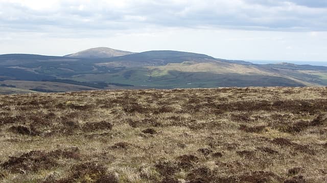
Beinn Ghuilean stands at 354m directly above Campbeltown, a familiar backdrop to the town and its loch. Once a Forestry Commission viewpoint, the hill remains popular with locals taking the well-signed forest paths.
Quick facts
- Height
- 354m/ 1161ft
- Prominence
- 276 m
- Grid ref
- NR 72938 17075
- Nearest city
- Glasgow· 99km
- Dogs
- Dogs on lead required near livestockDog-friendly guide ↗
Height and prominence cross-checked against the Database of British and Irish Hills (CC BY).
No GPX track yet
Walked this route? Share your track to help other walkers.
Standard route
heather moorland 65% · grass slopes 25% · rocky summit 10%
Marked forest trails climb from the Beinn Ghuilean car park on the south edge of Campbeltown to a summit viewpoint with interpretation boards. About two hours circuit.
Terrain
Surfaced forest paths and gravel tracks throughout, with a short heather section to the cairn. Family-friendly in dry weather.
In winter
Snow rarely settles. Forest tracks remain walkable year-round though ice can form in sheltered hollows.
Best time of year
Getting there
- Glasgow4h 40m
- Edinburgh6h 22m
OS maps: OS Landranger 68, OS Explorer 356S
Mobile signal: Poor. signal drops on the approach; Kintyre's spine road is far away.
Current conditions
Daylight Today
- Sunrise
- 05:25
- Sunset
- 21:32
- Civil dawn
- 04:37
- Civil dusk
- 22:20
NOAA Solar Calculator · 30 July 2026
Around Beinn Ghuilean on the SCOT network
Getting there, basing yourself, and what to do off the hill.
Getting there: Ardrossan Harbour station
Ferry to Brodick (Arran) — Goat Fell, Arran ridge
55km from the hill
tripscot.co.uk
On TripSCOTBase yourself in Campbeltown
Kintyre Way finish; Mull of Kintyre; whisky town
4km from the hill
tripscot.co.uk
On TasteSCOTAfter the hill: Springbank
Campbeltown — cult, family-owned, every step on site from floor malt to bottle
4km from the hill
tastescot.co.uk
Beinn Ghuilean — common questions
- What difficulty is Beinn Ghuilean?
- On the OutdoorSCOT scale, Beinn Ghuilean comes in at 1/5 — easy. Terrain: Surfaced forest paths and gravel tracks throughout, with a short heather section to the cairn.
- How prominent is Beinn Ghuilean?
- Beinn Ghuilean has 276m of topographic prominence — the height of its summit above the highest col connecting it to higher ground. Marilyns are defined by that measure: at least 150m of drop on all sides.
- When should I climb Beinn Ghuilean?
- The standard good-weather months for Beinn Ghuilean are March, April, May, June, July, August, September, October. Outside those months, expect winter conditions on the high ground — full mountain kit, navigation skills, and a check of the SAIS avalanche forecast for the relevant region.
- Can I bring my dog up Beinn Ghuilean?
- On a lead only — the route crosses ground with livestock or nesting-bird interest.
- What's mobile reception like on Beinn Ghuilean?
- Poor. signal drops on the approach; Kintyre's spine road is far away.
- Is Beinn Ghuilean safe in winter?
- Snow rarely settles. Forest tracks remain walkable year-round though ice can form in sheltered hollows.
Get the OutdoorSCOT weekly
One email a week — new route, hill and bothy guides, seasonal conditions and the odd hard-won lesson. No spam, unsubscribe in one click.