Marilyn · Argyll & Bute
Beinn Tart a' Mhill
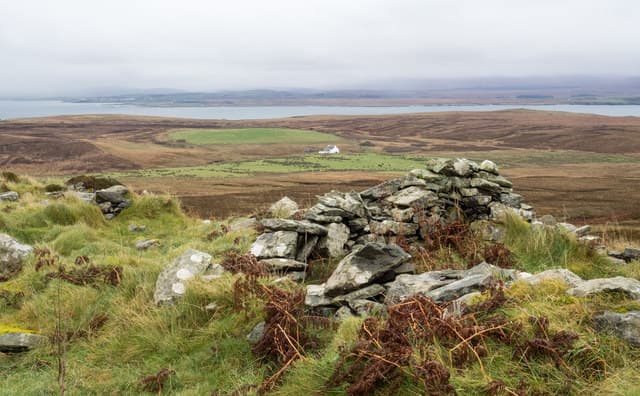
Hill of the Thirst, the high point of the Rinns of Islay peninsula in the far west of the island. A trig pillar crowns the summit and the open situation gives a remarkable horizon for so modest a height — Jura, Colonsay, the Antrim coast and the open Atlantic all in view on a clear day.
Quick facts
- Height
- 232m/ 761ft
- Prominence
- 227 m
- Grid ref
- NR 21066 56979
- Dogs
- Dogs on lead required near livestockDog-friendly guide ↗
Height and prominence cross-checked against the Database of British and Irish Hills (CC BY).
No GPX track yet
Walked this route? Share your track to help other walkers.
Standard route
heather and bog 60% · rocky slopes 25% · coastal grass 15%
Most parties start from the Portnahaven road and pick a line up the rough heather slopes from a layby near Loch Gorm. There is no path of any note and the going is wet — give it three hours round trip and accept boggy boots as part of the experience.
Terrain
Trackless heather and peat hags across the Rinns plateau. The summit area is rocky but the approach is the wettest part — wet feet are almost guaranteed after rain.
In winter
Mild Atlantic winters mean genuine snow cover is rare, but gales sweep the Rinns from October through March. Visibility can drop to nothing in driving rain — a compass is essential off the road.
Best time of year
Getting there
- Glasgow6h 41m
- Edinburgh8h 26m
Ferry access
Kennacraig → Port Askaig or Port Ellen
- Crossing time135 min
- Summer sailings2–3 sailings daily (Apr–Oct)
- Winter sailings1–2 sailings daily (Nov–Mar)
- Book ahead14 days
- Last ferry backCheck CalMac timetable
OS maps: OS Landranger 60, OS Explorer 353W
Mobile signal: Poor. The Rinns of Islay have patchy coverage; EE works near Portnahaven but fades on the open moor.
Current conditions
Daylight Today
- Sunrise
- 05:27
- Sunset
- 21:38
- Civil dawn
- 04:38
- Civil dusk
- 22:26
NOAA Solar Calculator · 30 July 2026
Around Beinn Tart a' Mhill on the SCOT network
Getting there, basing yourself, and what to do off the hill.
Beinn Tart a' Mhill — common questions
- Is Beinn Tart a' Mhill a hard climb?
- Beinn Tart a' Mhill is rated 1/5 (easy) on the OutdoorSCOT scale. Terrain: Trackless heather and peat hags across the Rinns plateau.
- How prominent is Beinn Tart a' Mhill?
- Beinn Tart a' Mhill's prominence is its full height — 227m — because it is the highest point of its landmass, with no higher ground connected to it. Marilyns are defined by that measure: at least 150m of drop on all sides.
- When should I climb Beinn Tart a' Mhill?
- The standard good-weather months for Beinn Tart a' Mhill are March, April, May, June, July, August, September, October. Outside those months, expect winter conditions on the high ground — full mountain kit, navigation skills, and a check of the SAIS avalanche forecast for the relevant region.
- Can I bring my dog up Beinn Tart a' Mhill?
- On a lead only — the route crosses ground with livestock or nesting-bird interest.
- What's mobile reception like on Beinn Tart a' Mhill?
- Poor. The Rinns of Islay have patchy coverage; EE works near Portnahaven but fades on the open moor.
- How do I get the ferry to Beinn Tart a' Mhill?
- Kennacraig → Port Askaig or Port Ellen. 2–3 sailings daily (Apr–Oct) in summer; 1–2 sailings daily (Nov–Mar) in winter. Book at least 14 days ahead.
- Is Beinn Tart a' Mhill safe in winter?
- Mild Atlantic winters mean genuine snow cover is rare, but gales sweep the Rinns from October through March. Visibility can drop to nothing in driving rain — a compass is essential off the road.
Get the OutdoorSCOT weekly
One email a week — new route, hill and bothy guides, seasonal conditions and the odd hard-won lesson. No spam, unsubscribe in one click.