Marilyn · Argyll & Bute
Beinn Mhor
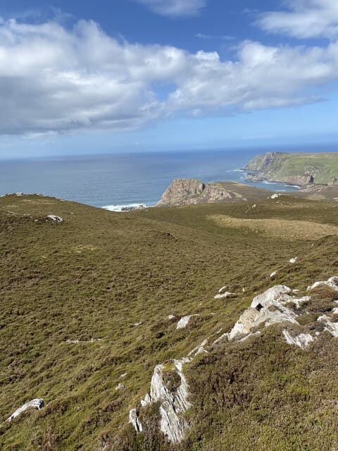
Big Hill, the high point of the Oa peninsula on Islay's wild south-western tip. The American Monument on the nearby clifftop and the seabird-haunted sea cliffs of the Mull of Oa give the area a character quite unlike the rest of the island.
Gaelic: “mountain, big” · Pronunciation: bine vore
Quick facts
- Height
- 202m/ 663ft
- Grid ref
- NR 29481 40455
- Dogs
- Dogs on lead required near livestockDog-friendly guide ↗
No GPX track yet
Walked this route? Share your track to help other walkers.
Standard route
heather moorland 50% · rough grassland 30% · granite/schist 20%
From the RSPB car park at the end of the Oa road, follow waymarked tracks past the American Monument and then strike north-east across rough moor to the summit. Around 7km return and easily managed in two to three hours.
Terrain
Short-cropped maritime grassland near the cliffs gives way to tussock and bog inland. Choughs and golden eagles are sometimes seen on the Oa.
In winter
Snow is very unusual on the Oa; the real winter challenges are the screaming Atlantic gales and short daylight. Pick a settled day and a low tide for the cliff approach.
Best time of year
Getting there
- Glasgow5h 20m
- Edinburgh8h 5m
Ferry access
Kennacraig → Port Askaig or Port Ellen
- Crossing time135 min
- Summer sailings2–3 sailings daily (Apr–Oct)
- Winter sailings1–2 sailings daily (Nov–Mar)
- Book ahead14 days
- Last ferry backCheck CalMac timetable
OS maps: OS Landranger 60, OS Explorer 352
Mobile signal: Moderate. EE works near Port Ellen but is patchy on the Oa moor itself.
Current conditions
Daylight Today
- Sunrise
- 04:44
- Sunset
- 22:13
- Civil dawn
- 03:43
- Civil dusk
- 23:13
NOAA Solar Calculator · 27 June 2026
Around Beinn Mhor on the SCOT network
Getting there, basing yourself, and what to do off the hill.
Beinn Mhor — common questions
- How hard is Beinn Mhor?
- Beinn Mhor is rated 1/5 (easy) on the OutdoorSCOT scale. Terrain: Short-cropped maritime grassland near the cliffs gives way to tussock and bog inland.
- When is the best time to climb Beinn Mhor?
- The standard good-weather months for Beinn Mhor are March, April, May, June, July, August, September, October. Outside those months, expect winter conditions on the high ground — full mountain kit, navigation skills, and a check of the SAIS avalanche forecast for the relevant region.
- Can I bring my dog up Beinn Mhor?
- Yes, but dogs must be kept on a lead — there is livestock or ground-nesting bird interest on the route.
- Is there mobile signal on Beinn Mhor?
- Moderate. EE works near Port Ellen but is patchy on the Oa moor itself.
- How do I get the ferry to Beinn Mhor?
- Kennacraig → Port Askaig or Port Ellen. 2–3 sailings daily (Apr–Oct) in summer; 1–2 sailings daily (Nov–Mar) in winter. Book at least 14 days ahead.
- Is Beinn Mhor safe in winter?
- Snow is very unusual on the Oa; the real winter challenges are the screaming Atlantic gales and short daylight. Pick a settled day and a low tide for the cliff approach.
Get the OutdoorSCOT weekly
One email a week — new route, hill and bothy guides, seasonal conditions and the odd hard-won lesson. No spam, unsubscribe in one click.