Marilyn · Argyll & Bute
Glas Bheinn
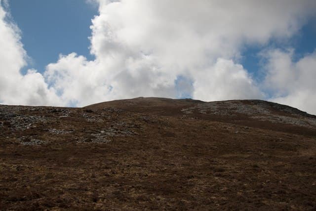
Glas Bheinn on Islay is the close neighbour of Beinn Bheigier — a 472m hill on the same wild eastern moorland. Its limestone-influenced geology gives surprisingly green, drained turf in contrast to the boggy approach.
Gaelic: “grey-green” · Pronunciation: glass bheinn
Quick facts
- Height
- 472m/ 1549ft
- Grid ref
- NR 42977 59196
- Dogs
- Dogs on lead required near livestockDog-friendly guide ↗
No GPX track yet
Walked this route? Share your track to help other walkers.
Standard route
limestone grassland 40% · heather moorland 40% · rocky outcrops 20%
Often combined with Beinn Bheigier from Ardtalla, taking the ridge link between the two summits. As a stand-alone ascent allow 3-4 hours. There is no path either way.
Terrain
Surprisingly well-drained turf on the upper slopes thanks to the limestone bedrock. The approach moor is wetter and tussockier.
In winter
Snow is unusual on Islay. The bigger risk is high wind on the exposed upper ridge — gales of 60mph are not unusual in winter and make the summit untenable.
Best time of year
Getting there
- Glasgow5h 47m
- Edinburgh8h 32m
Ferry access
Kennacraig → Port Askaig (Islay) then Port Askaig → Feolin (Jura)
- Crossing time145 min
- Summer sailingsIslay: 1–2 CalMac sailings daily. Jura ferry: frequent throughout the day
- Winter sailingsIslay: 1 CalMac sailing daily. Jura ferry: reduced but regular
- Book ahead21 days
- Last ferry backLast Jura ferry ~17:00; last Islay sailing varies — check both timetables
Two ferries required: CalMac Kennacraig → Port Askaig (2h15), then the short Jura passenger ferry (10 min) from Port Askaig to Feolin. No car needed once on Jura for the Paps.
Book on ferry operator ↗OS maps: OS Landranger 60, OS Explorer 352
Mobile signal: Moderate. Islay; EE reliable near Bowmore.
Current conditions
Daylight Today
- Sunrise
- 04:42
- Sunset
- 22:13
- Civil dawn
- 03:41
- Civil dusk
- 23:14
NOAA Solar Calculator · 27 June 2026
Around Glas Bheinn on the SCOT network
Getting there, basing yourself, and what to do off the hill.
Glas Bheinn — common questions
- How hard is Glas Bheinn?
- Glas Bheinn is rated 1/5 (easy) on the OutdoorSCOT scale. Terrain: Surprisingly well-drained turf on the upper slopes thanks to the limestone bedrock.
- When is the best time to climb Glas Bheinn?
- The standard good-weather months for Glas Bheinn are March, April, May, June, July, August, September, October. Outside those months, expect winter conditions on the high ground — full mountain kit, navigation skills, and a check of the SAIS avalanche forecast for the relevant region.
- Can I bring my dog up Glas Bheinn?
- Yes, but dogs must be kept on a lead — there is livestock or ground-nesting bird interest on the route.
- Is there mobile signal on Glas Bheinn?
- Moderate. Islay; EE reliable near Bowmore.
- How do I get the ferry to Glas Bheinn?
- Kennacraig → Port Askaig (Islay) then Port Askaig → Feolin (Jura). Islay: 1–2 CalMac sailings daily. Jura ferry: frequent throughout the day in summer; Islay: 1 CalMac sailing daily. Jura ferry: reduced but regular in winter. Book at least 21 days ahead. Two ferries required: CalMac Kennacraig → Port Askaig (2h15), then the short Jura passenger ferry (10 min) from Port Askaig to Feolin. No car needed once on Jura for the Paps.
- Is Glas Bheinn safe in winter?
- Snow is unusual on Islay. The bigger risk is high wind on the exposed upper ridge — gales of 60mph are not unusual in winter and make the summit untenable.
Get the OutdoorSCOT weekly
One email a week — new route, hill and bothy guides, seasonal conditions and the odd hard-won lesson. No spam, unsubscribe in one click.