Sub-Marilyn · Argyll & Bute
Giur-bheinn
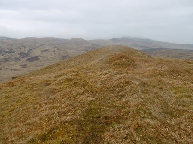
Giur-bheinn is a 317m Marilyn rising from the moorland core of northern Islay, set amid lochan-pocked moorland. The summit gives a fine all-round view of the island, with Jura and Colonsay visible across the sea.
Quick facts
- Height
- 317.4m/ 1041ft
- Prominence
- 149 m
- Grid ref
- NR 37990 72853
- Dogs
- Dogs on lead required near livestockDog-friendly guide ↗
Sub-Marilyn: 149m of drop — misses the 150m Marilyn cut by 1m. We keep it on the list as a near-miss.
Height and prominence cross-checked against the Database of British and Irish Hills (CC BY).
No GPX track yet
Walked this route? Share your track to help other walkers.
Standard route
heather and bog 60% · rocky slopes 25% · coastal grass 15%
A short trackless walk-in from the B8017 north of Bridgend. The ground is rough but the ascent direct, taking around 2-3 hours for the round trip.
Terrain
Lochan-strewn heather moor with peat hags. The summit itself is a low rocky outcrop with good drainage.
In winter
Easily attempted in winter. The flat surroundings can make navigation tricky in poor visibility — a compass bearing from the road is wise.
Best time of year
Getting there
- Glasgow5h 1m
- Edinburgh8h 46m
Ferry access
Kennacraig → Port Askaig or Port Ellen
- Crossing time135 min
- Summer sailings2–3 sailings daily (Apr–Oct)
- Winter sailings1–2 sailings daily (Nov–Mar)
- Book ahead14 days
- Last ferry backCheck CalMac timetable
OS maps: OS Landranger 60, OS Landranger 61, OS Explorer 353E
Mobile signal: Moderate. Northern Islay; EE workable near Bridgend.
Current conditions
Daylight Today
- Sunrise
- 05:25
- Sunset
- 21:37
- Civil dawn
- 04:36
- Civil dusk
- 22:26
NOAA Solar Calculator · 30 July 2026
Around Giur-bheinn on the SCOT network
Getting there, basing yourself, and what to do off the hill.
Giur-bheinn — common questions
- How difficult is Giur-bheinn?
- Giur-bheinn carries a 1/5 (easy) grade on the OutdoorSCOT scale. Underfoot: Lochan-strewn heather moor with peat hags.
- What is Giur-bheinn's prominence?
- 149m of prominence. That's the vertical drop from the summit to the col that links Giur-bheinn to the next higher ground. That leaves it 1m short of the 150m drop a Marilyn needs — DoBIH classes it a sub-Marilyn, a near-miss rather than a full Marilyn.
- When is the best time to climb Giur-bheinn?
- March, April, May, June, July, August, September, October give the most reliable conditions on Giur-bheinn. Beyond that window the high ground turns wintry: carry full mountain kit, be confident navigating, and check the SAIS avalanche forecast for the area.
- Is Giur-bheinn dog-friendly?
- Yes, but dogs must be kept on a lead — there is livestock or ground-nesting bird interest on the route.
- Is there mobile signal on Giur-bheinn?
- Moderate. Northern Islay; EE workable near Bridgend.
- How do I get the ferry to Giur-bheinn?
- Kennacraig → Port Askaig or Port Ellen. 2–3 sailings daily (Apr–Oct) in summer; 1–2 sailings daily (Nov–Mar) in winter. Book at least 14 days ahead.
- Is Giur-bheinn safe in winter?
- Easily attempted in winter. The flat surroundings can make navigation tricky in poor visibility — a compass bearing from the road is wise.
Get the OutdoorSCOT weekly
One email a week — new route, hill and bothy guides, seasonal conditions and the odd hard-won lesson. No spam, unsubscribe in one click.