Marilyn · Glen Coe & Lochaber
Beinn Sgluich
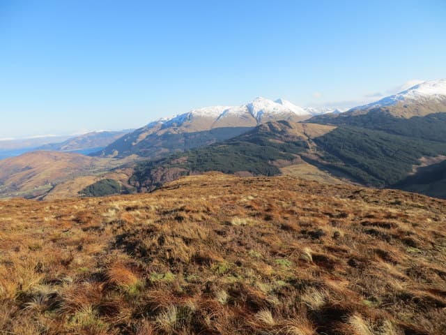
Beinn Sgluich — a 466m grass-and-quartzite Marilyn in NM-square Argyll, set on the high ground between Glen Kinglass and the head of Loch Etive west of Bonawe. The summit watches the long fjord-finger of Etive bend north into the Glencoe hills, with the Cruachan horseshoe just over the southern skyline.
Quick facts
- Height
- 466m/ 1529ft
- Prominence
- 216 m
- Grid ref
- NM 96661 51240
- Nearest city
- Oban· 24km
- Dogs
- Dogs on lead required near livestockDog-friendly guide ↗
Height and prominence cross-checked against the Database of British and Irish Hills (CC BY).
No GPX track yet
Walked this route? Share your track to help other walkers.
Standard route
heather and bog 70% · grass slopes 20% · rocky outcrops 10%
Walkers usually begin from the forestry road at Inverliever, north of Taynuilt, following the track up Glen Kinglass before breaking out east onto the open hillside. The upper slopes are pathless mossy grass and short heather climbing in zigzags to a low, broad cairn with views down to Loch Etive.
Terrain
Wet schist underfoot with patches of crowberry and short heather. The lower forestry edge is boggy after rain; higher up, runnels of bare quartz break through grass cropped tight by deer.
In winter
A sub-500m hill so snow is intermittent, but freezing fog rolls up Loch Etive and binds the grass into icy mats. Spikes are useful on the steeper grass step below the cairn; full crampons rarely needed.
This hill is in the Glen Coe SAIS forecast area. Check SAIS forecasts in winter (December–April).
Best time of year
Getting there
- Glasgow3h 22m
- Edinburgh6h 45m
OS maps: OS Landranger 49, OS Explorer 376
Mobile signal: Poor. No signal; nearest EE coverage near the coast or main A-road.
Current conditions
Daylight Today
- Sunrise
- 05:18
- Sunset
- 21:38
- Civil dawn
- 04:27
- Civil dusk
- 22:29
NOAA Solar Calculator · 30 July 2026
Around Beinn Sgluich on the SCOT network
Getting there, basing yourself, and what to do off the hill.
Getting there: Oban station
Argyll ferry hub; Mull, Lismore, Coll, Tiree, Barra connections
24km from the hill
tripscot.co.uk
On TripSCOTBase yourself in Oban
Argyll ferry hub — Mull, Lismore, Coll, Tiree, Barra
24km from the hill
tripscot.co.uk
On TasteSCOTAfter the hill: Oban
Oban town centre — tiny two-still distillery bridging Highland and West Coast styles
24km from the hill
tastescot.co.uk
Beinn Sgluich — common questions
- What difficulty is Beinn Sgluich?
- On the OutdoorSCOT scale, Beinn Sgluich comes in at 1/5 — easy. Ground conditions: Wet schist underfoot with patches of crowberry and short heather.
- How much drop does Beinn Sgluich have?
- The drop is 216m: measured from the summit of Beinn Sgluich down to the saddle joining it to higher terrain. Passing the 150m-drop threshold on all sides is exactly what makes it a Marilyn.
- What's the best month to climb Beinn Sgluich?
- Aim for March, April, May, June, July, August, September, October on Beinn Sgluich. In the remaining months treat it as a winter hill — full kit, solid navigation, and a look at the relevant SAIS avalanche forecast before you go.
- Can dogs go up Beinn Sgluich?
- Dogs are fine on a lead. The route passes livestock or ground-nesting bird habitat, so keep them close throughout.
- Will I get phone signal on Beinn Sgluich?
- Poor. No signal; nearest EE coverage near the coast or main A-road.
- Is Beinn Sgluich safe in winter?
- A sub-500m hill so snow is intermittent, but freezing fog rolls up Loch Etive and binds the grass into icy mats. Spikes are useful on the steeper grass step below the cairn; full crampons rarely needed.
Get the OutdoorSCOT weekly
One email a week — new route, hill and bothy guides, seasonal conditions and the odd hard-won lesson. No spam, unsubscribe in one click.