Marilyn · Glen Coe & Lochaber
Beinn Donn
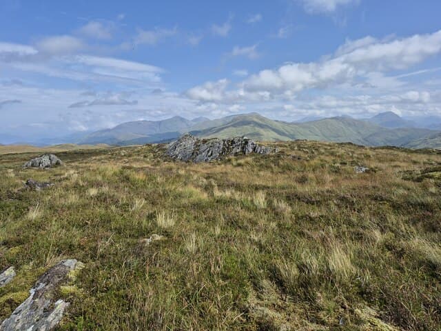
Beinn Donn — the brown hill — is a 473m Marilyn in NM-square Argyll, planted on the south shore of Loch Etive between Bonawe and Inverawe. The summit looks across the loch to Ben Cruachan and south over the slate quarries to the Pass of Brander and the head of Loch Awe.
Gaelic: “mountain, brown” · Pronunciation: bine donn
Quick facts
- Height
- 473m/ 1552ft
- Prominence
- 204 m
- Grid ref
- NM 96120 47702
- Nearest city
- Oban· 20km
- Dogs
- Dogs on lead required near livestockDog-friendly guide ↗
Height and prominence cross-checked against the Database of British and Irish Hills (CC BY).
No GPX track yet
Walked this route? Share your track to help other walkers.
Standard route
heather moorland 65% · grass slopes 25% · rocky summit 10%
Most walkers start from Bonawe quarry or the Ardchattan road, picking up forest tracks east of Achnacloich before climbing rough heather and outcrops onto the south-east shoulder. The final dome is a short pull on cropped grass to a small cairn perched above the loch.
Terrain
A mix of birch scrub, bracken and tussocky moor low down, with bare schist slabs on the upper crest. Several burns cut the slope and need a careful line in wet weather.
In winter
Below 500m the summit rarely holds snow long, but glaze-ice on the upper slabs is the usual hazard after a freeze. A wet south-westerly will turn the heather to ankle-snagging armour rather than leave a useable snow cover.
This hill is in the Glen Coe SAIS forecast area. Check SAIS forecasts in winter (December–April).
Best time of year
Getting there
- Glasgow3h 20m
- Edinburgh6h 45m
OS maps: OS Landranger 49, OS Explorer 376
Mobile signal: Poor. Remote Argyll/Loch Awe area; limited coverage.
Current conditions
Daylight Today
- Sunrise
- 05:18
- Sunset
- 21:38
- Civil dawn
- 04:27
- Civil dusk
- 22:28
NOAA Solar Calculator · 30 July 2026
Around Beinn Donn on the SCOT network
Getting there, basing yourself, and what to do off the hill.
Getting there: Oban station
Argyll ferry hub; Mull, Lismore, Coll, Tiree, Barra connections
21km from the hill
tripscot.co.uk
On TripSCOTBase yourself in Oban
Argyll ferry hub — Mull, Lismore, Coll, Tiree, Barra
21km from the hill
tripscot.co.uk
On TasteSCOTAfter the hill: Oban
Oban town centre — tiny two-still distillery bridging Highland and West Coast styles
20km from the hill
tastescot.co.uk
Beinn Donn — common questions
- What difficulty is Beinn Donn?
- On the OutdoorSCOT scale, Beinn Donn comes in at 1/5 — easy. Terrain: A mix of birch scrub, bracken and tussocky moor low down, with bare schist slabs on the upper crest.
- How prominent is Beinn Donn?
- Beinn Donn has 204m of topographic prominence — the height of its summit above the highest col connecting it to higher ground. Marilyns are defined by that measure: at least 150m of drop on all sides.
- When should I climb Beinn Donn?
- The standard good-weather months for Beinn Donn are March, April, May, June, July, August, September, October. Outside those months, expect winter conditions on the high ground — full mountain kit, navigation skills, and a check of the SAIS avalanche forecast for the relevant region.
- Can I bring my dog up Beinn Donn?
- On a lead only — the route crosses ground with livestock or nesting-bird interest.
- What's mobile reception like on Beinn Donn?
- Poor. Remote Argyll/Loch Awe area; limited coverage.
- Is Beinn Donn safe in winter?
- Below 500m the summit rarely holds snow long, but glaze-ice on the upper slabs is the usual hazard after a freeze. A wet south-westerly will turn the heather to ankle-snagging armour rather than leave a useable snow cover.
Get the OutdoorSCOT weekly
One email a week — new route, hill and bothy guides, seasonal conditions and the odd hard-won lesson. No spam, unsubscribe in one click.