Marilyn · Glen Coe & Lochaber
Airds Hill
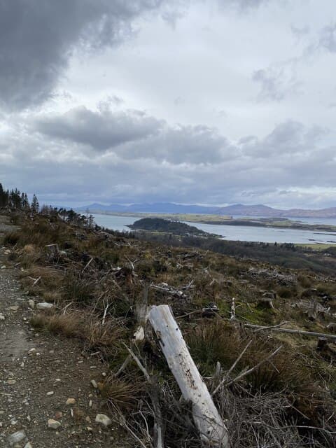
Airds Hill is a 181m heather knoll in NM-square Appin, set on the small peninsula between Loch Creran and Loch Linnhe just north of Port Appin. The summit is the highest point of the Airds estate and looks west across the Lynn of Lorn to Lismore and the green farmland of the priory.
Quick facts
- Height
- 181m/ 594ft
- Prominence
- 153 m
- Grid ref
- NM 92620 45861
- Nearest city
- Oban· 17km
- Dogs
- Dogs on lead required near livestockDog-friendly guide ↗
Height and prominence cross-checked against the Database of British and Irish Hills (CC BY).
No GPX track yet
Walked this route? Share your track to help other walkers.
Standard route
heather moorland 65% · grass slopes 25% · rocky summit 10%
Walkers usually start from the Port Appin car park or the lay-by below Airds House, taking a permissive path that contours up through old oak and rhododendron before turning onto open hillside. A short pull on rough grass and bracken leads to a modest cairn with sea views in every quadrant.
Terrain
Permissive path through ornamental woodland gives way to bracken and tussocky grass on the upper bank. The summit dome is short heather with knobs of bare rock. No water on the hill itself.
In winter
A coastal Marilyn under 200m — settled snow is rare and brief. The real winter worry is wet ground freezing into uneven plates underfoot in the bracken zone. A pair of poles makes the descent much steadier.
This hill is in the Glen Coe SAIS forecast area. Check SAIS forecasts in winter (December–April).
Best time of year
Getting there
- Glasgow3h 25m
- Edinburgh6h 52m
OS maps: OS Landranger 49, OS Explorer 376
Mobile signal: Poor. Remote Appin; limited coverage.
Current conditions
Daylight Today
- Sunrise
- 05:18
- Sunset
- 21:38
- Civil dawn
- 04:28
- Civil dusk
- 22:28
NOAA Solar Calculator · 30 July 2026
Around Airds Hill on the SCOT network
Getting there, basing yourself, and what to do off the hill.
Getting there: Oban station
Argyll ferry hub; Mull, Lismore, Coll, Tiree, Barra connections
17km from the hill
tripscot.co.uk
On TripSCOTBase yourself in Oban
Argyll ferry hub — Mull, Lismore, Coll, Tiree, Barra
17km from the hill
tripscot.co.uk
On TasteSCOTAfter the hill: Oban
Oban town centre — tiny two-still distillery bridging Highland and West Coast styles
17km from the hill
tastescot.co.uk
Airds Hill — common questions
- Is Airds Hill a hard climb?
- Airds Hill is rated 1/5 (easy) on the OutdoorSCOT scale. Terrain: Permissive path through ornamental woodland gives way to bracken and tussocky grass on the upper bank.
- How prominent is Airds Hill?
- Airds Hill has 153m of topographic prominence — the height of its summit above the highest col connecting it to higher ground. Marilyns are defined by that measure: at least 150m of drop on all sides.
- When should I climb Airds Hill?
- The standard good-weather months for Airds Hill are March, April, May, June, July, August, September, October. Outside those months, expect winter conditions on the high ground — full mountain kit, navigation skills, and a check of the SAIS avalanche forecast for the relevant region.
- Can I bring my dog up Airds Hill?
- On a lead only — the route crosses ground with livestock or nesting-bird interest.
- What's mobile reception like on Airds Hill?
- Poor. Remote Appin; limited coverage.
- Is Airds Hill safe in winter?
- A coastal Marilyn under 200m — settled snow is rare and brief. The real winter worry is wet ground freezing into uneven plates underfoot in the bracken zone. A pair of poles makes the descent much steadier.
Get the OutdoorSCOT weekly
One email a week — new route, hill and bothy guides, seasonal conditions and the odd hard-won lesson. No spam, unsubscribe in one click.