Marilyn · Glen Coe & Lochaber
Beinn Churalain
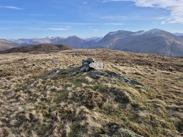
Beinn Churalain at 549m is a striking little peak above Glen Creran in north Argyll at NM 990 461. From the south it rises in a near-perfect cone of grass and rock from the sea-level head of Loch Creran. Views from the cairn span Lismore, the Sound of Mull and inland to Beinn Sgulaird.
Quick facts
- Height
- 549m/ 1801ft
- Prominence
- 176 m
- Grid ref
- NM 99041 46119
- Nearest city
- Oban· 21km
- Dogs
- Dogs on lead required near livestockDog-friendly guide ↗
Height and prominence cross-checked against the Database of British and Irish Hills (CC BY).
No GPX track yet
Walked this route? Share your track to help other walkers.
Standard route
heather and bog 65% · grass slopes 25% · rocky summit 10%
Park at the road end at Elleric in upper Glen Creran. Cross the river by the bridge and follow the path north-east up the Allt Buidhe, leaving it to climb the steep south ridge of Beinn Churalain by short grass and rocky steps direct to the summit.
Terrain
Tussock and bog on the lower glen, then steep cropped grass on the conical south ridge. Loose stones in places near the summit; minor scrambling possible but easily avoided on grass to the east of the crest.
In winter
A pointed Argyll hill where the south-facing slopes shed snow quickly; the upper rocks ice readily, however. A short steep day for axe practice in true winter conditions; not advisable for novices in iced-up grass.
This hill is in the Glen Coe SAIS forecast area. Check SAIS forecasts in winter (December–April).
Best time of year
Getting there
- Glasgow3h 12m
- Edinburgh6h 37m
OS maps: OS Landranger 49, OS Explorer 376, OS Explorer 384
Mobile signal: Poor. EE, Vodafone, Three all fail; remote glen has no infrastructure nearby.
Current conditions
Daylight Today
- Sunrise
- 05:18
- Sunset
- 21:37
- Civil dawn
- 04:27
- Civil dusk
- 22:28
NOAA Solar Calculator · 30 July 2026
Around Beinn Churalain on the SCOT network
Getting there, basing yourself, and what to do off the hill.
Getting there: Oban station
Argyll ferry hub; Mull, Lismore, Coll, Tiree, Barra connections
21km from the hill
tripscot.co.uk
On TripSCOTBase yourself in Oban
Argyll ferry hub — Mull, Lismore, Coll, Tiree, Barra
21km from the hill
tripscot.co.uk
On TasteSCOTAfter the hill: Oban
Oban town centre — tiny two-still distillery bridging Highland and West Coast styles
21km from the hill
tastescot.co.uk
Beinn Churalain — common questions
- What difficulty is Beinn Churalain?
- On the OutdoorSCOT scale, Beinn Churalain comes in at 2/5 — moderate. Underfoot: Tussock and bog on the lower glen, then steep cropped grass on the conical south ridge.
- What is Beinn Churalain's prominence?
- 176m of prominence. That's the vertical drop from the summit to the col that links Beinn Churalain to the next higher ground. That drop is what qualifies it as a Marilyn — a hill with at least 150m of descent on every side.
- When is the best time to climb Beinn Churalain?
- March, April, May, June, July, August, September, October give the most reliable conditions on Beinn Churalain. Beyond that window the high ground turns wintry: carry full mountain kit, be confident navigating, and check the SAIS avalanche forecast for the area.
- Is Beinn Churalain dog-friendly?
- Yes, but dogs must be kept on a lead — there is livestock or ground-nesting bird interest on the route.
- Is there mobile signal on Beinn Churalain?
- Poor. EE, Vodafone, Three all fail; remote glen has no infrastructure nearby.
- Is Beinn Churalain safe in winter?
- A pointed Argyll hill where the south-facing slopes shed snow quickly; the upper rocks ice readily, however. A short steep day for axe practice in true winter conditions; not advisable for novices in iced-up grass.
Get the OutdoorSCOT weekly
One email a week — new route, hill and bothy guides, seasonal conditions and the odd hard-won lesson. No spam, unsubscribe in one click.