Marilyn · Glen Coe & Lochaber
Ardsheal Hill
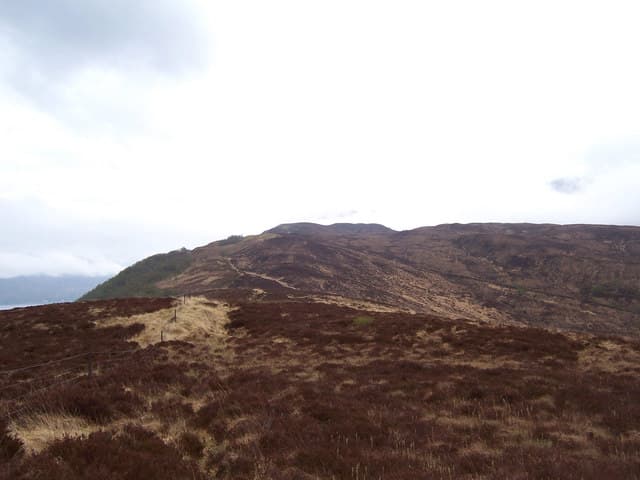
Ardsheal Hill is a 263m wooded Marilyn in NM-square Appin, occupying the small peninsula that juts into Loch Linnhe opposite the Corran Narrows. The summit knoll looks north across the loch to Ardgour, east into the entrance of Loch Leven, and south over Kentallen pier toward Beinn Bheithir.
Quick facts
- Height
- 263m/ 863ft
- Prominence
- 231 m
- Grid ref
- NM 99517 56841
- Nearest city
- Fort William· 20km
- Dogs
- Dogs on lead required near livestockDog-friendly guide ↗
Height and prominence cross-checked against the Database of British and Irish Hills (CC BY).
No GPX track yet
Walked this route? Share your track to help other walkers.
Standard route
heather moorland 60% · grass slopes 25% · rocky summit 15%
The usual approach leaves the A828 at Kentallen and follows the minor road past Ardsheal House, then turns off onto an estate track climbing through old oak and Sitka plantings before breaking out onto open hillside. A pathless 80m of heather and outcrop leads to a small cairn on a slabby top.
Terrain
Estate track for the first half then mixed oakwood and bracken, with short heather and granite slabs on the dome. Bracken is shoulder-high from June to October on the lower bank.
In winter
Sea-level start and a 263m top mean snow is incidental — ice on the estate track and on the mossy granite slabs is the only winter concern. Yaktrax-style spikes are more useful than crampons here.
This hill is in the Glen Coe SAIS forecast area. Check SAIS forecasts in winter (December–April).
Best time of year
Getting there
- Glasgow3h 21m
- Edinburgh6h 41m
OS maps: OS Landranger 49, OS Explorer 376, OS Explorer 384
Mobile signal: Weak. Remote Appin; coverage here is marginal.
Current conditions
Daylight Today
- Sunrise
- 05:17
- Sunset
- 21:38
- Civil dawn
- 04:26
- Civil dusk
- 22:29
NOAA Solar Calculator · 30 July 2026
Around Ardsheal Hill on the SCOT network
Getting there, basing yourself, and what to do off the hill.
Getting there: Fort William station
Ben Nevis, Mamores, Aonachs, Knoydart ferry connection
20km from the hill
tripscot.co.uk
On TripSCOTBase yourself in Fort William
Ben Nevis base, West Highland Line, gateway to Lochaber
20km from the hill
tripscot.co.uk
On TasteSCOTAfter the hill: Ben Nevis Distillery
Fort William — Lochaber distillery at the foot of the Ben; long-aged Japanese-owned classics
23km from the hill
tastescot.co.uk
Ardsheal Hill — common questions
- What difficulty is Ardsheal Hill?
- On the OutdoorSCOT scale, Ardsheal Hill comes in at 1/5 — easy. Ground conditions: Estate track for the first half then mixed oakwood and bracken, with short heather and granite slabs on the dome.
- How much drop does Ardsheal Hill have?
- The drop is 231m: measured from the summit of Ardsheal Hill down to the saddle joining it to higher terrain. Passing the 150m-drop threshold on all sides is exactly what makes it a Marilyn.
- What's the best month to climb Ardsheal Hill?
- Aim for March, April, May, June, July, August, September, October on Ardsheal Hill. In the remaining months treat it as a winter hill — full kit, solid navigation, and a look at the relevant SAIS avalanche forecast before you go.
- Can dogs go up Ardsheal Hill?
- Dogs are fine on a lead. The route passes livestock or ground-nesting bird habitat, so keep them close throughout.
- Will I get phone signal on Ardsheal Hill?
- Weak. Remote Appin; coverage here is marginal.
- Is Ardsheal Hill safe in winter?
- Sea-level start and a 263m top mean snow is incidental — ice on the estate track and on the mossy granite slabs is the only winter concern. Yaktrax-style spikes are more useful than crampons here.
Get the OutdoorSCOT weekly
One email a week — new route, hill and bothy guides, seasonal conditions and the odd hard-won lesson. No spam, unsubscribe in one click.