Marilyn · Argyll
Beinn Dubh Airigh
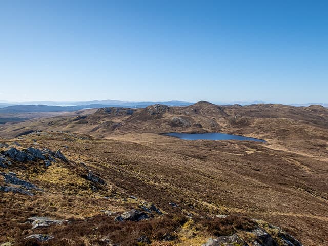
Beinn Dubh Airigh — the Dark Hill of the Shieling — is a 459m summit in mid-Knapdale, named for the long-gone summer pastures on its slopes. It is a quiet, little-frequented top.
Gaelic: “mountain, black, shieling” · Pronunciation: bine doo airigh
Quick facts
- Height
- 459m/ 1506ft
- Prominence
- 181 m
- Grid ref
- NM 95855 03524
- Nearest city
- Oban· 28km
- Dogs
- Dogs on lead required near livestockDog-friendly guide ↗
Height and prominence cross-checked against the Database of British and Irish Hills (CC BY).
No GPX track yet
Walked this route? Share your track to help other walkers.
Standard route
heather and bog 65% · grass slopes 25% · rocky summit 10%
Park near Loch Coille-Bharr and pick up forestry tracks before striking out across rough ground for the summit. Pathless going through bog and tussock means progress is slow; allow 3 to 5 hours.
Terrain
Mixed forestry tracks lead to extensive bog and tussock-grass on the open hill. The summit dome itself is grassier with a few small dark outcrops.
In winter
Winter snow rarely settles for long here but the bog stays unpleasant when frozen-then-thawed. Forestry rides may be closed for harvesting in winter.
Best time of year
Getting there
- Glasgow3h 49m
- Edinburgh5h 28m
OS maps: OS Landranger 55, OS Explorer 358N, OS Explorer 360S
Mobile signal: Poor. Signal absent on summit; inform a contact before heading out.
Current conditions
Daylight Today
- Sunrise
- 05:20
- Sunset
- 21:35
- Civil dawn
- 04:30
- Civil dusk
- 22:25
NOAA Solar Calculator · 30 July 2026
Around Beinn Dubh Airigh on the SCOT network
Getting there, basing yourself, and what to do off the hill.
Getting there: Oban station
Argyll ferry hub; Mull, Lismore, Coll, Tiree, Barra connections
28km from the hill
tripscot.co.uk
On TripSCOTBase yourself in Oban
Argyll ferry hub — Mull, Lismore, Coll, Tiree, Barra
28km from the hill
tripscot.co.uk
On TasteSCOTAfter the hill: Oban
Oban town centre — tiny two-still distillery bridging Highland and West Coast styles
28km from the hill
tastescot.co.uk
Beinn Dubh Airigh — common questions
- How hard is Beinn Dubh Airigh?
- We grade Beinn Dubh Airigh at 1/5, which puts it in easy territory. Terrain: Mixed forestry tracks lead to extensive bog and tussock-grass on the open hill.
- How prominent is Beinn Dubh Airigh?
- Beinn Dubh Airigh has 181m of topographic prominence — the height of its summit above the highest col connecting it to higher ground. Marilyns are defined by that measure: at least 150m of drop on all sides.
- When should I climb Beinn Dubh Airigh?
- The standard good-weather months for Beinn Dubh Airigh are March, April, May, June, July, August, September, October. Outside those months, expect winter conditions on the high ground — full mountain kit, navigation skills, and a check of the SAIS avalanche forecast for the relevant region.
- Can I bring my dog up Beinn Dubh Airigh?
- On a lead only — the route crosses ground with livestock or nesting-bird interest.
- What's mobile reception like on Beinn Dubh Airigh?
- Poor. Signal absent on summit; inform a contact before heading out.
- Is Beinn Dubh Airigh safe in winter?
- Winter snow rarely settles for long here but the bog stays unpleasant when frozen-then-thawed. Forestry rides may be closed for harvesting in winter.
Get the OutdoorSCOT weekly
One email a week — new route, hill and bothy guides, seasonal conditions and the odd hard-won lesson. No spam, unsubscribe in one click.