Marilyn · Argyll
Beinn Dearg
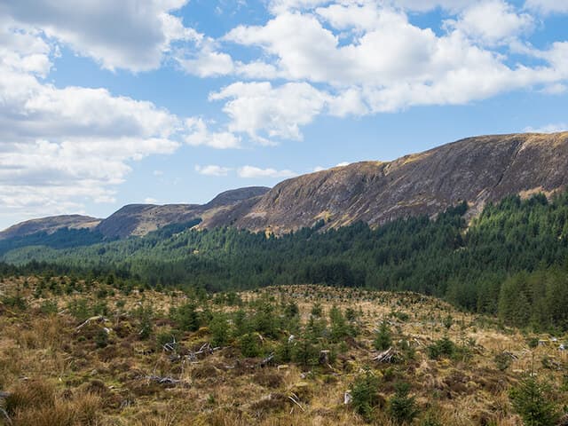
Beinn Dearg, the Red Hill, reaches 483m in the Knapdale hills behind Lochgilphead. Iron-rich rock gives the summit slopes their characteristic warm hue, especially after rain. 483.3 m — a argyll hill.
Gaelic: “mountain, red” · Pronunciation: bine jerr-ak
Quick facts
- Height
- 483.3m/ 1586ft
- Grid ref
- NN 02430 05011
- Nearest city
- Oban· 30km
- Dogs
- Dogs on lead required near livestockDog-friendly guide ↗
No GPX track yet
Walked this route? Share your track to help other walkers.
Standard route
heather moorland 60% · grass slopes 25% · schist outcrops 15%
A short approach from the B841 by the Crinan Canal climbs heathery slopes and small schist ribs to the summit. Around 2 to 3 hours suffices for a return trip when the line is well chosen.
Terrain
Open Knapdale moorland — heather, bracken in summer, and broken schist outcrops near the top. Drainage is poor in places after wet weather.
In winter
Too low for reliable snow cover but exposed to coastal winds. Frozen bog underfoot is the most likely winter hazard.
Best time of year
Getting there
- Glasgow3h 34m
- Edinburgh5h 12m
OS maps: OS Landranger 55, OS Explorer 360S
Mobile signal: Poor. South Knapdale; limited coverage.
Current conditions
Daylight Today
- Sunrise
- 04:35
- Sunset
- 22:13
- Civil dawn
- 03:31
- Civil dusk
- 23:16
NOAA Solar Calculator · 27 June 2026
Around Beinn Dearg on the SCOT network
Getting there, basing yourself, and what to do off the hill.
Getting there: Loch Awe station
East shore Loch Awe; Ben Cruachan; Kilchurn Castle
25km from the hill
tripscot.co.uk
On TripSCOTBase yourself in Oban
Argyll ferry hub — Mull, Lismore, Coll, Tiree, Barra
30km from the hill
tripscot.co.uk
On TasteSCOTAfter the hill: Oban
Oban town centre — tiny two-still distillery bridging Highland and West Coast styles
30km from the hill
tastescot.co.uk
Beinn Dearg — common questions
- How hard is Beinn Dearg?
- Beinn Dearg is rated 1/5 (easy) on the OutdoorSCOT scale. Terrain: Open Knapdale moorland — heather, bracken in summer, and broken schist outcrops near the top.
- When is the best time to climb Beinn Dearg?
- The standard good-weather months for Beinn Dearg are March, April, May, June, July, August, September, October. Outside those months, expect winter conditions on the high ground — full mountain kit, navigation skills, and a check of the SAIS avalanche forecast for the relevant region.
- Can I bring my dog up Beinn Dearg?
- Yes, but dogs must be kept on a lead — there is livestock or ground-nesting bird interest on the route.
- Is there mobile signal on Beinn Dearg?
- Poor. South Knapdale; limited coverage.
- Is Beinn Dearg safe in winter?
- Too low for reliable snow cover but exposed to coastal winds. Frozen bog underfoot is the most likely winter hazard.
Get the OutdoorSCOT weekly
One email a week — new route, hill and bothy guides, seasonal conditions and the odd hard-won lesson. No spam, unsubscribe in one click.