Marilyn · Argyll
Beinn Bhreac
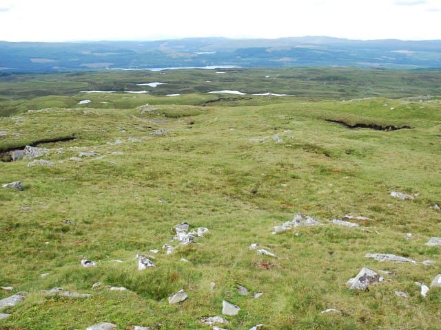
Beinn Bhreac (Speckled Hill) sits at 526m above Strachur on the eastern shore of Loch Fyne. Its name reflects the patchwork of heather, grass and outcrop that mottles its slopes when viewed from below.
Quick facts
- Height
- 526m/ 1726ft
- Grid ref
- NN 02772 10255
- Nearest city
- Oban· 26km
- Dogs
- Dogs on lead required near livestockDog-friendly guide ↗
No GPX track yet
Walked this route? Share your track to help other walkers.
Standard route
heather moorland 50% · grass slopes 35% · rocky outcrops 15%
Most ascents begin near Strachur and follow a mix of forest track and open hillside to the trig point. There is no consistent path on the upper slopes; budget 3 to 4 hours for a there-and-back.
Terrain
A typical Cowal mix: forestry edge, heather moorland, grassy benches and scattered schist outcrops. Wetness varies wildly with recent rainfall.
In winter
Snow tends to come and go quickly at this altitude beside Loch Fyne. Ice on the trig point dome and on forestry tracks is the more reliable winter hazard.
Best time of year
Getting there
- Glasgow3h 37m
- Edinburgh5h 13m
OS maps: OS Landranger 50, OS Landranger 55, OS Explorer 360S
Mobile signal: Poor. Loch Awe/Lorn area; limited coverage.
Current conditions
Daylight Today
- Sunrise
- 04:34
- Sunset
- 22:13
- Civil dawn
- 03:31
- Civil dusk
- 23:17
NOAA Solar Calculator · 27 June 2026
Around Beinn Bhreac on the SCOT network
Getting there, basing yourself, and what to do off the hill.
Getting there: Loch Awe station
East shore Loch Awe; Ben Cruachan; Kilchurn Castle
20km from the hill
tripscot.co.uk
On TripSCOTBase yourself in Oban
Argyll ferry hub — Mull, Lismore, Coll, Tiree, Barra
26km from the hill
tripscot.co.uk
On TasteSCOTAfter the hill: Oban
Oban town centre — tiny two-still distillery bridging Highland and West Coast styles
26km from the hill
tastescot.co.uk
Beinn Bhreac — common questions
- How hard is Beinn Bhreac?
- Beinn Bhreac is rated 2/5 (moderate) on the OutdoorSCOT scale. Terrain: A typical Cowal mix: forestry edge, heather moorland, grassy benches and scattered schist outcrops.
- When is the best time to climb Beinn Bhreac?
- The standard good-weather months for Beinn Bhreac are March, April, May, June, July, August, September, October. Outside those months, expect winter conditions on the high ground — full mountain kit, navigation skills, and a check of the SAIS avalanche forecast for the relevant region.
- Can I bring my dog up Beinn Bhreac?
- Yes, but dogs must be kept on a lead — there is livestock or ground-nesting bird interest on the route.
- Is there mobile signal on Beinn Bhreac?
- Poor. Loch Awe/Lorn area; limited coverage.
- Is Beinn Bhreac safe in winter?
- Snow tends to come and go quickly at this altitude beside Loch Fyne. Ice on the trig point dome and on forestry tracks is the more reliable winter hazard.
Get the OutdoorSCOT weekly
One email a week — new route, hill and bothy guides, seasonal conditions and the odd hard-won lesson. No spam, unsubscribe in one click.