Marilyn · Argyll & Bute
Beinn Bhuidhe
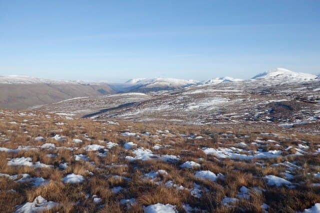
Beinn Bhuidhe — the Yellow Hill — rises 413m above the Sound of Mull east of Salen, taking its name from the cast of its summer grasses. The view down the Sound to Lismore and Morvern is the chief reward, with the Mull railway-era pier of Craignure visible to the south.
Quick facts
- Height
- 413m/ 1355ft
- Grid ref
- NM 59018 39946
- Nearest city
- Oban· 29km
- Dogs
- Dogs on lead required near livestockDog-friendly guide ↗
No GPX track yet
Walked this route? Share your track to help other walkers.
Standard route
heather and bog 60% · grass slopes 25% · rocky summit 15%
From Salen take the minor road towards Gruline and park where space allows, then climb north-east straight up the broad heathery flank. There is no path but the gradient is even. Total time on foot is 3 to 4 hours.
Terrain
Heather and tussock grass over peaty subsoil. The shoulder above 300m levels out into a wide plateau of yellow Molinia grass — quite open and pleasant after recent muirburn.
In winter
Low enough to be largely snow-free in most winters. The hilltop plateau funnels the prevailing south-westerly wind and can be punishing in a gale.
Best time of year
Getting there
- Glasgow5h 36m
- Edinburgh7h 11m
Ferry access
Oban → Craignure
- Crossing time45 min
- Summer sailingsUp to 8 sailings daily (Apr–Oct)
- Winter sailings4–5 sailings daily (Nov–Mar)
- Book ahead7 days
- Last ferry backCheck CalMac timetable — sailings run until ~21:00 in peak summer
Foot passengers can usually turn up without booking. Book vehicle spaces in advance. The Lochaline → Fishnish crossing (15 min) is shorter but serves east Mull only.
Book on CalMac ↗OS maps: OS Landranger 47, OS Landranger 48, OS Explorer 374E, OS Explorer 375E, OS Explorer 375W
Mobile signal: Poor. Remote Mull or Argyll; limited coverage.
Current conditions
Daylight Today
- Sunrise
- 04:33
- Sunset
- 22:16
- Civil dawn
- 03:28
- Civil dusk
- 23:21
NOAA Solar Calculator · 16 June 2026
Around Beinn Bhuidhe on the SCOT network
Getting there, basing yourself, and what to do off the hill.
Getting there: Oban station
Argyll ferry hub; Mull, Lismore, Coll, Tiree, Barra connections
29km from the hill
tripscot.co.uk
On TripSCOTBase yourself in Tobermory
Mull base — Ben More, Treshnish, ferry to Iona
18km from the hill
tripscot.co.uk
On TasteSCOTAfter the hill: Tobermory
Mull — colourful harbour-front distillery making both unpeated and peated (Ledaig) whisky
18km from the hill
tastescot.co.uk
Beinn Bhuidhe — common questions
- How hard is Beinn Bhuidhe?
- Beinn Bhuidhe is rated 1/5 (easy) on the OutdoorSCOT scale. Terrain: Heather and tussock grass over peaty subsoil.
- When is the best time to climb Beinn Bhuidhe?
- The standard good-weather months for Beinn Bhuidhe are March, April, May, June, July, August, September, October. Outside those months, expect winter conditions on the high ground — full mountain kit, navigation skills, and a check of the SAIS avalanche forecast for the relevant region.
- Can I bring my dog up Beinn Bhuidhe?
- Yes, but dogs must be kept on a lead — there is livestock or ground-nesting bird interest on the route.
- Is there mobile signal on Beinn Bhuidhe?
- Poor. Remote Mull or Argyll; limited coverage.
- How do I get the ferry to Beinn Bhuidhe?
- Oban → Craignure. Up to 8 sailings daily (Apr–Oct) in summer; 4–5 sailings daily (Nov–Mar) in winter. Book at least 7 days ahead. Foot passengers can usually turn up without booking. Book vehicle spaces in advance. The Lochaline → Fishnish crossing (15 min) is shorter but serves east Mull only.
- Is Beinn Bhuidhe safe in winter?
- Low enough to be largely snow-free in most winters. The hilltop plateau funnels the prevailing south-westerly wind and can be punishing in a gale.
Get the OutdoorSCOT weekly
One email a week — new route, hill and bothy guides, seasonal conditions and the odd hard-won lesson. No spam, unsubscribe in one click.