Marilyn · Torridon
An Staonach
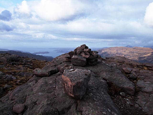
An Staonach reaches 516m at NG 830 480 on the long peninsula between Loch Torridon and Loch Kishorn, north of the Bealach na Ba. Staonach hints at a leaning or sloping form, and the hill does present a noticeably canted summit ridge from the Applecross road.
Quick facts
- Height
- 516m/ 1693ft
- Prominence
- 229 m
- Grid ref
- NG 83002 48083
- Nearest city
- Inverness· 83km
- Dogs
- Dogs on lead required near livestockDog-friendly guide ↗
Height and prominence cross-checked against the Database of British and Irish Hills (CC BY).
No GPX track yet
Walked this route? Share your track to help other walkers.
Standard route
Torridonian sandstone 45% · heather moorland 35% · rocky summit 20%
Park at the small layby on the Applecross-Shieldaig coast road near Kenmore. Cross the burn and climb pathless ground north-east up sandstone terraces and heather to the summit. About 4 hours.
Terrain
Classic Torridonian terracing — easy walking on the flat steps separated by short rocky risers. Heather and bilberry fill the steps; a few short scrambles can be avoided if preferred.
In winter
Coastal Torridonian hill where weather changes fast. Snow comes and goes; iced sandstone steps are the routine winter concern. Crampons rarely needed, but stiff boots and an alert eye certainly are.
This hill is in the Torridon SAIS forecast area. Check SAIS forecasts in winter (December–April).
Best time of year
Getting there
- Glasgow5h 28m
- Edinburgh7h 25m
OS maps: OS Landranger 24, OS Explorer 428N
Mobile signal: Poor. Signal drops completely on the approach; remote Wester Ross gives zero coverage.
Current conditions
Daylight Today
- Sunrise
- 05:14
- Sunset
- 21:44
- Civil dawn
- 04:21
- Civil dusk
- 22:37
NOAA Solar Calculator · 30 July 2026
Around An Staonach on the SCOT network
Getting there, basing yourself, and what to do off the hill.
An Staonach — common questions
- Is An Staonach a hard climb?
- An Staonach is rated 2/5 (moderate) on the OutdoorSCOT scale. Ground conditions: Classic Torridonian terracing — easy walking on the flat steps separated by short rocky risers.
- How much drop does An Staonach have?
- The drop is 229m: measured from the summit of An Staonach down to the saddle joining it to higher terrain. Passing the 150m-drop threshold on all sides is exactly what makes it a Marilyn.
- What's the best month to climb An Staonach?
- Aim for March, April, May, June, July, August, September, October on An Staonach. In the remaining months treat it as a winter hill — full kit, solid navigation, and a look at the relevant SAIS avalanche forecast before you go.
- Can dogs go up An Staonach?
- Dogs are fine on a lead. The route passes livestock or ground-nesting bird habitat, so keep them close throughout.
- Will I get phone signal on An Staonach?
- Poor. Signal drops completely on the approach; remote Wester Ross gives zero coverage.
- Is An Staonach safe in winter?
- Coastal Torridonian hill where weather changes fast. Snow comes and goes; iced sandstone steps are the routine winter concern. Crampons rarely needed, but stiff boots and an alert eye certainly are.
Get the OutdoorSCOT weekly
One email a week — new route, hill and bothy guides, seasonal conditions and the odd hard-won lesson. No spam, unsubscribe in one click.