Marilyn · Torridon
Bad a' Chreamha
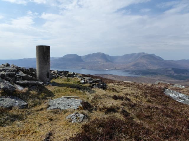
Bad a' Chreamha — the wild garlic clump — reaches 395m at NG 857 366 on the southern part of the Applecross peninsula above Loch Kishorn. The name records where ramsons once grew thickly in the wooded gullies below; remnants of the plant still appear on damp eastern slopes in spring.
Quick facts
- Height
- 395m/ 1296ft
- Prominence
- 256 m
- Grid ref
- NG 85770 36635
- Nearest city
- Inverness· 81km
- Dogs
- Dogs on lead required near livestockDog-friendly guide ↗
Height and prominence cross-checked against the Database of British and Irish Hills (CC BY).
No GPX track yet
Walked this route? Share your track to help other walkers.
Standard route
heather and bog 65% · grass slopes 25% · rocky summit 10%
Park at the head of Loch Kishorn near Tornapress. Cross the moor heading west, then climb directly to the rocky summit. About 3 hours, with the climb shorter than the trackless approach.
Terrain
A trackless boggy moor for the first kilometre with deer-trodden lines giving some help. Higher up the ground firms into heathery slopes and small sandstone steps near the rocky summit.
In winter
Maritime hill where snow seldom holds for long. The slabby summit becomes greasy with frost or wet snow; a couple of small steps want care in icy conditions. Daylight is the main constraint.
This hill is in the Torridon SAIS forecast area. Check SAIS forecasts in winter (December–April).
Best time of year
Getting there
- Glasgow5h 11m
- Edinburgh7h 9m
OS maps: OS Landranger 24, OS Explorer 428S
Mobile signal: Very poor. No signal at all; one of Scotland's most remote walking areas.
Current conditions
Daylight Today
- Sunrise
- 05:15
- Sunset
- 21:43
- Civil dawn
- 04:22
- Civil dusk
- 22:36
NOAA Solar Calculator · 30 July 2026
Around Bad a' Chreamha on the SCOT network
Getting there, basing yourself, and what to do off the hill.
Bad a' Chreamha — common questions
- Is Bad a' Chreamha a hard climb?
- Bad a' Chreamha is rated 1/5 (easy) on the OutdoorSCOT scale. Ground conditions: A trackless boggy moor for the first kilometre with deer-trodden lines giving some help.
- How much drop does Bad a' Chreamha have?
- The drop is 256m: measured from the summit of Bad a' Chreamha down to the saddle joining it to higher terrain. Passing the 150m-drop threshold on all sides is exactly what makes it a Marilyn.
- What's the best month to climb Bad a' Chreamha?
- Aim for March, April, May, June, July, August, September, October on Bad a' Chreamha. In the remaining months treat it as a winter hill — full kit, solid navigation, and a look at the relevant SAIS avalanche forecast before you go.
- Can dogs go up Bad a' Chreamha?
- Dogs are fine on a lead. The route passes livestock or ground-nesting bird habitat, so keep them close throughout.
- Will I get phone signal on Bad a' Chreamha?
- Very poor. No signal at all; one of Scotland's most remote walking areas.
- Is Bad a' Chreamha safe in winter?
- Maritime hill where snow seldom holds for long. The slabby summit becomes greasy with frost or wet snow; a couple of small steps want care in icy conditions. Daylight is the main constraint.
Get the OutdoorSCOT weekly
One email a week — new route, hill and bothy guides, seasonal conditions and the odd hard-won lesson. No spam, unsubscribe in one click.