Marilyn · Torridon
An Sgurr
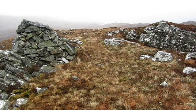
An Sgurr — simply the peak — reaches 391m at NG 857 387 on the southern Applecross peninsula, sister hill to Bad a' Chreamha just to the south. The sharp sgurr name fits the small but distinct rocky summit, conspicuous from the road over the Bealach na Ba.
Quick facts
- Height
- 391m/ 1283ft
- Prominence
- 202 m
- Grid ref
- NG 85705 38731
- Nearest city
- Inverness· 81km
- Dogs
- Dogs on lead required near livestockDog-friendly guide ↗
Height and prominence cross-checked against the Database of British and Irish Hills (CC BY).
No GPX track yet
Walked this route? Share your track to help other walkers.
Standard route
heather moorland 50% · rocky slopes 35% · grass slopes 15%
Begin from the Tornapress to Applecross road and climb west onto rough moor, then a steeper pull to the summit cone. Around 3 hours; can be combined with Bad a' Chreamha for a longer day.
Terrain
Trackless moor on the approach with a band of slabs and small craglets to weave through on the final pull. Once on the summit ridge the going is easy on cropped heather between gneiss outcrops.
In winter
A coastal hill, generally snow-free below 300m. The summit slabs accept verglas readily; a fall on iced gneiss would be unforgiving. Choose calm cold days and watch the rock conditions.
This hill is in the Torridon SAIS forecast area. Check SAIS forecasts in winter (December–April).
Best time of year
Getting there
- Glasgow5h 13m
- Edinburgh7h 11m
OS maps: OS Landranger 24, OS Explorer 428S
Mobile signal: Poor. Remote Sutherland or Highland coast; limited coverage.
Current conditions
Daylight Today
- Sunrise
- 05:14
- Sunset
- 21:43
- Civil dawn
- 04:22
- Civil dusk
- 22:36
NOAA Solar Calculator · 30 July 2026
Around An Sgurr on the SCOT network
Getting there, basing yourself, and what to do off the hill.
An Sgurr — common questions
- Is An Sgurr a hard climb?
- An Sgurr is rated 1/5 (easy) on the OutdoorSCOT scale. Ground conditions: Trackless moor on the approach with a band of slabs and small craglets to weave through on the final pull.
- How much drop does An Sgurr have?
- The drop is 202m: measured from the summit of An Sgurr down to the saddle joining it to higher terrain. Passing the 150m-drop threshold on all sides is exactly what makes it a Marilyn.
- What's the best month to climb An Sgurr?
- Aim for March, April, May, June, July, August, September, October on An Sgurr. In the remaining months treat it as a winter hill — full kit, solid navigation, and a look at the relevant SAIS avalanche forecast before you go.
- Can dogs go up An Sgurr?
- Dogs are fine on a lead. The route passes livestock or ground-nesting bird habitat, so keep them close throughout.
- Will I get phone signal on An Sgurr?
- Poor. Remote Sutherland or Highland coast; limited coverage.
- Is An Sgurr safe in winter?
- A coastal hill, generally snow-free below 300m. The summit slabs accept verglas readily; a fall on iced gneiss would be unforgiving. Choose calm cold days and watch the rock conditions.
Get the OutdoorSCOT weekly
One email a week — new route, hill and bothy guides, seasonal conditions and the odd hard-won lesson. No spam, unsubscribe in one click.