Sub-Marilyn · Kintail
Beinn Raimh
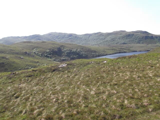
Beinn Raimh — possibly the oar hill, from raimh meaning oar — rises to 447m at NG 847 311 between Stromeferry and Plockton. The hill's elongated north-south summit ridge does resemble an oar laid across the landscape when seen from the railway.
Quick facts
- Height
- 447.7m/ 1469ft
- Prominence
- 148 m
- Grid ref
- NG 84781 31185
- Nearest city
- Inverness· 83km
- Dogs
- Dogs on lead required near livestockDog-friendly guide ↗
Sub-Marilyn: 148m of drop — misses the 150m Marilyn cut by 2m. We keep it on the list as a near-miss.
Height and prominence cross-checked against the Database of British and Irish Hills (CC BY).
No GPX track yet
Walked this route? Share your track to help other walkers.
Standard route
heather moorland 65% · grass slopes 25% · rocky summit 10%
Begin at the cattle grid south of Achmore village. A faint quad-bike track leads onto the southern shoulder; thereafter it is open hillside up to the long summit ridge. Around 3 hours for the simple up-and-back.
Terrain
Tussocky molinia grass and heather throughout, with occasional gneiss outcrops poking through near the summit. The ridge itself is dry and walkable but the approach can be sloppy after rain.
In winter
Coastal location keeps the hill snow-free for most of the season. After cold easterlies a thin frosting may appear; rarely sufficient to require winter kit. The long ridge can be wind-blasted in gales.
Best time of year
Getting there
- Glasgow5h 6m
- Edinburgh7h 7m
OS maps: OS Landranger 24, OS Explorer 428S
Mobile signal: Poor. A blackspot on every network; the characteristic quartzite mountains block signals.
Current conditions
Daylight Today
- Sunrise
- 05:15
- Sunset
- 21:43
- Civil dawn
- 04:22
- Civil dusk
- 22:35
NOAA Solar Calculator · 30 July 2026
Around Beinn Raimh on the SCOT network
Getting there, basing yourself, and what to do off the hill.
Beinn Raimh — common questions
- What difficulty is Beinn Raimh?
- On the OutdoorSCOT scale, Beinn Raimh comes in at 1/5 — easy. Ground conditions: Tussocky molinia grass and heather throughout, with occasional gneiss outcrops poking through near the summit.
- How much drop does Beinn Raimh have?
- The drop is 148m: measured from the summit of Beinn Raimh down to the saddle joining it to higher terrain. That leaves it 2m short of the 150m drop a Marilyn needs — DoBIH classes it a sub-Marilyn, a near-miss rather than a full Marilyn.
- What's the best month to climb Beinn Raimh?
- Aim for March, April, May, June, July, August, September, October on Beinn Raimh. In the remaining months treat it as a winter hill — full kit, solid navigation, and a look at the relevant SAIS avalanche forecast before you go.
- Can dogs go up Beinn Raimh?
- Dogs are fine on a lead. The route passes livestock or ground-nesting bird habitat, so keep them close throughout.
- Will I get phone signal on Beinn Raimh?
- Poor. A blackspot on every network; the characteristic quartzite mountains block signals.
- Is Beinn Raimh safe in winter?
- Coastal location keeps the hill snow-free for most of the season. After cold easterlies a thin frosting may appear; rarely sufficient to require winter kit. The long ridge can be wind-blasted in gales.
Get the OutdoorSCOT weekly
One email a week — new route, hill and bothy guides, seasonal conditions and the odd hard-won lesson. No spam, unsubscribe in one click.