Marilyn · Kintail
Creag Mhor
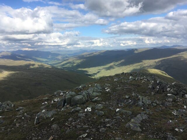
This Creag Mhor reaches 407m at NG 903 315 above Glen Udalain, between Stromeferry and the head of Loch Long. A common name in Gaelic — big crag — but this particular hill stands distinct on its small craggy plateau north of the Achmore road.
Gaelic: “crag, big” · Pronunciation: krayg vore
Quick facts
- Height
- 407m/ 1335ft
- Prominence
- 158 m
- Grid ref
- NG 90308 31590
- Nearest city
- Inverness· 77km
- Dogs
- Dogs on lead required near livestockDog-friendly guide ↗
Height and prominence cross-checked against the Database of British and Irish Hills (CC BY).
No GPX track yet
Walked this route? Share your track to help other walkers.
Standard route
heather moorland 50% · rocky slopes 35% · grass slopes 15%
Park near the cottages at Braeintra and follow the rough track east up Allt nan Iongnan, then turn south onto the open hillside to reach the rocky summit. About 3 hours for the round.
Terrain
Estate track for the first stretch, then deep heather over hidden boulders. Lewisian gneiss crops out as low knolls and slabs across the upper hillside; route-finding is by eye between them.
In winter
A maritime hill where snow seldom lingers more than a few days. The gneiss slabs become greasy when wet or freezing, and a few short rocky steps are the only places you might want extra grip.
Best time of year
Getting there
- Glasgow5h 57m
- Edinburgh7h 55m
OS maps: OS Landranger 25, OS Explorer 428S, OS Explorer 429
Mobile signal: Poor. Remote Highland hill; EE and Vodafone both absent on this summit.
Current conditions
Daylight Today
- Sunrise
- 05:14
- Sunset
- 21:42
- Civil dawn
- 04:22
- Civil dusk
- 22:35
NOAA Solar Calculator · 30 July 2026
Around Creag Mhor on the SCOT network
Getting there, basing yourself, and what to do off the hill.
Creag Mhor — common questions
- How hard is Creag Mhor?
- We grade Creag Mhor at 1/5, which puts it in easy territory. Terrain: Estate track for the first stretch, then deep heather over hidden boulders.
- How prominent is Creag Mhor?
- Creag Mhor has 158m of topographic prominence — the height of its summit above the highest col connecting it to higher ground. Marilyns are defined by that measure: at least 150m of drop on all sides.
- When should I climb Creag Mhor?
- The standard good-weather months for Creag Mhor are March, April, May, June, July, August, September, October. Outside those months, expect winter conditions on the high ground — full mountain kit, navigation skills, and a check of the SAIS avalanche forecast for the relevant region.
- Can I bring my dog up Creag Mhor?
- On a lead only — the route crosses ground with livestock or nesting-bird interest.
- What's mobile reception like on Creag Mhor?
- Poor. Remote Highland hill; EE and Vodafone both absent on this summit.
- Is Creag Mhor safe in winter?
- A maritime hill where snow seldom lingers more than a few days. The gneiss slabs become greasy when wet or freezing, and a few short rocky steps are the only places you might want extra grip.
Get the OutdoorSCOT weekly
One email a week — new route, hill and bothy guides, seasonal conditions and the odd hard-won lesson. No spam, unsubscribe in one click.