Donald · Central Belt
Uamh Bheag
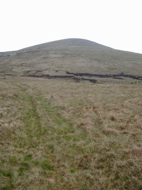
Uamh Bheag — 'the little cave' — is the high point of the Braes of Doune above Callander, a sprawling moorland top on the southern edge of the Trossachs. The summit lies near a junction of cairn and fence in the middle of a vast peat-hag plateau studded with wind turbines.
Gaelic: “small” · Pronunciation: uamh vek
Quick facts
- Height
- 665.8m/ 2184ft
- Prominence
- 325 m
- Grid ref
- NN691118
- Parking
- NN660137
- Nearest city
- Stirling· 21km
- Dogs
- Dogs on lead required near livestockDog-friendly guide ↗
Height and prominence cross-checked against the Database of British and Irish Hills (CC BY).
No GPX track yet
Walked this route? Share your track to help other walkers.
Standard route
heather and bracken 55% · grass slopes 30% · rocky summit 15%
From the Braes of Doune wind farm access road, follow the turbine track to the south-eastern ridge then drop and re-climb the watershed for the cairn. Around 12km return with 450m of climb.
Terrain
Wind farm hardcore tracks dominate the lower approach. Above the wind farm, the ground turns into tussock and saturated peat hags.
In winter
Wet snow on peat creates very awkward travel. The wind farm tracks usually remain passable but the open hags between them fill with knee-deep slush in a thaw.
Best time of year
Getting there
- Glasgow1h 8m
- Edinburgh2h 37m
OS maps: OS Landranger 57
Mobile signal: Moderate. EE weak on top; stronger on southern aspects toward Callander.
Current conditions
Daylight Today
- Sunrise
- 04:46
- Sunset
- 21:58
- Civil dawn
- 03:48
- Civil dusk
- 22:56
NOAA Solar Calculator · 13 July 2026
Around Uamh Bheag on the SCOT network
Getting there, basing yourself, and what to do off the hill.
Getting there: Dunblane station
Stirling-area; Sheriffmuir; gateway north
14km from the hill
tripscot.co.uk
On TripSCOTBase yourself in Callander
Trossachs gateway — Ben Ledi, Stuc a Chroin, Rob Roy Way
7km from the hill
tripscot.co.uk
On TasteSCOTAfter the hill: Deanston
Doune — converted cotton mill; floral, honeyed Perthshire distillery
12km from the hill
tastescot.co.uk
Uamh Bheag — common questions
- Is Uamh Bheag a hard climb?
- Uamh Bheag is rated 3/5 (moderately challenging) on the OutdoorSCOT scale. Ground conditions: Wind farm hardcore tracks dominate the lower approach.
- How much drop does Uamh Bheag have?
- The drop is 325m: measured from the summit of Uamh Bheag down to the saddle joining it to higher terrain.
- Where's the parking for Uamh Bheag?
- Park at NN660137. Double-check the grid reference on an OS map first; informal laybys here fill early in high season.
- What's the best month to climb Uamh Bheag?
- Aim for March, April, May, June, July, August, September, October, November on Uamh Bheag. In the remaining months treat it as a winter hill — full kit, solid navigation, and a look at the relevant SAIS avalanche forecast before you go.
- Can dogs go up Uamh Bheag?
- Dogs are fine on a lead. The route passes livestock or ground-nesting bird habitat, so keep them close throughout.
- Will I get phone signal on Uamh Bheag?
- Moderate. EE weak on top; stronger on southern aspects toward Callander.
- Is Uamh Bheag safe in winter?
- Wet snow on peat creates very awkward travel. The wind farm tracks usually remain passable but the open hags between them fill with knee-deep slush in a thaw.
Get the OutdoorSCOT weekly
One email a week — new route, hill and bothy guides, seasonal conditions and the odd hard-won lesson. No spam, unsubscribe in one click.