Donald · Galloway
Shalloch on Minnoch
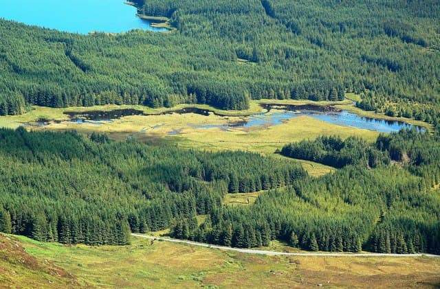
The northernmost peak of the Awful Hand and the only Galloway Donald entirely in South Ayrshire. A pointed quartz rock by the summit cairn looks across to the Stinchar Valley and the wind farms of Carrick. Its name comes from Gaelic — the "willow place on the river" below.
Quick facts
- Height
- 774.2m/ 2540ft
- Prominence
- 194 m
- Distance
- 14 km
- Ascent
- 635 m
- Time
- 4–7 hrs
- Grid ref
- NX407905
- Parking
- NX414881
- Nearest city
- Dumfries· 58km
- Dogs
- Dogs on lead required near livestockDog-friendly guide ↗
Height and prominence cross-checked against the Database of British and Irish Hills (CC BY).
No GPX track yet
Walked this route? Share your track to help other walkers.
Standard route
heather moorland 60% · grass moorland 25% · rocky summit 15%
The shortest line is from the Straiton–Glentrool road at Tairlaw, climbing past the felled plantation onto Pilot Knowe and then the ridge. Combining it with Tarfessock gives the classic north Awful Hand round.
Terrain
Rough heather and chest-deep windblown branches in the felled plantations on the way in. Once on the ridge the going eases to short heath and granite slabs. Carry a GPS — the felled ground is hard to read in mist.
In winter
Open to Atlantic squalls that can blow in horizontal sleet within minutes. Permanent snow is rare but rime ice on the summit rock and verglas on the slabs are common in February. Cite SAIS Southern Uplands for cornice risk on the eastern aspect.
Best time of year
Getting there
- Glasgow2h 50m
- Edinburgh3h 32m
OS maps: OS Landranger 77
Mobile signal: Moderate. EE flickers up top; patchy in the Galloway interior.
Current conditions
Daylight Today
- Sunrise
- 05:01
- Sunset
- 21:48
- Civil dawn
- 04:08
- Civil dusk
- 22:40
NOAA Solar Calculator · 17 July 2026
Pair with
Curated multi-hill combinations from Shalloch on Minnoch.
Around Shalloch on Minnoch on the SCOT network
Getting there, basing yourself, and what to do off the hill.
Shalloch on Minnoch — common questions
- How hard is Shalloch on Minnoch?
- We grade Shalloch on Minnoch at 2/5, which puts it in moderate territory. The usual route is around 14km with 635m of climbing; allow 4-7 hours. Terrain: Rough heather and chest-deep windblown branches in the felled plantations on the way in.
- How prominent is Shalloch on Minnoch?
- Shalloch on Minnoch has 194m of topographic prominence — the height of its summit above the highest col connecting it to higher ground.
- Where should I park to climb Shalloch on Minnoch?
- Standard parking is at NX414881. Check the parking grid reference on an OS map before travel; informal laybys can fill on summer weekends.
- When should I climb Shalloch on Minnoch?
- The standard good-weather months for Shalloch on Minnoch are April, May, June, July, August, September, October. Outside those months, expect winter conditions on the high ground — full mountain kit, navigation skills, and a check of the SAIS avalanche forecast for the relevant region.
- Can I bring my dog up Shalloch on Minnoch?
- On a lead only — the route crosses ground with livestock or nesting-bird interest.
- What's mobile reception like on Shalloch on Minnoch?
- Moderate. EE flickers up top; patchy in the Galloway interior.
- Is Shalloch on Minnoch safe in winter?
- Open to Atlantic squalls that can blow in horizontal sleet within minutes. Permanent snow is rare but rime ice on the summit rock and verglas on the slabs are common in February. Cite SAIS Southern Uplands for cornice risk on the eastern aspect.
Get the OutdoorSCOT weekly
One email a week — new route, hill and bothy guides, seasonal conditions and the odd hard-won lesson. No spam, unsubscribe in one click.