Donald · Southern Uplands
Queensberry
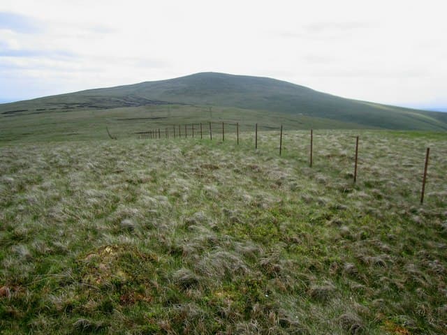
Queensberry is the tallest hill of the eastern Lowther group above Thornhill — the seat from which the Douglas Earls of Queensberry took their title. A handsome conical cairn caps the summit and the view sweeps from Tinto south to the Solway and east across Annandale.
Quick facts
- Height
- 697.1m/ 2287ft
- Prominence
- 363 m
- Distance
- 13 km
- Ascent
- 572 m
- Time
- 3–6 hrs
- Grid ref
- NX989997
- Parking
- NS914083
- Nearest city
- Dumfries· 23km
- Dogs
- Dogs on lead required near livestockDog-friendly guide ↗
Height and prominence cross-checked against the Database of British and Irish Hills (CC BY).
No GPX track yet
Walked this route? Share your track to help other walkers.
Standard route
grass moorland 75% · heather slopes 15% · summit plateau 10%
The shortest line is from the road end at Mitchellslacks above Closeburn, climbing rough pasture to Loch Ettrick before tackling the steep south-west shoulder direct. The southerly approach via Penbreck offers a longer but more shapely day.
Terrain
Rush-strewn pasture turns to dry moss above the in-bye. The summit cone has a faint cairn-to-cairn trail worn in by regular visitors. Bog above the loch needs care after rain.
In winter
Its conspicuous height above the Nith valley exposes it to all wind quarters — easterly snow showers off the Solway often coat this hill while neighbouring Lowther stays bare. Limited shelter; a brimmed hat is worth its weight on a freezing day.
Best time of year
Getting there
- Glasgow2h 49m
- Edinburgh2h 53m
OS maps: OS Landranger 78
Mobile signal: Good summit signal; steady on EE and Vodafone. Fine views to Solway Firth.
Current conditions
Daylight Today
- Sunrise
- 04:51
- Sunset
- 21:49
- Civil dawn
- 03:56
- Civil dusk
- 22:44
NOAA Solar Calculator · 13 July 2026
Around Queensberry on the SCOT network
Getting there, basing yourself, and what to do off the hill.
Queensberry — common questions
- Is Queensberry a hard climb?
- Queensberry is rated 3/5 (moderately challenging) on the OutdoorSCOT scale. The standard route covers about 13km with 572m of ascent and takes most walkers 3-6 hours. Ground conditions: Rush-strewn pasture turns to dry moss above the in-bye.
- How much drop does Queensberry have?
- The drop is 363m: measured from the summit of Queensberry down to the saddle joining it to higher terrain.
- Where's the parking for Queensberry?
- Park at NS914083. Double-check the grid reference on an OS map first; informal laybys here fill early in high season.
- What's the best month to climb Queensberry?
- Aim for March, April, May, June, July, August, September, October, November on Queensberry. In the remaining months treat it as a winter hill — full kit, solid navigation, and a look at the relevant SAIS avalanche forecast before you go.
- Can dogs go up Queensberry?
- Dogs are fine on a lead. The route passes livestock or ground-nesting bird habitat, so keep them close throughout.
- Will I get phone signal on Queensberry?
- Good summit signal; steady on EE and Vodafone. Fine views to Solway Firth.
- Is Queensberry safe in winter?
- Its conspicuous height above the Nith valley exposes it to all wind quarters — easterly snow showers off the Solway often coat this hill while neighbouring Lowther stays bare. Limited shelter; a brimmed hat is worth its weight on a freezing day.
Get the OutdoorSCOT weekly
One email a week — new route, hill and bothy guides, seasonal conditions and the odd hard-won lesson. No spam, unsubscribe in one click.