Donald · Galloway
Mullwharchar
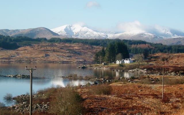
Mullwharchar is the lonely heart of Galloway — a hill of bare ice-scoured slabs at the centre of the Dungeon range, ringed by Loch Enoch, Loch Macaterick and Loch Doon. Once briefly considered as a nuclear waste repository in the 1980s, it remains as wild as anywhere in the Southern Uplands.
Quick facts
- Height
- 692m/ 2270ft
- Prominence
- 187 m
- Distance
- 13 km
- Ascent
- 567 m
- Time
- 3–6 hrs
- Grid ref
- NX454866
- Parking
- NX454856
- Nearest city
- Dumfries· 53km
- Dogs
- Dogs on lead required near livestockDog-friendly guide ↗
Height and prominence cross-checked against the Database of British and Irish Hills (CC BY).
No GPX track yet
Walked this route? Share your track to help other walkers.
Standard route
heather and bog 55% · granite boulders 30% · grass moorland 15%
Approaches are all long: the Bruce's Stone route via Loch Enoch and Mid Hill, or the longer Loch Doon approach across rough moor. The summit is a low knot of weathered granite a few metres above the surrounding tableland.
Terrain
A bewildering chess-board of slabs, lochans, peat hags and erratics — Galloway at its most disorienting. There are no paths and few cairns. Map, compass and a fully charged GPS are essential.
In winter
Truly serious in winter once snow fills the hollows between the granite slabs — a single hummock looks identical to a peat pit hidden beneath powder. Allow longer than you would for any other Donald and turn back early if cloud descends.
Best time of year
Getting there
- Glasgow2h 54m
- Edinburgh3h 31m
OS maps: OS Landranger 77
Mobile signal: Moderate. EE intermittent up top; limited coverage in the Galloway interior.
Current conditions
Daylight Today
- Sunrise
- 04:55
- Sunset
- 21:52
- Civil dawn
- 04:01
- Civil dusk
- 22:46
NOAA Solar Calculator · 13 July 2026
Pair with
Curated multi-hill combinations from Mullwharchar.
Around Mullwharchar on the SCOT network
Getting there, basing yourself, and what to do off the hill.
Mullwharchar — common questions
- How difficult is Mullwharchar?
- Mullwharchar carries a 3/5 (moderately challenging) grade on the OutdoorSCOT scale. Count on about 13km, 567m of ascent and a 3-6 hour day on the standard route. Terrain: A bewildering chess-board of slabs, lochans, peat hags and erratics — Galloway at its most disorienting.
- How prominent is Mullwharchar?
- Mullwharchar has 187m of topographic prominence — the height of its summit above the highest col connecting it to higher ground.
- Where should I park to climb Mullwharchar?
- Standard parking is at NX454856. Check the parking grid reference on an OS map before travel; informal laybys can fill on summer weekends.
- When should I climb Mullwharchar?
- The standard good-weather months for Mullwharchar are March, April, May, June, July, August, September, October, November. Outside those months, expect winter conditions on the high ground — full mountain kit, navigation skills, and a check of the SAIS avalanche forecast for the relevant region.
- Can I bring my dog up Mullwharchar?
- On a lead only — the route crosses ground with livestock or nesting-bird interest.
- What's mobile reception like on Mullwharchar?
- Moderate. EE intermittent up top; limited coverage in the Galloway interior.
- Is Mullwharchar safe in winter?
- Truly serious in winter once snow fills the hollows between the granite slabs — a single hummock looks identical to a peat pit hidden beneath powder. Allow longer than you would for any other Donald and turn back early if cloud descends.
Get the OutdoorSCOT weekly
One email a week — new route, hill and bothy guides, seasonal conditions and the odd hard-won lesson. No spam, unsubscribe in one click.