Corbett · Knoydart
Sgurr an Fhuarain
Sgùrr an Fhuarain is the high point of the ridge running west from Sgùrr Mòr (Munro) into Glen Kingie — a remote 901m Corbett sitting at the heart of the rough country between Loch Quoich and the Knoydart hills proper. There is no short way in: every approach is a serious commitment of distance and trackless ground. The reward is a quiet summit on one of the wildest watersheds in mainland Scotland, with views to Sgùrr na Cìche, Garbh Chioch Mhòr and the long western Knoydart ridges.
Quick facts
- Height
- 901m/ 2956ft
- Prominence
- 183 m
- Distance
- 28 km
- Ascent
- 1200 m
- Time
- 9–13 hrs
- Grid ref
- NM987979
- Parking
- NN071995
- Nearest city
- Fort William· 27km
- Dogs
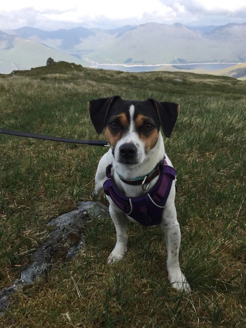
- Dogs on lead required near livestockDog-friendly guide ↗
Height and prominence cross-checked against the Database of British and Irish Hills (CC BY).
No GPX track yet
Walked this route? Share your track to help other walkers.
Standard route
loch-side track 20% · rough heather 45% · grassy ridge 25% · summit area 10%
Most parties tackle Sgùrr an Fhuarain as part of a two-day expedition from the head of Loch Arkaig, basing at Kinbreack bothy. From the bothy, climb north onto the ridge above Glen Kingie and traverse west over Sgùrr Beag and onto Sgùrr an Fhuarain. Single-day attempts start from the Loch Quoich dam, around 28km return with serious peat-hag terrain. Allow 9–11 hours as a single day; 6–7 hours from a bothy base.
Terrain
Long stretches of trackless peat hag and tussock on the approach — slow and tiring even in dry weather. Stalkers' paths exist in places but are vague and often lost in the moor. The upper ridge is firm grass and scree with no rocky difficulties; the top itself is a broad grassy crown crowned by a small trig pillar.
In winter
A serious far-west winter day rarely attempted because of the approach length. The combination of short midwinter daylight, no phone signal, no road access for help, and committing terrain means single-day winter ascents are for very experienced parties only. Two-day with a bothy base is more sensible.
Best time of year
Getting there
- Glasgow3h 6m
- Edinburgh3h 24m
OS maps: OS Landranger 33, OS Landranger 40
Mobile signal: No usable signal anywhere on the approach or hill. PLB or satellite messenger strongly recommended for solo or single-day attempts
Current conditions
Daylight Today
- Sunrise
- 04:46
- Sunset
- 22:08
- Civil dawn
- 03:45
- Civil dusk
- 23:09
NOAA Solar Calculator · 13 July 2026
Pair with
Curated multi-hill combinations from Sgurr an Fhuarain.
Around Sgurr an Fhuarain on the SCOT network
Getting there, basing yourself, and what to do off the hill.
Getting there: Glenfinnan station
Glenfinnan Viaduct; Streap, Sgurr Thuilm, Glen Finnan Munros
19km from the hill
tripscot.co.uk
On TripSCOTBase yourself in Fort William
Ben Nevis base, West Highland Line, gateway to Lochaber
27km from the hill
tripscot.co.uk
On TasteSCOTAfter the hill: Ben Nevis Distillery
Fort William — Lochaber distillery at the foot of the Ben; long-aged Japanese-owned classics
26km from the hill
tastescot.co.uk
Sgurr an Fhuarain — common questions
- What difficulty is Sgurr an Fhuarain?
- On the OutdoorSCOT scale, Sgurr an Fhuarain comes in at 4/5 — challenging. Expect roughly 28km and 1200m of ascent on the usual route — 9-13 hours for most parties. Ground conditions: Long stretches of trackless peat hag and tussock on the approach — slow and tiring even in dry weather.
- How much drop does Sgurr an Fhuarain have?
- The drop is 183m: measured from the summit of Sgurr an Fhuarain down to the saddle joining it to higher terrain.
- Where's the parking for Sgurr an Fhuarain?
- Park at NN071995. Double-check the grid reference on an OS map first; informal laybys here fill early in high season.
- What's the best month to climb Sgurr an Fhuarain?
- Aim for May, June, July, August, September on Sgurr an Fhuarain. In the remaining months treat it as a winter hill — full kit, solid navigation, and a look at the relevant SAIS avalanche forecast before you go.
- Can dogs go up Sgurr an Fhuarain?
- Dogs are fine on a lead. The route passes livestock or ground-nesting bird habitat, so keep them close throughout.
- Will I get phone signal on Sgurr an Fhuarain?
- No usable signal anywhere on the approach or hill. PLB or satellite messenger strongly recommended for solo or single-day attempts
- Is Sgurr an Fhuarain safe in winter?
- A serious far-west winter day rarely attempted because of the approach length. The combination of short midwinter daylight, no phone signal, no road access for help, and committing terrain means single-day winter ascents are for very experienced parties only. Two-day with a bothy base is more sensible.
Get the OutdoorSCOT weekly
One email a week — new route, hill and bothy guides, seasonal conditions and the odd hard-won lesson. No spam, unsubscribe in one click.