Corbett · North-West Highlands
Beinn Liath Mhor a' Ghiubhais Li (Beinn Liath Mhor a' Ghiuthais)
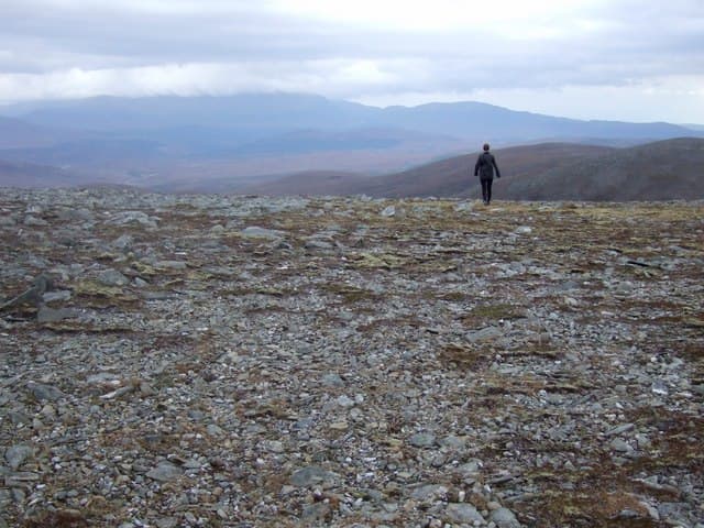
Beinn Liath Mhòr a' Ghiubhais Li — 'the big grey hill of the variegated pinewood' — is the rambling Corbett rising directly above the Loch Glascarnoch reservoir on the A835 between Garve and Ullapool. The 766m summit sits at the heart of a broad heather plateau, a mile or two from the road, and gives a wide-angle view of the Strathvaich estate and the eastern shoulders of An Teallach. The mountain is rarely climbed alone — most parties bag it on the way past, or pair it with the adjacent Munros at Beinn Dearg or Am Faochagach.
Gaelic: “mountain, grey, big, of the, grey, big, of the” · Pronunciation: bine lee-ah vore uh ghiubhais li (beinn lee-ah vore uh ghiuthais)
Quick facts
- Height
- 766m/ 2513ft
- Prominence
- 281 m
- Distance
- 8 km
- Ascent
- 500 m
- Time
- 2–3 hrs
- Grid ref
- NH280713
- Parking
- NH287713
- Nearest
- Ullapool· Inverness 46km
- Dogs
- Dogs on lead required near livestockDog-friendly guide ↗
Height and prominence cross-checked against the Database of British and Irish Hills (CC BY).
No GPX track yet
Walked this route? Share your track to help other walkers.
Standard route
NNR path 25% · heather hillside 40% · rocky upper slopes 25% · summit area 10%
Park in the layby at the east end of Loch Glascarnoch reservoir (NH287713). Cross the dam wall and follow a clear path west onto the open hillside, gaining the broad south-east ridge of the hill. From there a steady pull over heather and short grass leads to the destroyed trig pillar at the summit. The walk is short and uncomplicated; navigation in cloud demands attention because the plateau has subtle subsidiary tops. Allow 3.5–4.5 hours.
Terrain
Heather and grass throughout — drier than the Wester Ross average thanks to the reservoir's rain-shadow position. The path is reasonable on the lower slopes but vague on the broad summit plateau. The destroyed trig point sits in a small windbreak shelter.
In winter
A short friendly winter Corbett — gentle gradients, no avalanche concerns on the standard line, and the A835 is generally well-cleared by the council. The reservoir-side approach can be slippery when iced. Snow lies long on the north aspect. Cold easterlies coming over the Easter Ross moors can be ferocious on the open plateau.
This hill is in the Torridon SAIS forecast area. Check SAIS forecasts in winter (December–April).
Best time of year
Getting there
- Glasgow4h 0m
- Edinburgh4h 14m
OS maps: OS Landranger 20
Mobile signal: EE/Vodafone usable at the Glascarnoch dam; weakens on the summit but recovers given line of sight to the A835
Current conditions
Daylight Today
- Sunrise
- 04:39
- Sunset
- 22:12
- Civil dawn
- 03:35
- Civil dusk
- 23:16
NOAA Solar Calculator · 13 July 2026
Got a photo of Beinn Liath Mhor a' Ghiubhais Li (Beinn Liath Mhor a' Ghiuthais)?
30 seconds, helps other walkers.
Submit a photoAround Beinn Liath Mhor a' Ghiubhais Li (Beinn Liath Mhor a' Ghiuthais) on the SCOT network
Getting there, basing yourself, and what to do off the hill.
Beinn Liath Mhor a' Ghiubhais Li (Beinn Liath Mhor a' Ghiuthais) — common questions
- Is Beinn Liath Mhor a' Ghiubhais Li (Beinn Liath Mhor a' Ghiuthais) a hard climb?
- Beinn Liath Mhor a' Ghiubhais Li (Beinn Liath Mhor a' Ghiuthais) is rated 1/5 (easy) on the OutdoorSCOT scale. The standard route covers about 8km with 500m of ascent and takes most walkers 2-3 hours. Terrain: Heather and grass throughout — drier than the Wester Ross average thanks to the reservoir's rain-shadow position.
- How prominent is Beinn Liath Mhor a' Ghiubhais Li (Beinn Liath Mhor a' Ghiuthais)?
- Beinn Liath Mhor a' Ghiubhais Li (Beinn Liath Mhor a' Ghiuthais) has 281m of topographic prominence — the height of its summit above the highest col connecting it to higher ground.
- Where should I park to climb Beinn Liath Mhor a' Ghiubhais Li (Beinn Liath Mhor a' Ghiuthais)?
- Standard parking is at NH287713 near Ullapool. Check the parking grid reference on an OS map before travel; informal laybys can fill on summer weekends.
- When should I climb Beinn Liath Mhor a' Ghiubhais Li (Beinn Liath Mhor a' Ghiuthais)?
- The standard good-weather months for Beinn Liath Mhor a' Ghiubhais Li (Beinn Liath Mhor a' Ghiuthais) are May, June, July, August, September. Outside those months, expect winter conditions on the high ground — full mountain kit, navigation skills, and a check of the SAIS avalanche forecast for the relevant region.
- Can I bring my dog up Beinn Liath Mhor a' Ghiubhais Li (Beinn Liath Mhor a' Ghiuthais)?
- On a lead only — the route crosses ground with livestock or nesting-bird interest.
- What's mobile reception like on Beinn Liath Mhor a' Ghiubhais Li (Beinn Liath Mhor a' Ghiuthais)?
- EE/Vodafone usable at the Glascarnoch dam; weakens on the summit but recovers given line of sight to the A835
- Is Beinn Liath Mhor a' Ghiubhais Li (Beinn Liath Mhor a' Ghiuthais) safe in winter?
- A short friendly winter Corbett — gentle gradients, no avalanche concerns on the standard line, and the A835 is generally well-cleared by the council. The reservoir-side approach can be slippery when iced. Snow lies long on the north aspect. Cold easterlies coming over the Easter Ross moors can be ferocious on the open plateau.
Get the OutdoorSCOT weekly
One email a week — new route, hill and bothy guides, seasonal conditions and the odd hard-won lesson. No spam, unsubscribe in one click.