Corbett · North-West Highlands
Beinn Dronaig
Beinn Dronaig is the 796m Corbett standing at the heart of the Attadale Forest, a long way from any road and only practically reached on a bike-and-walk approach. The mountain occupies the country between Attadale and Lurg Mhòr (Munro), and is sometimes bagged as one stop on an extended traverse of the inner Attadale Corbetts. Bendronaig Lodge, the estate's stalking base, sits below the south flank and is the natural overnight stop for parties tackling the full cluster.
Quick facts
- Height
- 796.8m/ 2614ft
- Prominence
- 434 m
- Distance
- 34 km
- Ascent
- 700 m
- Time
- 8–12 hrs
- Grid ref
- NH037381
- Parking
- NG924386
- Nearest
- Ullapool· Inverness 63km
- Dogs
- Dogs on lead required near livestockDog-friendly guide ↗
Height and prominence cross-checked against the Database of British and Irish Hills (CC BY).
No GPX track yet
Walked this route? Share your track to help other walkers.
Standard route
glen track 25% · rough heather 45% · rocky upper slopes 20% · summit area 10%
Park at Attadale station car park (NG924386). Cycle the long Attadale estate track east up the Allt a' Bhealaich Mhòir for around 16km — past Bendronaig Lodge — to the foot of Beinn Dronaig's south flank. Climb north up grass and rock to the summit cairn. Bike-and-walk total: 12–14 hours. Most parties stay overnight at Bendronaig Lodge bothy and combine with Lurg Mhòr.
Terrain
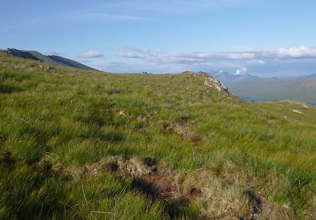
Exceptional estate track to Bendronaig Lodge — wide, well-graded, ideal for cycling. Beyond the lodge the terrain mixes heather, grass and peat hag with a number of stream crossings. The summit area is solid rock interspersed with turf, marked by a small cairn. The estate is genuinely empty country — you may walk for hours without meeting another party.
In winter
Beinn Dronaig in winter is among the most committing Corbetts in the country because of the access length. The Attadale track holds drift in north-easterly winds; the bike becomes useless once snow lies. A two-day round from Bendronaig bothy is the only realistic approach in midwinter daylight.
This hill is in the Torridon SAIS forecast area. Check SAIS forecasts in winter (December–April).
Best time of year
Getting there
- Glasgow3h 29m
- Edinburgh4h 56m
OS maps: OS Landranger 25
Mobile signal: EE/Vodafone usable at Attadale station; no signal once past Bendronaig Lodge. Bothy has no signal
Current conditions
Daylight Today
- Sunrise
- 04:43
- Sunset
- 22:11
- Civil dawn
- 03:40
- Civil dusk
- 23:14
NOAA Solar Calculator · 13 July 2026
Pair with
Curated multi-hill combinations from Beinn Dronaig.
Around Beinn Dronaig on the SCOT network
Getting there, basing yourself, and what to do off the hill.
Beinn Dronaig — common questions
- Is Beinn Dronaig a hard climb?
- Beinn Dronaig is rated 3/5 (moderately challenging) on the OutdoorSCOT scale. The standard route covers about 34km with 700m of ascent and takes most walkers 8-12 hours. Underfoot: Exceptional estate track to Bendronaig Lodge — wide, well-graded, ideal for cycling.
- What is Beinn Dronaig's prominence?
- 434m of prominence. That's the vertical drop from the summit to the col that links Beinn Dronaig to the next higher ground.
- Where do I park for Beinn Dronaig?
- Most walkers start from NG924386 near Ullapool. Verify the grid reference on an OS map before you set off — space is tight on busy summer weekends.
- When is the best time to climb Beinn Dronaig?
- April, May, June, July, August, September, October give the most reliable conditions on Beinn Dronaig. Beyond that window the high ground turns wintry: carry full mountain kit, be confident navigating, and check the SAIS avalanche forecast for the area.
- Is Beinn Dronaig dog-friendly?
- Yes, but dogs must be kept on a lead — there is livestock or ground-nesting bird interest on the route.
- Is there mobile signal on Beinn Dronaig?
- EE/Vodafone usable at Attadale station; no signal once past Bendronaig Lodge. Bothy has no signal
- Is Beinn Dronaig safe in winter?
- Beinn Dronaig in winter is among the most committing Corbetts in the country because of the access length. The Attadale track holds drift in north-easterly winds; the bike becomes useless once snow lies. A two-day round from Bendronaig bothy is the only realistic approach in midwinter daylight.
Get the OutdoorSCOT weekly
One email a week — new route, hill and bothy guides, seasonal conditions and the odd hard-won lesson. No spam, unsubscribe in one click.