Corbett · North-West Highlands
Beinn a' Bhathaich Ard (Beinn a' Bha' ach Ard)
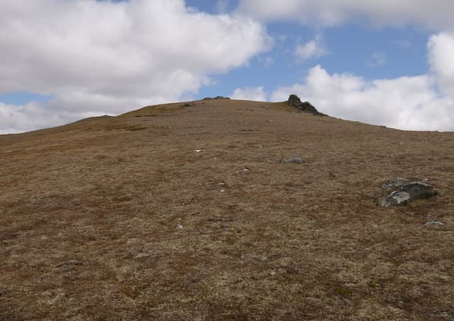
Beinn a' Bha' ach Ard — usually written Bhathaich Ard but locally pronounced like "vach-ard" — is the easternmost Corbett of the Strathfarrar group, rising in isolation above the entrance to the glen near Struy. The 862m summit carries a trig point on a broad rocky top and looks south down Strathglass to the Beauly basin and north over the four Munros of upper Strathfarrar. Access is via Struy on the A831, outside the locked-gate stretch of Strathfarrar itself, so no permit issues apply.
Gaelic: “mountain, of the, high, of the” · Pronunciation: bine uh bhathaich art (beinn uh bha' ach ard)
Quick facts
- Height
- 862m/ 2828ft
- Prominence
- 241 m
- Distance
- ~15 km
- Ascent
- ~759 m
- Time
- 5–8 hrs
- Grid ref
- NH360434
- Parking
- NH404403
- Nearest city
- Inverness· 31km
- Dogs
- Dogs on lead required near livestockDog-friendly guide ↗
Height and prominence cross-checked against the Database of British and Irish Hills (CC BY).
No GPX track yet
Walked this route? Share your track to help other walkers.
Standard route
estate track 30% · open heather 25% · broad ridge 35% · summit trig 10%
Park in the lay-by just east of Struy bridge on the A831 and follow the estate track north up Glen Orrin, then climb west onto the broad south-east ridge of Beinn a' Bha' ach Ard. The ridge gives a long gradual pull on grass and heather to the summit trig. Day totals about 15km with 759m up. The hill is normally tackled on its own; the Strathfarrar Munros across the glen require a separate permit and earlier start.
Terrain
The Glen Orrin track is firm to its end above the river. Off the track the ground is short heather, mossy grass and patches of bog; the going is generally good but slow. The broad south-east ridge is a single uniform pull with no tricky features. The summit area is small rocky outcrops around the trig pillar. No exposure or scrambling.
In winter
A friendlier winter hill than the Strathfarrar Munros across the glen — broad slopes hold snow but with little avalanche risk and no cornicing on the rounded ridge. The Glen Orrin track is generally clear; access at Struy itself is reliable. Short daylight is the main limiter. The summit trig in deep snow makes a clear landmark.
Kit for this: the winter Munro kit list · which boots take crampons
Best time of year
Getting there
- Glasgow3h 27m
- Edinburgh4h 41m
OS maps: OS Landranger 26
Mobile signal: Reasonable signal at Struy; fades quickly into Glen Orrin
Current conditions
Daylight Today
- Sunrise
- 07:50
- Sunset
- 18:20
- Civil dawn
- 07:11
- Civil dusk
- 18:59
NOAA Solar Calculator · 14 October 2026
Got a photo of Beinn a' Bhathaich Ard (Beinn a' Bha' ach Ard)?
30 seconds, helps other walkers.
Submit a photoAround Beinn a' Bhathaich Ard (Beinn a' Bha' ach Ard) on the SCOT network
Getting there, basing yourself, and what to do off the hill.
Getting there: Dingwall station
Ben Wyvis approach; Easter Ross; junction for Kyle and Far North lines
25km from the hill
tripscot.co.uk
On TripSCOTBase yourself in Inverness
Highland capital — gateway to Cairngorms, Affric, Far North
31km from the hill
tripscot.co.uk
On TasteSCOTAfter the hill: Glen Ord
Muir of Ord — Black Isle distillery; the Singleton range's Highland anchor
18km from the hill
tastescot.co.uk
Beinn a' Bhathaich Ard (Beinn a' Bha' ach Ard) — common questions
- Is Beinn a' Bhathaich Ard (Beinn a' Bha' ach Ard) a hard climb?
- Beinn a' Bhathaich Ard (Beinn a' Bha' ach Ard) is rated 3/5 (moderately challenging) on the OutdoorSCOT scale. The standard route covers about 15km with 759m of ascent and takes most walkers 5-8 hours. Ground conditions: The Glen Orrin track is firm to its end above the river.
- How much drop does Beinn a' Bhathaich Ard (Beinn a' Bha' ach Ard) have?
- The drop is 241m: measured from the summit of Beinn a' Bhathaich Ard (Beinn a' Bha' ach Ard) down to the saddle joining it to higher terrain.
- Where's the parking for Beinn a' Bhathaich Ard (Beinn a' Bha' ach Ard)?
- Park at NH404403. Double-check the grid reference on an OS map first; informal laybys here fill early in high season.
- What's the best month to climb Beinn a' Bhathaich Ard (Beinn a' Bha' ach Ard)?
- Aim for May, June, July, August, September, October on Beinn a' Bhathaich Ard (Beinn a' Bha' ach Ard). In the remaining months treat it as a winter hill — full kit, solid navigation, and a look at the relevant SAIS avalanche forecast before you go.
- Can dogs go up Beinn a' Bhathaich Ard (Beinn a' Bha' ach Ard)?
- Dogs are fine on a lead. The route passes livestock or ground-nesting bird habitat, so keep them close throughout.
- Will I get phone signal on Beinn a' Bhathaich Ard (Beinn a' Bha' ach Ard)?
- Reasonable signal at Struy; fades quickly into Glen Orrin
- Is Beinn a' Bhathaich Ard (Beinn a' Bha' ach Ard) safe in winter?
- A friendlier winter hill than the Strathfarrar Munros across the glen — broad slopes hold snow but with little avalanche risk and no cornicing on the rounded ridge. The Glen Orrin track is generally clear; access at Struy itself is reliable. Short daylight is the main limiter. The summit trig in deep snow makes a clear landmark.
Get the OutdoorSCOT weekly
One email a week — new route, hill and bothy guides, seasonal conditions and the odd hard-won lesson. No spam, unsubscribe in one click.