Sub-Marilyn · Glen Coe & Lochaber
Druim Garbh
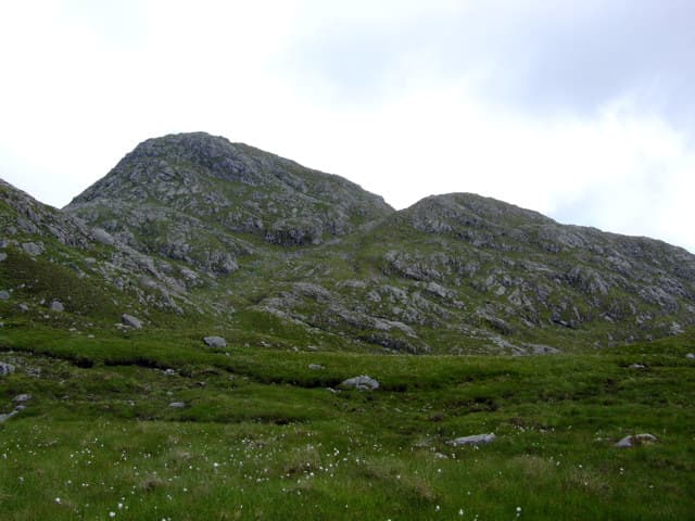
Druim Garbh — the Rough Ridge — is one of the larger Corbett-sized Marilyns of central Ardgour, a long undulating ridge culminating at 803m well back from any road. It is rarely climbed in its own right, often combined with neighbouring Corbetts. The reward for the long walk in is a wonderful sense of empty country, with views deep into the Rough Bounds.
Gaelic: “ridge, rough” · Pronunciation: drim garrav
Quick facts
- Height
- 803.9m/ 2637ft
- Prominence
- 144 m
- Grid ref
- NM 88193 68349
- Nearest city
- Fort William· 23km
- Dogs
- Dogs on lead required near livestockDog-friendly guide ↗
Sub-Marilyn: 144m of drop — misses the 150m Marilyn cut by 6m. We keep it on the list as a near-miss.
Height and prominence cross-checked against the Database of British and Irish Hills (CC BY).
No GPX track yet
Walked this route? Share your track to help other walkers.
Standard route
heather and bog 60% · rocky slopes 25% · grass slopes 15%
The usual approach is from Inversanda via the long bealach to the south, or from Cona Glen further north. Either way expect a substantial day on rough trackless ground. Six to eight hours depending on combination with neighbours.
Terrain
Pathless throughout. The ridge is broken by countless rocky knobs and small boulderfields, with peaty hollows between. Slow ground that rewards patient route-finding.
In winter
A serious winter undertaking — long approach, no escape routes and a complex summit ridge that can hold large cornices. Axe, crampons and full winter experience essential.
This hill is in the Glen Coe SAIS forecast area. Check SAIS forecasts in winter (December–April).
Best time of year
Getting there
- Glasgow4h 55m
- Edinburgh6h 15m
OS maps: OS Landranger 40, OS Explorer 391
Mobile signal: Poor. Remote Moidart/Sunart; limited coverage.
Current conditions
Daylight Today
- Sunrise
- 05:18
- Sunset
- 21:39
- Civil dawn
- 04:26
- Civil dusk
- 22:30
NOAA Solar Calculator · 30 July 2026
Around Druim Garbh on the SCOT network
Getting there, basing yourself, and what to do off the hill.
Getting there: Glenfinnan station
Glenfinnan Viaduct; Streap, Sgurr Thuilm, Glen Finnan Munros
13km from the hill
tripscot.co.uk
On TripSCOTBase yourself in Fort William
Ben Nevis base, West Highland Line, gateway to Lochaber
23km from the hill
tripscot.co.uk
On TasteSCOTAfter the hill: Ben Nevis Distillery
Fort William — Lochaber distillery at the foot of the Ben; long-aged Japanese-owned classics
25km from the hill
tastescot.co.uk
Druim Garbh — common questions
- How difficult is Druim Garbh?
- Druim Garbh carries a 3/5 (moderately challenging) grade on the OutdoorSCOT scale. Terrain: Pathless throughout.
- How prominent is Druim Garbh?
- Druim Garbh has 144m of topographic prominence — the height of its summit above the highest col connecting it to higher ground. That leaves it 6m short of the 150m drop a Marilyn needs — DoBIH classes it a sub-Marilyn, a near-miss rather than a full Marilyn.
- When should I climb Druim Garbh?
- The standard good-weather months for Druim Garbh are April, May, June, September. Outside those months, expect winter conditions on the high ground — full mountain kit, navigation skills, and a check of the SAIS avalanche forecast for the relevant region.
- Can I bring my dog up Druim Garbh?
- On a lead only — the route crosses ground with livestock or nesting-bird interest.
- What's mobile reception like on Druim Garbh?
- Poor. Remote Moidart/Sunart; limited coverage.
- Is Druim Garbh safe in winter?
- A serious winter undertaking — long approach, no escape routes and a complex summit ridge that can hold large cornices. Axe, crampons and full winter experience essential.
Get the OutdoorSCOT weekly
One email a week — new route, hill and bothy guides, seasonal conditions and the odd hard-won lesson. No spam, unsubscribe in one click.