Marilyn · Glen Coe & Lochaber
A' Bheinn Bhan
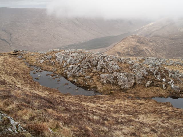
A' Bheinn Bhan — the White Hill — is a pale-flanked 477m summit in central Ardgour, named for the white quartzite outcrops that pattern its upper slopes. It looks out across Glen Tarbert to the Garbh Bheinn ridge, and its quiet position makes it a fine choice for those wanting to escape the Glencoe crowds.
Gaelic: “of the, fair” · Pronunciation: uh bheinn vahn
Quick facts
- Height
- 477m/ 1565ft
- Prominence
- 179 m
- Grid ref
- NM 94586 66505
- Nearest city
- Fort William· 18km
- Dogs
- Dogs on lead required near livestockDog-friendly guide ↗
Height and prominence cross-checked against the Database of British and Irish Hills (CC BY).
No GPX track yet
Walked this route? Share your track to help other walkers.
Standard route
heather and bog 55% · rocky slopes 30% · grass slopes 15%
Start from Glen Tarbert and follow the burn north up a steep grassy hillside onto the broad south flank. Pick a careful line through the pale rocky bands to the trig point. Three to four hours up and down.
Terrain
Pale quartzite slabs streak the upper slopes and require route choice to weave between rather than over. Below that, the usual deep heather and bog of Ardgour, with sparse deer tracks to follow.
In winter
Quartzite bands hold ice well and the hill can give surprisingly sustained winter conditions for its height. The bealach below the summit catches wind cleanly — choose your day.
Best time of year
Getting there
- Glasgow4h 40m
- Edinburgh6h 59m
OS maps: OS Landranger 40, OS Explorer 391
Mobile signal: Close to none. No phone coverage; carry a personal locator beacon on this remote Ardgour hill.
Current conditions
Daylight Today
- Sunrise
- 06:50
- Sunset
- 19:45
- Civil dawn
- 06:11
- Civil dusk
- 20:23
NOAA Solar Calculator · 14 September 2026
Around A' Bheinn Bhan on the SCOT network
Getting there, basing yourself, and what to do off the hill.
Getting there: Glenfinnan station
Glenfinnan Viaduct; Streap, Sgurr Thuilm, Glen Finnan Munros
15km from the hill
tripscot.co.uk
On TripSCOTBase yourself in Glencoe
Three Sisters, Aonach Eagach and the Lost Valley — village base on Loch Leven
17km from the hill
tripscot.co.uk
On TasteSCOTAfter the hill: Ben Nevis Distillery
Fort William — Lochaber distillery at the foot of the Ben; long-aged Japanese-owned classics
20km from the hill
tastescot.co.uk
A' Bheinn Bhan — common questions
- What difficulty is A' Bheinn Bhan?
- On the OutdoorSCOT scale, A' Bheinn Bhan comes in at 1/5 — easy. Underfoot: Pale quartzite slabs streak the upper slopes and require route choice to weave between rather than over.
- What is A' Bheinn Bhan's prominence?
- 179m of prominence. That's the vertical drop from the summit to the col that links A' Bheinn Bhan to the next higher ground. That drop is what qualifies it as a Marilyn — a hill with at least 150m of descent on every side.
- When is the best time to climb A' Bheinn Bhan?
- March, April, May, June, July, August, September, October give the most reliable conditions on A' Bheinn Bhan. Beyond that window the high ground turns wintry: carry full mountain kit, be confident navigating, and check the SAIS avalanche forecast for the area.
- Is A' Bheinn Bhan dog-friendly?
- Yes, but dogs must be kept on a lead — there is livestock or ground-nesting bird interest on the route.
- Is there mobile signal on A' Bheinn Bhan?
- Close to none. No phone coverage; carry a personal locator beacon on this remote Ardgour hill.
- Is A' Bheinn Bhan safe in winter?
- Quartzite bands hold ice well and the hill can give surprisingly sustained winter conditions for its height. The bealach below the summit catches wind cleanly — choose your day.
Get the OutdoorSCOT weekly
One email a week — new route, hill and bothy guides, seasonal conditions and the odd hard-won lesson. No spam, unsubscribe in one click.