Marilyn · Glen Coe & Lochaber
Druim Leathad nam Fias
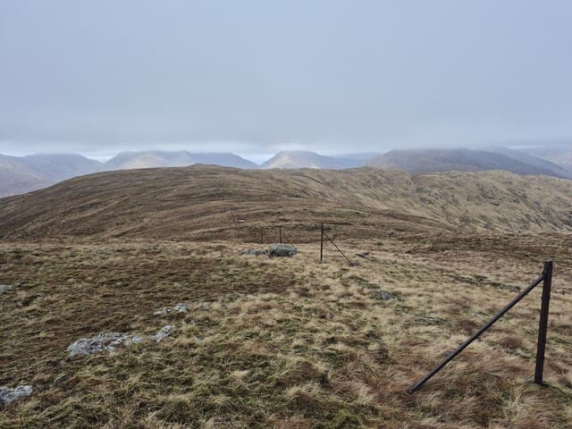
Druim Leathad nam Fias — the Broad Ridge of the Stripes — is an east Ardgour hill rising directly above the Cona Glen, its 576m summit a quiet outlier between bigger neighbours. Long pale grass stripes on its flanks give the hill its Gaelic name. The view to Garbh Bheinn from the top is one of the most dramatic in the area.
Quick facts
- Height
- 576m/ 1890ft
- Prominence
- 187 m
- Grid ref
- NM 95598 70284
- Nearest city
- Fort William· 15km
- Dogs
- Dogs on lead required near livestockDog-friendly guide ↗
Height and prominence cross-checked against the Database of British and Irish Hills (CC BY).
No GPX track yet
Walked this route? Share your track to help other walkers.
Standard route
heather moorland 55% · rocky slopes 30% · grass slopes 15%
From the Inversanda road in Glen Tarbert, follow the burn north up the steep south-facing flank, picking a line through outcrops. The summit ridge is open and easy. Around four hours up and down.
Terrain
Steep wet grass on the lower flank with bracken patches in summer, then short turf and small slabby outcrops above. Drier than many Ardgour hills thanks to a favourable south-facing aspect.
In winter
Snow lingers on the upper grass stripes that give the hill its name, sometimes forming firm runs to climb. The descent route can be slippery — gaiters and microspikes useful.
This hill is in the Glen Coe SAIS forecast area. Check SAIS forecasts in winter (December–April).
Best time of year
Getting there
- Glasgow4h 42m
- Edinburgh6h 59m
OS maps: OS Landranger 40, OS Explorer 391
Mobile signal: Poor. Moidart interior; no networks reach this remote hill.
Current conditions
Daylight Today
- Sunrise
- 05:17
- Sunset
- 21:39
- Civil dawn
- 04:26
- Civil dusk
- 22:30
NOAA Solar Calculator · 30 July 2026
Around Druim Leathad nam Fias on the SCOT network
Getting there, basing yourself, and what to do off the hill.
Getting there: Glenfinnan station
Glenfinnan Viaduct; Streap, Sgurr Thuilm, Glen Finnan Munros
11km from the hill
tripscot.co.uk
On TripSCOTBase yourself in Fort William
Ben Nevis base, West Highland Line, gateway to Lochaber
15km from the hill
tripscot.co.uk
On TasteSCOTAfter the hill: Ben Nevis Distillery
Fort William — Lochaber distillery at the foot of the Ben; long-aged Japanese-owned classics
18km from the hill
tastescot.co.uk
Druim Leathad nam Fias — common questions
- How difficult is Druim Leathad nam Fias?
- Druim Leathad nam Fias carries a 2/5 (moderate) grade on the OutdoorSCOT scale. Underfoot: Steep wet grass on the lower flank with bracken patches in summer, then short turf and small slabby outcrops above.
- What is Druim Leathad nam Fias's prominence?
- 187m of prominence. That's the vertical drop from the summit to the col that links Druim Leathad nam Fias to the next higher ground. That drop is what qualifies it as a Marilyn — a hill with at least 150m of descent on every side.
- When is the best time to climb Druim Leathad nam Fias?
- March, April, May, June, July, August, September, October give the most reliable conditions on Druim Leathad nam Fias. Beyond that window the high ground turns wintry: carry full mountain kit, be confident navigating, and check the SAIS avalanche forecast for the area.
- Is Druim Leathad nam Fias dog-friendly?
- Yes, but dogs must be kept on a lead — there is livestock or ground-nesting bird interest on the route.
- Is there mobile signal on Druim Leathad nam Fias?
- Poor. Moidart interior; no networks reach this remote hill.
- Is Druim Leathad nam Fias safe in winter?
- Snow lingers on the upper grass stripes that give the hill its name, sometimes forming firm runs to climb. The descent route can be slippery — gaiters and microspikes useful.
Get the OutdoorSCOT weekly
One email a week — new route, hill and bothy guides, seasonal conditions and the odd hard-won lesson. No spam, unsubscribe in one click.