Sub-Marilyn · North-West Highlands
Carn Gorm-loch
Carn Gorm-loch — cairn of the blue-green loch — is a serious 909m hill at NH 318 800 deep in the wilderness north of the Beinn Dearg Munros. It takes its name from the high mountain loch on its southern flank, set in a glacial bowl that holds ice into May most years.
Quick facts
- Height
- 909m/ 2982ft
- Prominence
- 146 m
- Grid ref
- NH 31897 80069
- Nearest city
- Inverness· 49km
- Dogs
- Dogs on lead required near livestockDog-friendly guide ↗
Sub-Marilyn: 146m of drop — misses the 150m Marilyn cut by 4m. We keep it on the list as a near-miss.
Height and prominence cross-checked against the Database of British and Irish Hills (CC BY).
No GPX track yet
Walked this route? Share your track to help other walkers.
Standard route
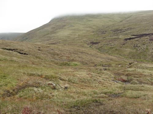
blanket bog 50% · heather moorland 35% · grassy summit 15%
There is no short way in. The standard approach is from Oykel Bridge or Inverlael, with 12-15km of estate track and stalkers' path before the climbing starts. Most parties stay overnight at the Schoolhouse bothy. A full 9-10 hour day.
Terrain
Moine schist with quartzite veins; the corrie holding the blue-green loch is steep on its north-east side. Above 700m the ground becomes gravel and frost-heaved stones with cushion plants between — alpine in feel, not just in altitude.
In winter
Above 900m this is full mountain country in winter with avalanche-prone east-facing slopes around the loch. Snow lies from November to May and cornicing is significant. Treat as a Munro-grade winter day with the additional remoteness.
This hill is in the Torridon SAIS forecast area. Check SAIS forecasts in winter (December–April).
Best time of year
Getting there
- Glasgow5h 11m
- Edinburgh6h 21m
OS maps: OS Landranger 20, OS Explorer 436N
Mobile signal: Poor. Dead zone; inform a contact with your planned return time.
Current conditions
Daylight Today
- Sunrise
- 05:09
- Sunset
- 21:42
- Civil dawn
- 04:15
- Civil dusk
- 22:36
NOAA Solar Calculator · 30 July 2026
Around Carn Gorm-loch on the SCOT network
Getting there, basing yourself, and what to do off the hill.
Carn Gorm-loch — common questions
- How hard is Carn Gorm-loch?
- We grade Carn Gorm-loch at 3/5, which puts it in moderately challenging territory. Terrain: Moine schist with quartzite veins; the corrie holding the blue-green loch is steep on its north-east side.
- How prominent is Carn Gorm-loch?
- Carn Gorm-loch has 146m of topographic prominence — the height of its summit above the highest col connecting it to higher ground. That leaves it 4m short of the 150m drop a Marilyn needs — DoBIH classes it a sub-Marilyn, a near-miss rather than a full Marilyn.
- When should I climb Carn Gorm-loch?
- The standard good-weather months for Carn Gorm-loch are April, May, June, September. Outside those months, expect winter conditions on the high ground — full mountain kit, navigation skills, and a check of the SAIS avalanche forecast for the relevant region.
- Can I bring my dog up Carn Gorm-loch?
- On a lead only — the route crosses ground with livestock or nesting-bird interest.
- What's mobile reception like on Carn Gorm-loch?
- Poor. Dead zone; inform a contact with your planned return time.
- Is Carn Gorm-loch safe in winter?
- Above 900m this is full mountain country in winter with avalanche-prone east-facing slopes around the loch. Snow lies from November to May and cornicing is significant. Treat as a Munro-grade winter day with the additional remoteness.
Get the OutdoorSCOT weekly
One email a week — new route, hill and bothy guides, seasonal conditions and the odd hard-won lesson. No spam, unsubscribe in one click.